MyTopo
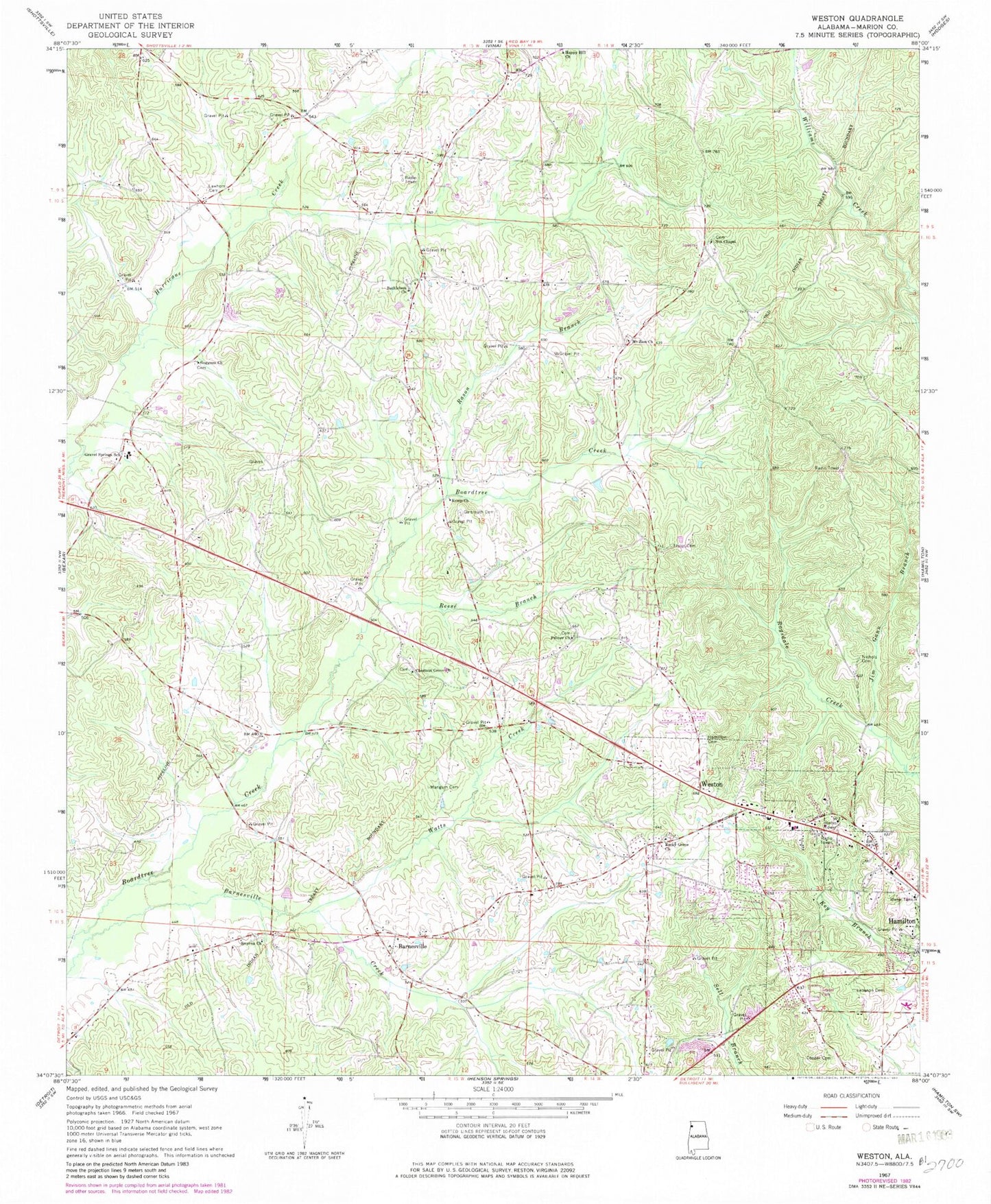
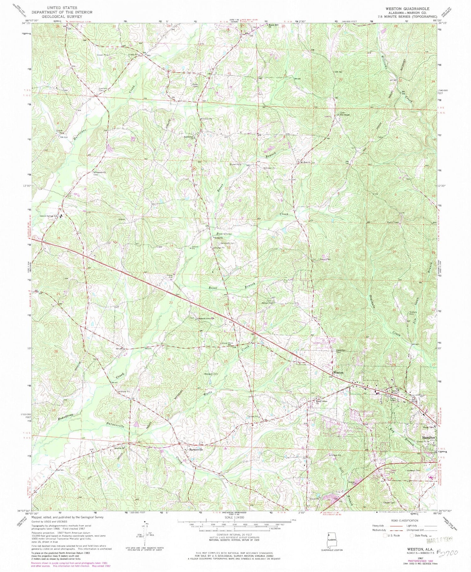
Classic USGS Weston Alabama 7.5'x7.5' Topo Map
Couldn't load pickup availability
Historical USGS topographic quad map of Weston in the state of Alabama. Map scale may vary for some years, but is generally around 1:24,000. Print size is approximately 24" x 27"
This quadrangle is in the following counties: Marion.
The map contains contour lines, roads, rivers, towns, and lakes. Printed on high-quality waterproof paper with UV fade-resistant inks, and shipped rolled.
Contains the following named places: Barnesville, Barnesville Cemetery, Bethlehem Cemetery, Bethlehem Methodist Church, Bexar Division, Cherry Hill Church, Chestnut Grove Cemetery, Chestnut Grove Church, Cockrell-Cofield Cemetery, Cooper Cemetery, Faith Tabernacle, Galbreath Cemetery, Gann Branch, Goggans Cemetery, Goggans Independent Missionary Baptist Church, Gospel Light Church, Gravel Springs Junior High School, Hamilton Cemetery, Happy Hill Church, Kemp Chapel Church, Kemp Church, Key Cemetery, Lawhorn Cemetery, Lebanon Cemetery, Lockridge Family Cemetery, Mangum Cemetery, Mount Zion Church, Nichols Cemetery, Nichols Family Cemetery, Nix Chapel Cemetery, Nix Chapel Church of God, Palmer Cemetery, Palmer Church, Rason Branch, Reese Branch, Rocky Grove Cemetery, Rocky Grove Freewill Baptist Church, Rousons Gin, Smyrna Cemetery, Smyrna Methodist Church, Taylor Cemetery, W70A-TV (Hamilton), Watts Creek, Weston, Weston Baptist Church