MyTopo
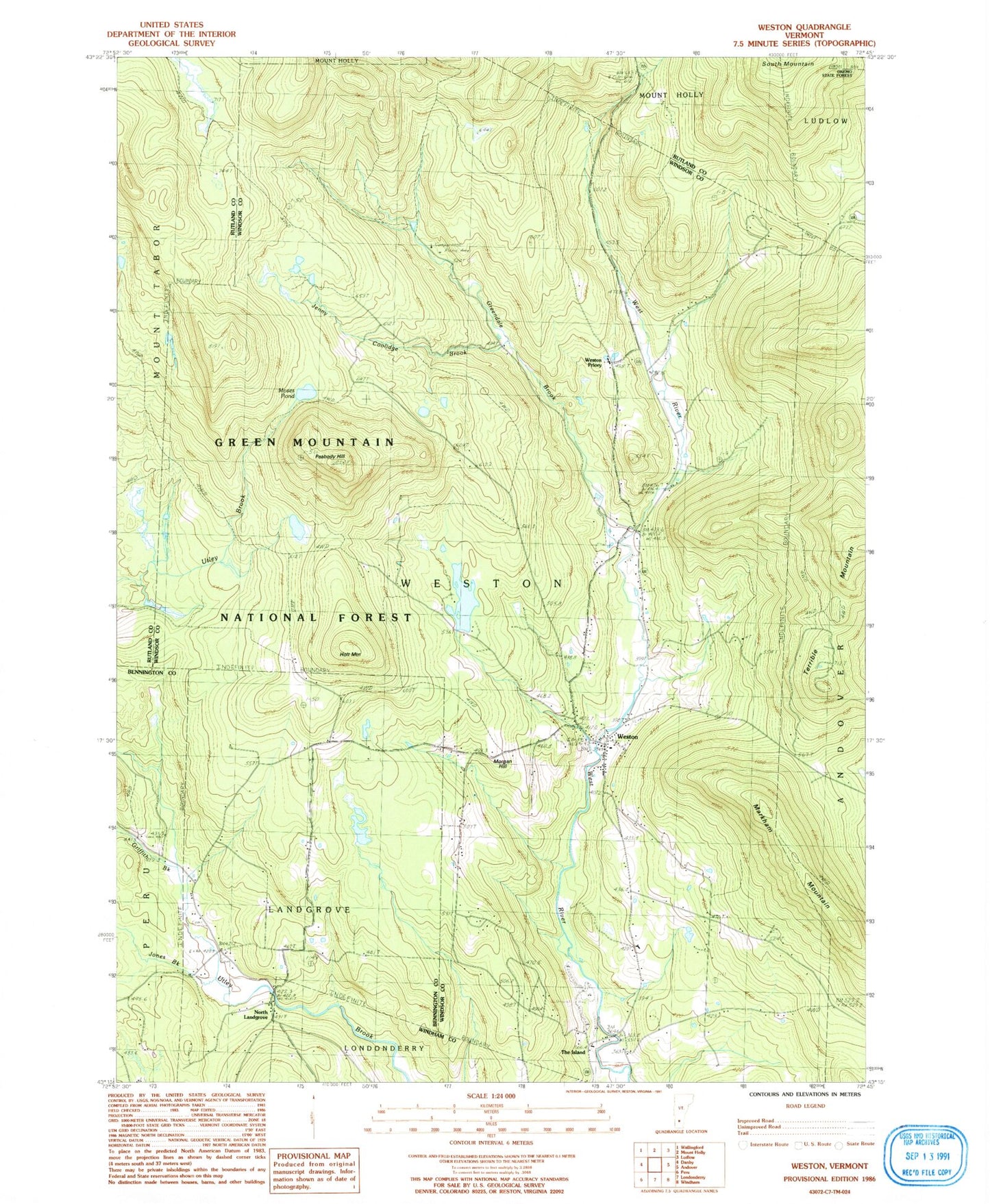
Classic USGS Weston Vermont 7.5'x7.5' Topo Map
Couldn't load pickup availability
Historical USGS topographic quad map of Weston in the state of Vermont. Typical map scale is 1:24,000, but may vary for certain years, if available. Print size: 24" x 27"
This quadrangle is in the following counties: Bennington, Rutland, Windham, Windsor.
The map contains contour lines, roads, rivers, towns, and lakes. Printed on high-quality waterproof paper with UV fade-resistant inks, and shipped rolled.
Contains the following named places: Beaver Meadows, Greendale Brook, Griffith Brook, Holt Mountain, Jenny Coolidge Brook, Jones Brook, Landgrove School, Markham Mountain, Morgan Hill, Moses Pond, North Landgrove, Peabody Hill, The Island, Weston, Weston Priory, Zion Chapel, Greendale Camp and Picnic Grounds, Peabody Pond, Villiage Inn Winter Sports Area, Wantastiquet Trout Club, Town of Landgrove, Town of Weston, Wantastiquet Lake Dam, Wantastiquet Lake, New Cemetery, Old Cemetery, Farrar-Mansur Museum, Farrar Park, Forefathers Cemetery, Island Cemetery, Maple Grove Cemetery, Old Parish Church, Weston Bowl Mill, Weston Community Church, Weston Volunteer Fire Department, Weston Playhouse, Weston Post Office, Weston Village Historic District, Wilder Memorial Library, Weston Census Designated Place