MyTopo
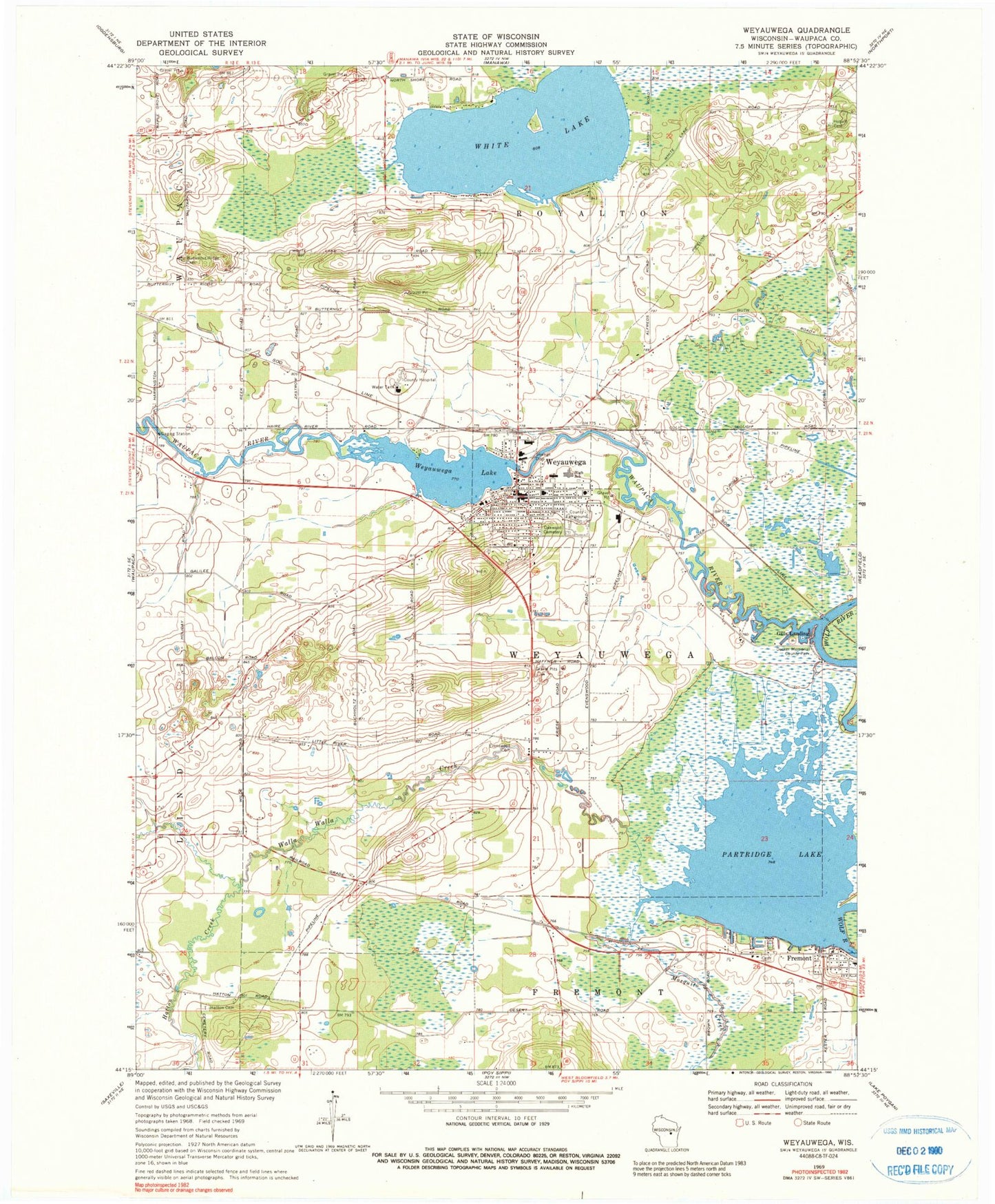
Classic USGS Weyauwega Wisconsin 7.5'x7.5' Topo Map
Couldn't load pickup availability
Historical USGS topographic quad map of Weyauwega in the state of Wisconsin. Map scale may vary for some years, but is generally around 1:24,000. Print size is approximately 24" x 27"
This quadrangle is in the following counties: Waupaca.
The map contains contour lines, roads, rivers, towns, and lakes. Printed on high-quality waterproof paper with UV fade-resistant inks, and shipped rolled.
Contains the following named places: City of Weyauwega, Decker Memorial County Park, Elder Lawn Farm, Evanswood, Evanswood Cemetery, Evanswood Stock Farm, Evenswood School, Farley Cemetery, First Presbyterian Church, Fremont Elementary School, Fremont Post Office, Galilee School, Gills Landing, Gills Landing Station, Hatton, Hatton Creek, Hatton School, Hobart Cemetery, Lakeside Cemetery, Little River, Mosquito Creek, Oakwood Cemetery, Partridge Lake, Rainbow School, Saint Peter Lutheran Church, Saint Peter Lutheran School, Saints Peter and Paul Church, Stanleys Landing School, Sunny Slope Farm, Town of Fremont, Town of Royalton, Town of Weyauwega, Walla Walla Creek, Waupaca County Charter School, Waupaca River, Weyauwega, Weyauwega - Fremont High School, Weyauwega - Fremont Middle School, Weyauwega 314 Reservoir, Weyauwega Area Ambulance, Weyauwega Elementary School, Weyauwega Fire Department, Weyauwega Lake, Weyauwega Police Department, Weyauwega Post Office, Weyauwega Wastewater Treatment Plant, Weyauwega WP137 Dam, White Lake, White Lake 2WP484 Dam, White Lake 9, White Lake School, ZIP Code: 54983