
MyTopo
Classic USGS Whatley Alabama 7.5'x7.5' Topo Map
Couldn't load pickup availability
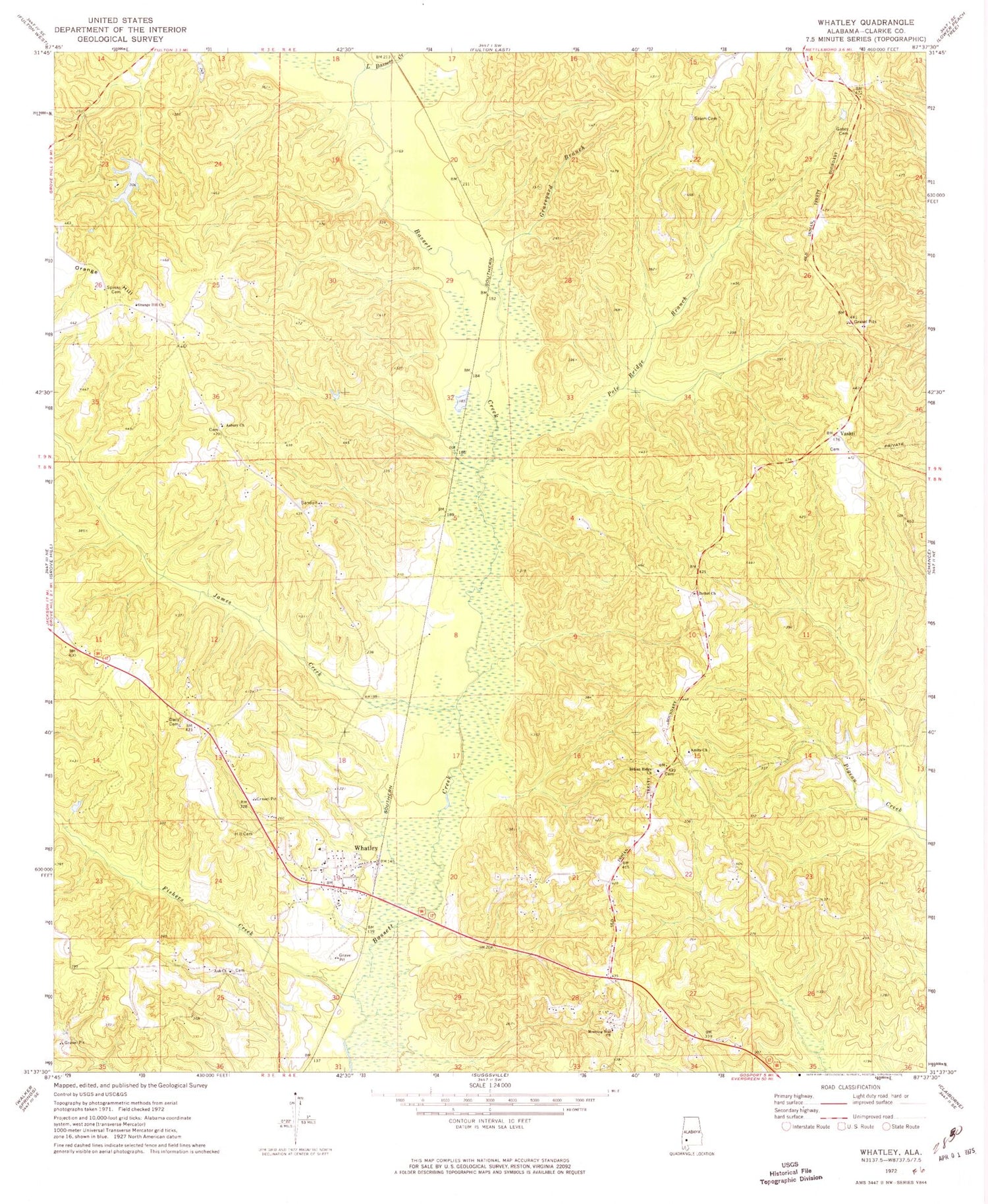
Historical USGS topographic quad map of Whatley in the state of Alabama. Map scale may vary for some years, but is generally around 1:24,000. Print size is approximately 24" x 27"
This quadrangle is in the following counties: Clarke.
The map contains contour lines, roads, rivers, towns, and lakes. Printed on high-quality waterproof paper with UV fade-resistant inks, and shipped rolled.
Contains the following named places: Amity Baptist Church, Amity Cemetery, Amity School, Andrew Jackson Memorial Park, Aoh Church, Asbury, Asbury Church, Bethel Cemetery, Bethel Church, Church of God, Cobbville, Dacy Cemetery, Davis Cemetery, Fishers Creek, Fort Sinquefield, Gates Cemetery, Graveyard Branch, Grove Hill Division, Hearin Morriss Cemetery, Hill Cemetery, Horeb Baptist Church, Indian Ridge Cemetery, Indian Ridge Church, James Creek, Lake Harringan, Little Bassett Creek, Moncrief School House, Morning Star Baptist Church, Orange Hill, Orange Hill Baptist Church, Orange Hill School, Pole Bridge Branch, Pouncey, Salem Cemetery, Spinks Cemetery, Spinks Chapel, Vashti, W D Harrigan Dam, Whatley, Whatley Cemetery, Whatley Census Designated Place, Whatley First Assembly of God Church, Whatley Post Office, ZIP Code: 36482


