
MyTopo
Classic USGS Wilson Kansas 7.5'x7.5' Topo Map
Couldn't load pickup availability
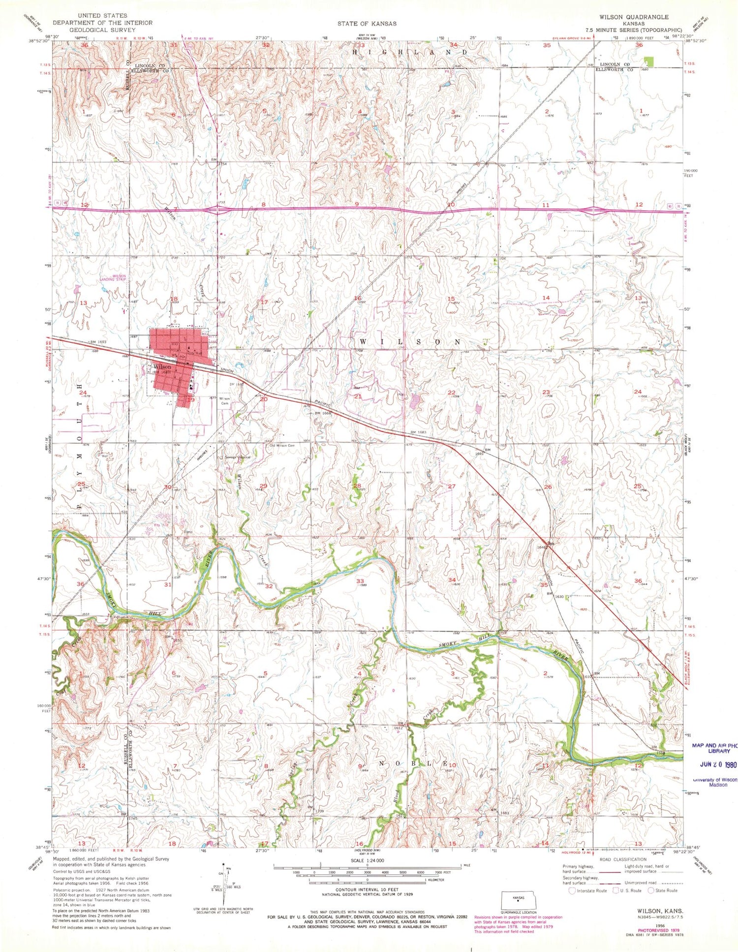
Historical USGS topographic quad map of Wilson in the state of Kansas. Map scale may vary for some years, but is generally around 1:24,000. Print size is approximately 24" x 27"
This quadrangle is in the following counties: Ellsworth, Lincoln, Russell.
The map contains contour lines, roads, rivers, towns, and lakes. Printed on high-quality waterproof paper with UV fade-resistant inks, and shipped rolled.
Contains the following named places: Blood Creek, City of Wilson, Coal Creek, First Baptist Church, First Presbyterian Church, Immanuel Lutheran Church, Lang Memorial Library, Old Wilson Cemetery, Saint Wenceslaus Catholic Cemetery, Saint Wenceslaus Catholic Church, Spring Creek, Sunrise School, Township of Wilson, Wilson, Wilson Airport, Wilson Cemetery, Wilson City Hall, Wilson Creek, Wilson Czech Opera House and Museum, Wilson Elementary School, Wilson Fire Department, Wilson Junior / Senior High School, Wilson Police Department, Wilson Post Office, Wilson United Methodist Church, Wilson Upper Elementary School, Wilson Wastewater Plant 2, ZIP Code: 67490


