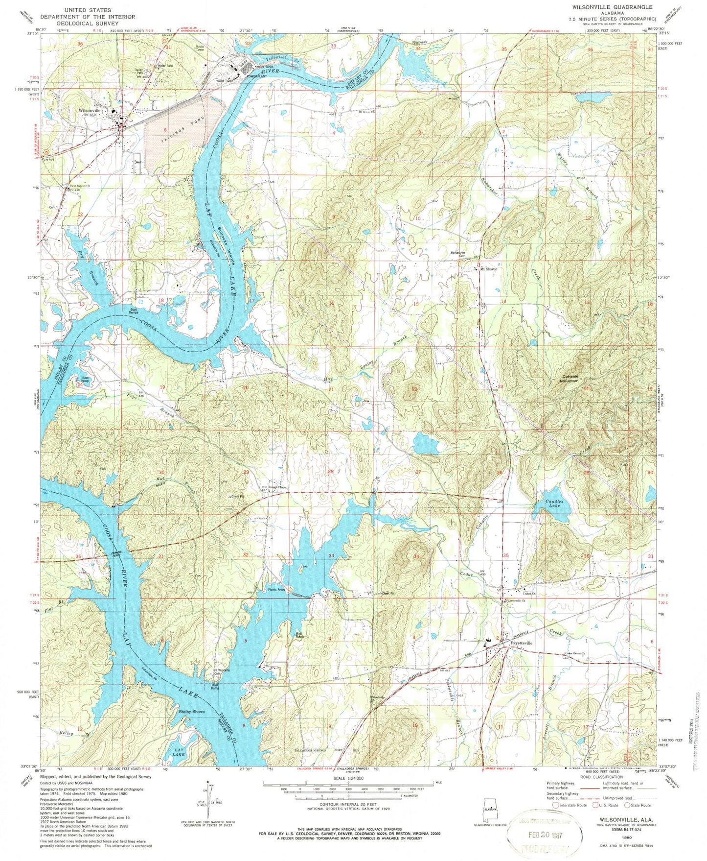
MyTopo
Classic USGS Wilsonville Alabama 7.5'x7.5' Topo Map
Couldn't load pickup availability
Historical USGS topographic quad map of Wilsonville in the state of Alabama. Typical map scale is 1:24,000, but may vary for certain years, if available. Print size: 24" x 27"
This quadrangle is in the following counties: Shelby, Talladega.
The map contains contour lines, roads, rivers, towns, and lakes. Printed on high-quality waterproof paper with UV fade-resistant inks, and shipped rolled.
Contains the following named places: Averett Branch, Bullocks Islands, Caudles Lake, Cedar Creek, Cohabie Creek, Cohabie Mountain, Dry Branch, Fayetteville, Fayetteville Church, First Baptist Church, Flat Branch, Fort Williams Cemetery, Friendship Church, Hay Spring Branch, Kahatchee Creek, Mount Grove Church, Periwinkle Branch, Pope Branch, Union Grove Church, United Church, Wilsonville, Caudle Dam, Goodner Dam, Goodner Lake, Cleitts Dam, Cleitts Lake, Wilsons Mill (historical), Amerines Corner, Brewers Crossroad (historical), Camp Brownie, Campbells Crossroads, Cedar Creek Campground, Cedar Creek Marina, Chalybeate Spring, Deans, Deans Spring, Fayetteville Baptist Church, Fayetteville High School, Fort Williams Shoals (historical), Heaslet Cemetery, Katala Hills, Lower Mud Creek, Old Fayetteville (historical), Rigginstown (historical), Russell School (historical), Springdale School (historical), Steamboat Island (historical), Three Island Shoals (historical), Earnest C Gaston Steam Plant, Smiths Camp, Wilsonville Cemetery, Wilsonville Elementary School, Chitothibi (historical), Kahatchee Cemetery, Kelley Branch, Mud Branch, Perkins Ferry, Russell Chapel Baptist Church, Waters Branch, Yellowleaf Creek, Mount Sharon, Shelby Shores, Fort Williams Ferry (historical), McGowans Ferry (historical), Owens Ferry (historical), Robertsons Mill (historical), Kahatchee, Wilsonville Post Office, Fort Williams (historical), Alabama Four-H Youth Development Center, Carleton Point, Helms Park, Homestead, Indian Shoals, Kowakas Mobile Home Park, Paradise Cove, Paradise Point Estates, Paradise Point Marina, Valentine, Wilsonville Town Hall, Cedar Creek Fish Camp, Town of Wilsonville, Fayetteville Census Designated Place, Lay Lake Volunteer Fire Department, Wilsonville Fire Department Station 1, Fayetteville Volunteer Fire Department, Southeast Shelby County Rescue Station 2, Wilsonville Fire Department Station 2, Wood Hog Farm, Wilsonville Police Department