MyTopo
Classic USGS Win Wan Flat Nevada 7.5'x7.5' Topo Map
Couldn't load pickup availability
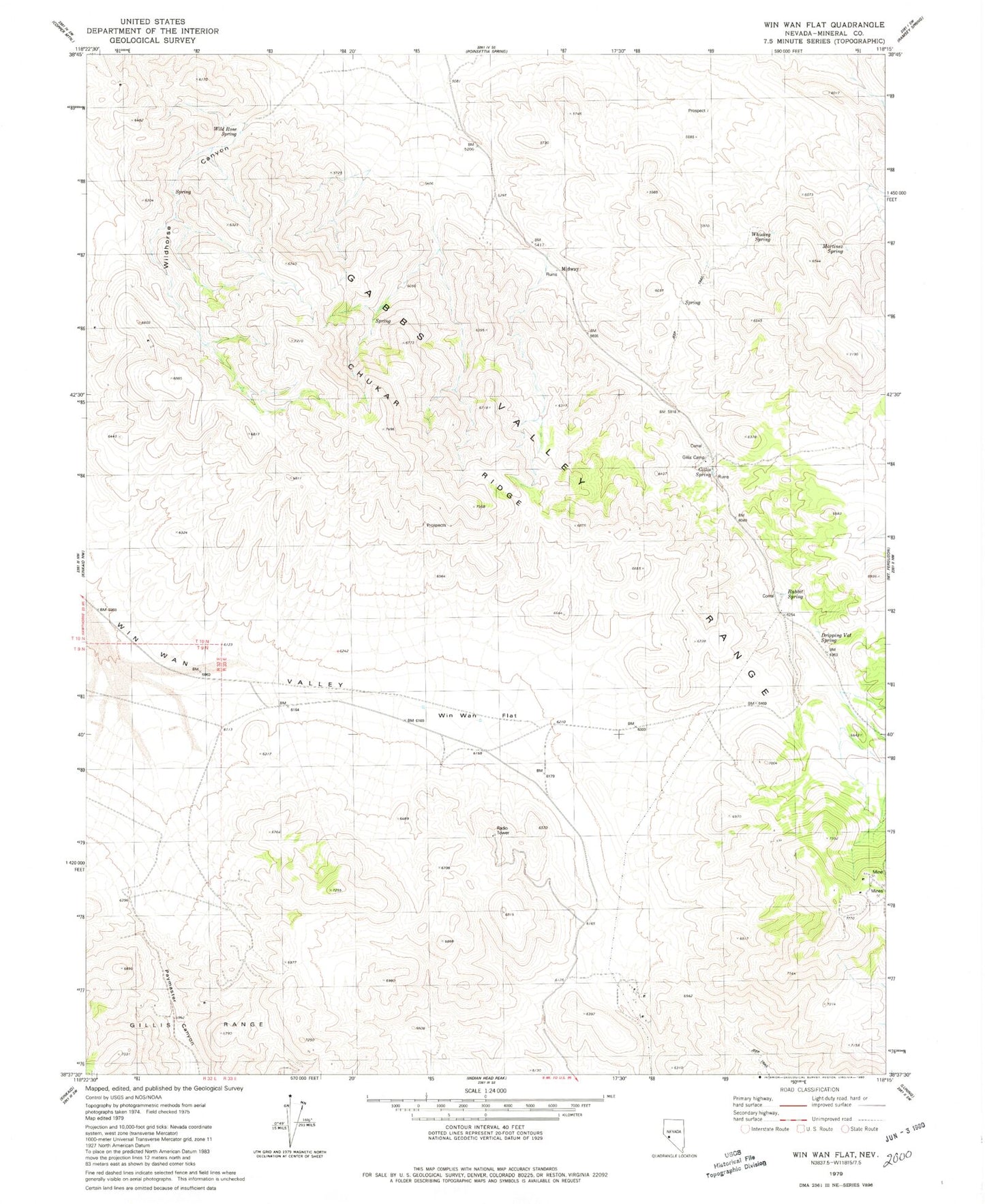
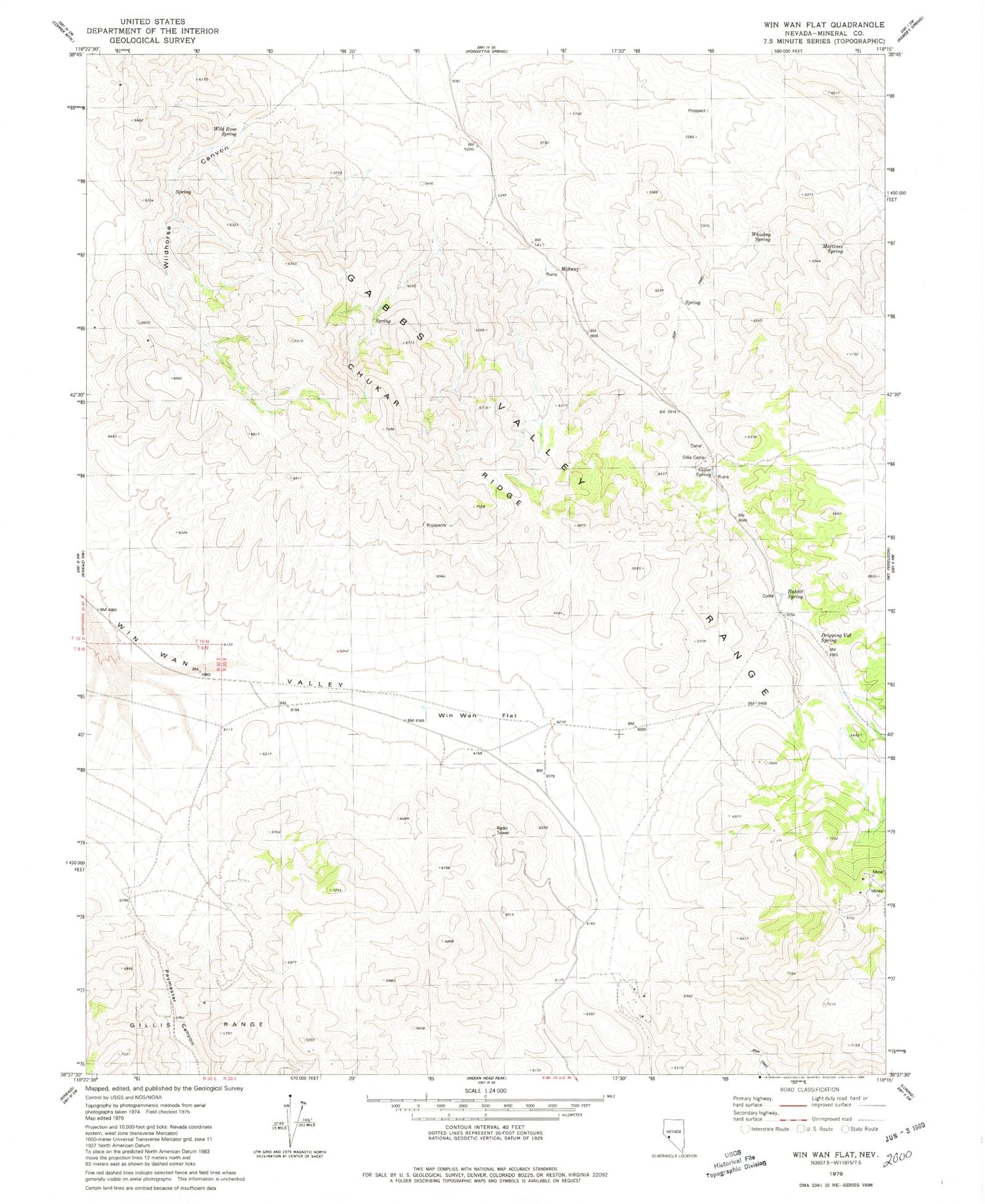
Historical USGS topographic quad map of Win Wan Flat in the state of Nevada. Map scale may vary for some years, but is generally around 1:24,000. Print size is approximately 24" x 27"
This quadrangle is in the following counties: Mineral.
The map contains contour lines, roads, rivers, towns, and lakes. Printed on high-quality waterproof paper with UV fade-resistant inks, and shipped rolled.
Contains the following named places: Acme Copper Mine, Chukar Ridge, Dripping Vat Spring, Gillis Camp, Gillis Canon, Gillis Spring, Gillis Station, Martinez Spring, Midway, Rabbit Spring, Rabbit Spring Microwave Station, Sargent Well, Sargent Well Spring, Sargent Well Spring Holding Corral, Whiskey Spring, Wild Rose Spring, Win Wan Flat