
MyTopo
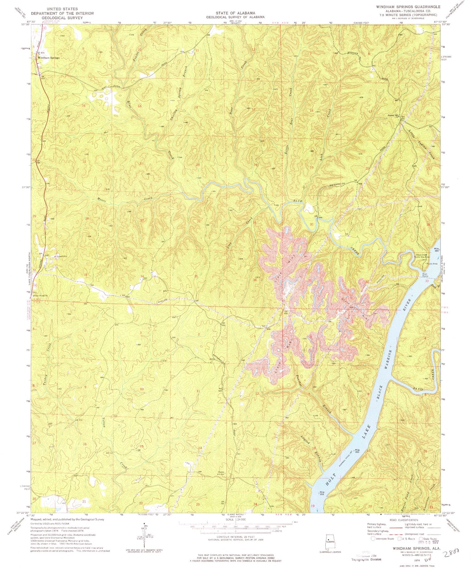
Classic USGS Windham Springs Alabama 7.5'x7.5' Topo Map
Couldn't load pickup availability
Historical USGS topographic quad map of Windham Springs in the state of Alabama. Typical map scale is 1:24,000, but may vary for certain years, if available. Print size: 24" x 27"
This quadrangle is in the following counties: Tuscaloosa.
The map contains contour lines, roads, rivers, towns, and lakes. Printed on high-quality waterproof paper with UV fade-resistant inks, and shipped rolled.
Contains the following named places: Allgood Branch, Bear Creek, Blue Creek, Blue Creek Public Use Area, Charley Spring Branch, Davis Creek, Jock Creek, Lick Creek, Little Bear Creek, McDuff Spring Branch, Moore Creek, Pewter Creek, Piney Woods Church, Pond Branch, Spencer Hill Church, Blue Creek Number 2 Mine, Boyds Camp (historical), Emily Number 5 Mine, Fair Shoals (historical), Harolds Lake (historical), Little Blue Creek, Piney Woods School (historical), Spencer Hill Cemetery, Spencer Hill School (historical), Turkey Creek Mine, Walton Road Ford, Windham Springs Baptist Church, Lock Number Eight (historical), Panther Branch, Windham Springs, Crowder Shoals (historical), Piney Woods Church, Piney Wood Cemetery, Windham Springs Division


