
MyTopo
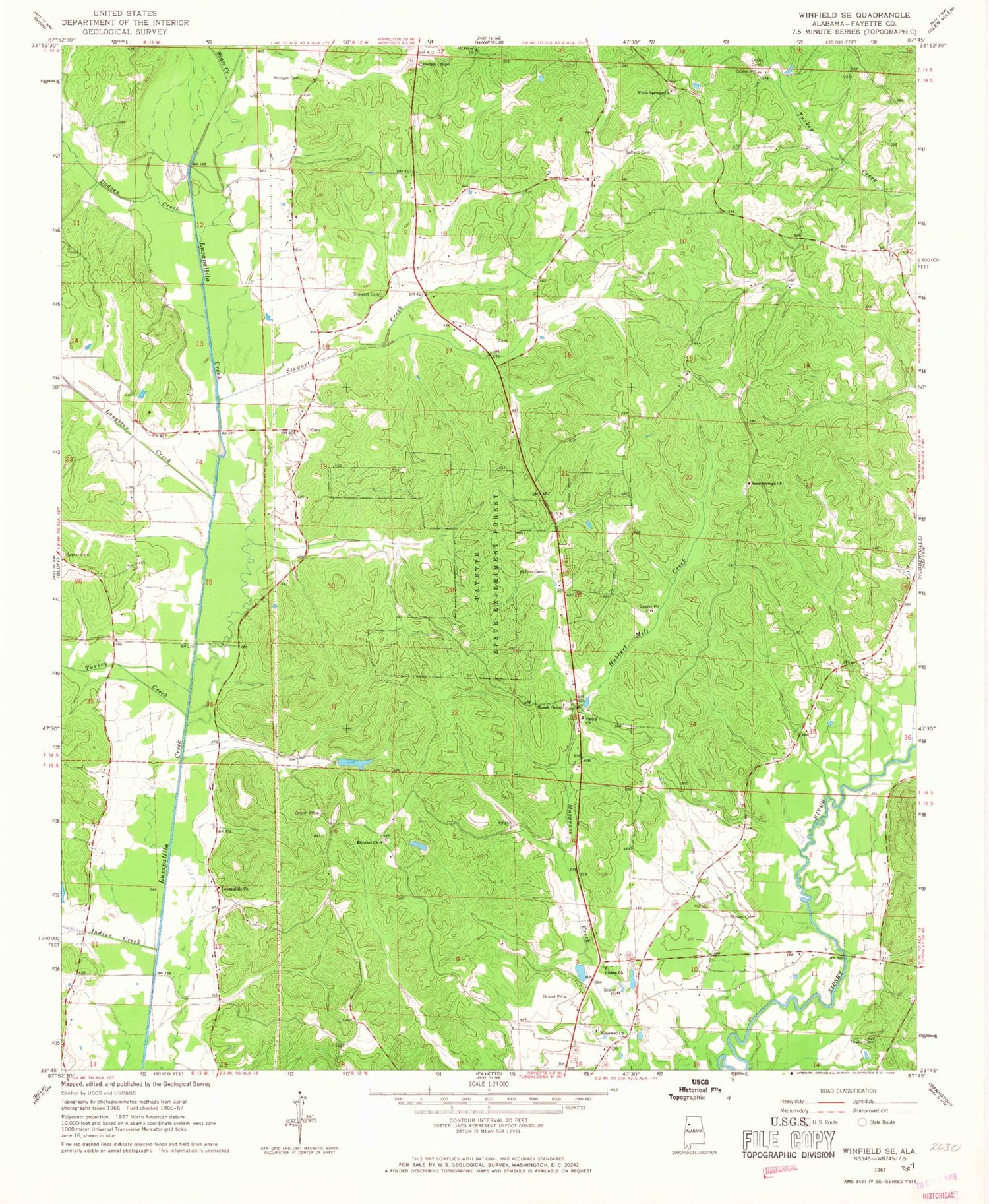
Classic USGS Winfield SE Alabama 7.5'x7.5' Topo Map
Couldn't load pickup availability
Historical USGS topographic quad map of Winfield SE in the state of Alabama. Map scale may vary for some years, but is generally around 1:24,000. Print size is approximately 24" x 27"
This quadrangle is in the following counties: Fayette.
The map contains contour lines, roads, rivers, towns, and lakes. Printed on high-quality waterproof paper with UV fade-resistant inks, and shipped rolled.
Contains the following named places: Ballard Cemetery, Ballard School, Bethel Church Gas Field, Bethlehem Church, Bird Nest Airport, Bluff Springs Church, Dodsen Creek, Dykes Cemetery, Elbethel Cemetery, Elbethel Church, Fayette State Experiment Forest, Flat Top School, Fowler Cemetery, Fowlers School, Gibson Church, Gilpin Cemetery, Hickory Rock School, Hodge Chapel Cemetery, Hodges Cemetery, Hodges Chapel, Hopewell Cemetery, Hopewell Primitive Baptist Church, Hopewell School, Housh Chapel Cemetery, Houshs Chapel Church of Christ, Hubbert Mill Creek, Indian Creek, Jones Mill, Killingsworth Lake, Killingsworth Lake Dam, Langston Creek, Lawrence Mill Volunteer Fire Department, Luxapallila Church, Mount Olive Church, Muskgrove Mill, Pine Grove Church, Porter Cemetery, Sand Springs Baptist Church, Sand Springs Cemetery, Sand Springs Oil Field, Shirley Cemetery, Stewart, Stewart Cemetery, Stewart Creek, Studhorse Creek Gas Field, Sugar Creek, Turkey Creek, Unity Baptist Church, Watkins Lake, Watkins Lake Dam, White Springs Cemetery, White Springs Church, Winfield-Glen Allen Division, Zion Church


