MyTopo
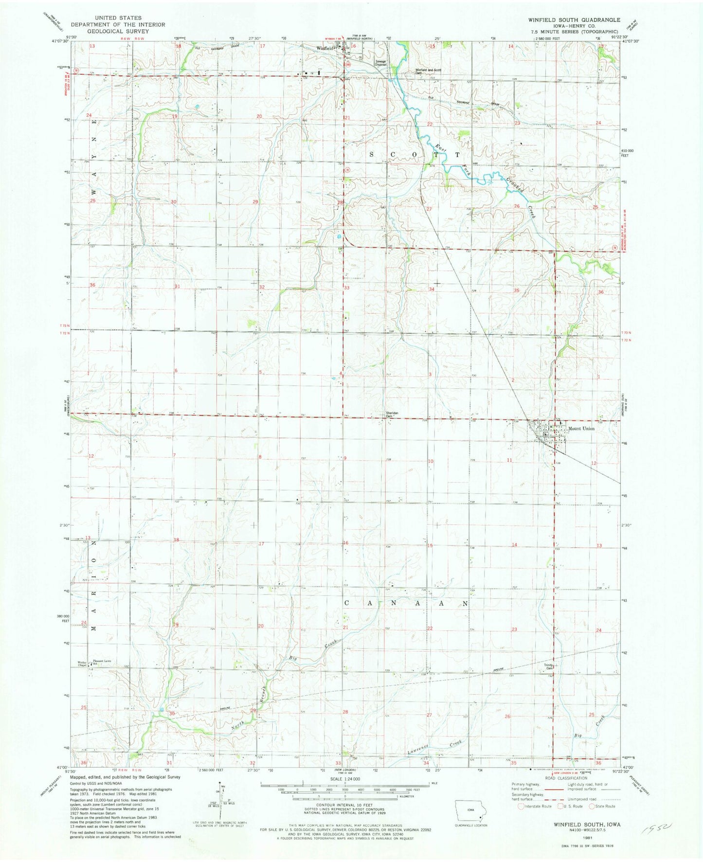
Classic USGS Winfield South Iowa 7.5'x7.5' Topo Map
Couldn't load pickup availability
Historical USGS topographic quad map of Winfield South in the state of Iowa. Map scale may vary for some years, but is generally around 1:24,000. Print size is approximately 24" x 27"
This quadrangle is in the following counties: Henry.
The map contains contour lines, roads, rivers, towns, and lakes. Printed on high-quality waterproof paper with UV fade-resistant inks, and shipped rolled.
Contains the following named places: City of Mount Union, Cotton Grove Post Office, Farmers Co-op Grain Elevator, Mount Union, Mount Union Benefited Fire Department, Mount Union Census Designated Place, Mount Union Post Office, Pleasant Lawn School, Prairie Ag Cooperative Elevator, Sheridan Cemetery, Tallman Cemetery, Township of Canaan, Township of Scott, Trinity Cemetery, United Methodist Church, Wesley Chapel, Winfield, Winfield Scott Township Cemetery, ZIP Code: 52644