
MyTopo
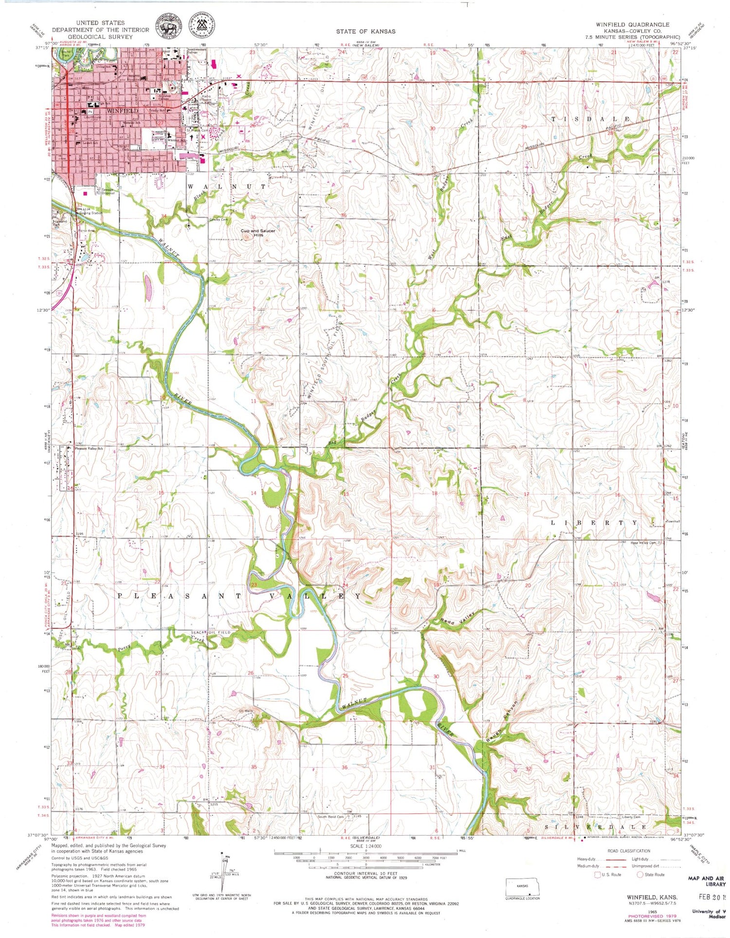
Classic USGS Winfield Kansas 7.5'x7.5' Topo Map
Couldn't load pickup availability
Historical USGS topographic quad map of Winfield in the state of Kansas. Map scale may vary for some years, but is generally around 1:24,000. Print size is approximately 24" x 27"
This quadrangle is in the following counties: Cowley.
The map contains contour lines, roads, rivers, towns, and lakes. Printed on high-quality waterproof paper with UV fade-resistant inks, and shipped rolled.
Contains the following named places: Albright Park, Baugh Canyon, Bethel African Methodist Episcopal Church, Big Badger Creek, Black Crook Creek, Center Point Church, Central Baptist Church, City of Winfield, Community Learning Center, Community of Christ, Cowley County Courthouse, Cowley County Farm, Cowley County Health Department, Cowley County Jail, Cowley County Poor Farm Cemetery, Cowley County Sheriff's Office, Crossroads Community Church, Cup and Saucer Hills, East Badger Creek, Fairview School, First Assembly of God Church, First Baptist Church, First Christian Church, First Church of the Nazarene, First Presbyterian Church, First United Methodist Church, Glenview Estates Mobile Home Park, Grace Episcopal Church, Grace United Methodist Church, Griffith Cemetery, Holy Name Catholic Church, Holy Name Catholic School, Irving Elementary School, Island Park, Kingdom Hall of Jehovah's Witnesses, KSWC-FM (Winfield), KWKS-FM (Winfield), Liberty Cemetery, Liberty School, Lowell Elementary School, McCollum Ford, Millington Street Baptist Church, Oddessa School, Pleasant Valley Elementary School, Pleasant View School, Posey Creek, Posey Oil Field, Praise Cathedral Church of God, Quail Ridge Golf Course, Red Valley Church, Redd Valley, Revival Tabernacle United Pentecostal Church, Rose Valley Cemetery, Saint Johns College, Saint Mary's Cemetery, Seacat Oil Field, Second Baptist Church, South Bend Cemetery, South Bend School, Southwestern College, Township of Pleasant Valley, Trinity Lutheran Church, Trinity Lutheran School, Twin Mounds Store, Walnut Valley School, Webster Elementary School, West Badger Creek, Whittier Elementary School, William Newton Hospital, William Newton Memorial Hospital Heliport, Winfield, Winfield Aquatic Center, Winfield Area Emergency Medical Services, Winfield Church of Christ, Winfield City Hall, Winfield Evangelical Free Church, Winfield Fire Department, Winfield High School, Winfield Intermediate School, Winfield Middle School, Winfield Municipal Power Plant, Winfield Oil Field, Winfield Plaza, Winfield Police Department, Winfield Post Office, Winfield Public Library, Winfield South Oil Field, Winfield State Hospital, Winfield Wastewater Plant, Wright Canon School


