MyTopo
Classic USGS Winnisquam Lake New Hampshire 7.5'x7.5' Topo Map
Couldn't load pickup availability
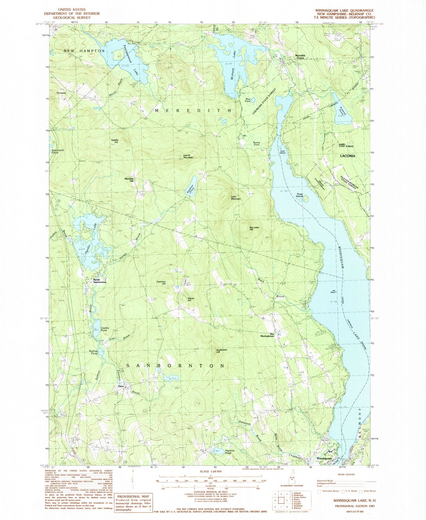
Historical USGS topographic quad map of Winnisquam Lake in the state of New Hampshire. Typical map scale is 1:24,000, but may vary for certain years, if available. Print size: 24" x 27"
This quadrangle is in the following counties: Belknap.
The map contains contour lines, roads, rivers, towns, and lakes. Printed on high-quality waterproof paper with UV fade-resistant inks, and shipped rolled.
Contains the following named places: Bachelder Hill, Bay Meetinghouse, Black Brook, Cawley Pond, Chapman Brook, Crockett Cemetery, Dolloff Brook, Eastman Cemetery, Eastman Hill, Edgerly School, Emerson Brook, Gaza, Giles Brook, Hadley Brook, Hermit Brook, Hermit Lake, Hopkinson Hill, Hunkins Pond, Ladd Mountain, Leavitt Mountain, Loon Island, Meredith Center, Meredith Hill, Merrill Brook, Mud Pond, North Sanbornton, Oakland Cemetery, Patterson Brook, Pemingewasset Lake, Pickerel Pond, Pinnacle Park, Pot Island, Randlett Pond, Robinson Cemetery, Rollins Pond, Saddle Hill, Steele Hill, Swamp Pond, Three Islands, Union Cemetery, Wallis Brook, Lake Wicwas, Winnisquam, Lake Winnisquam, WLNH-AM (Laconia), Town of Sanbornton, Storage Dam at Weeks Mill, Wickwas Lake Dam, Bay Meeting House (historical), Chemung State Forest, Hamel State Forest, Huston-Morgan State Forest, Lakeland School, Swain State Forest, Winnisquam Post Office, Hamlin Recreation and Conservation Area, Eames Recreation and Wildlife Area, White Mountain Ledge, Maple Grove, Crocketts Ledge, Double Dammed Pond, Beaver Meadow Pond, Arbutus Hill Pond, Snow Dragon Mountain, Leighton Mountain, Laconia Christian School, Meredith Fire Department, Surowiec Farm, Winnisquam Fire Department