MyTopo
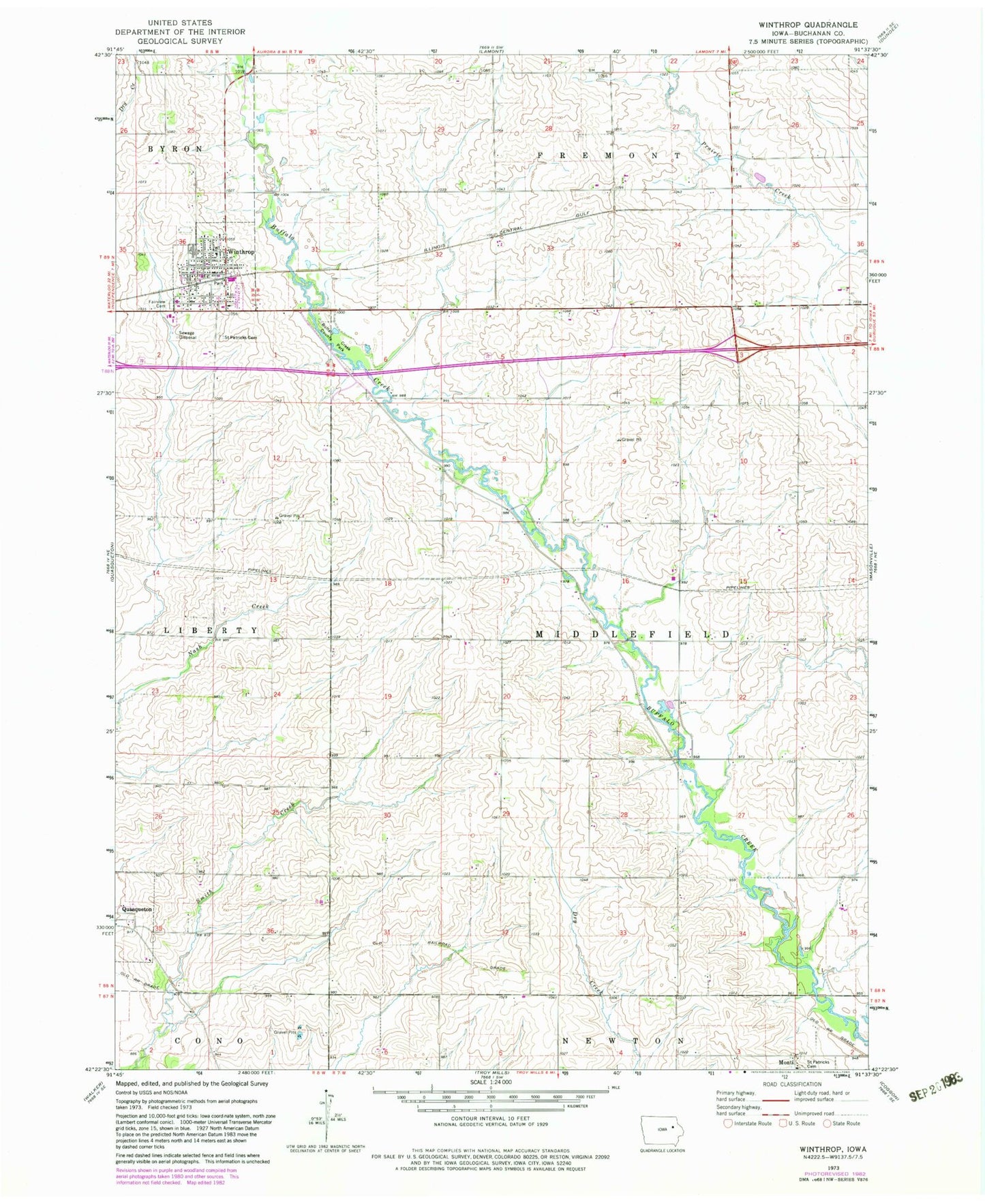
Classic USGS Winthrop Iowa 7.5'x7.5' Topo Map
Couldn't load pickup availability
Historical USGS topographic quad map of Winthrop in the state of Iowa. Map scale may vary for some years, but is generally around 1:24,000. Print size is approximately 24" x 27"
This quadrangle is in the following counties: Buchanan.
The map contains contour lines, roads, rivers, towns, and lakes. Printed on high-quality waterproof paper with UV fade-resistant inks, and shipped rolled.
Contains the following named places: Buffalo Creek Access Area, Buffalo Creek Country Club, Buffalo Creek County Park, Buffalo Creek Wildlife Area, City of Winthrop, East Buchanan Elementary School, East Buchanan Middle / High School, East Buchanan Middle School, Fairview Cemetery, Kiene, Kiene Post Office, Middlefield, Middlefield Post Office, Monti, Monti Post Office, Saint Patricks Cemetery, Saint Patrick's Church, Township of Middlefield, United Church of Christ, Winthrop, Winthrop Fire Department, Winthrop Library, Winthrop Medical Clinic, Winthrop Post Office, ZIP Codes: 50654, 50682