MyTopo
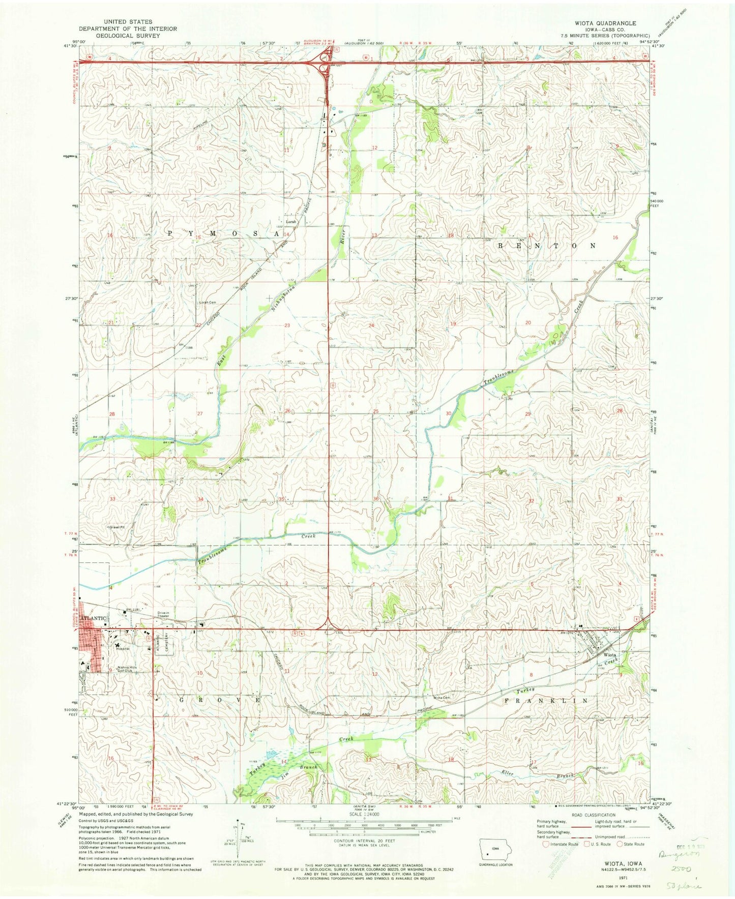
Classic USGS Wiota Iowa 7.5'x7.5' Topo Map
Couldn't load pickup availability
Historical USGS topographic quad map of Wiota in the state of Iowa. Map scale may vary for some years, but is generally around 1:24,000. Print size is approximately 24" x 27"
This quadrangle is in the following counties: Cass.
The map contains contour lines, roads, rivers, towns, and lakes. Printed on high-quality waterproof paper with UV fade-resistant inks, and shipped rolled.
Contains the following named places: Allen House, Atlantic Cemetery, Atlantic Dental Center, Atlantic High School, Atlantic Medical Center, Bluffs Urological Associates Center, Cass County Memorial Hospital, Cass County Memorial Hospital Heliport, City of Wiota, Eller Branch, Eye Associates of Atlantic Center, First Assembly of God Church, First United Pentecostal Church, Frank Chapman Memorial Woods, Grove City, Grove City Post Office, Heritage House, Jim Branch, Lorah, Lorah Cemetery, Lorah Post Office, Midwest Medical Center, Nishna Hills Golf Club, Northridge Speedway, Pymosa Post Office, Saint Pauls Lutheran Church, Seventh Day Adventist Church, Sycamore Village, The Church of Jesus Christ of Latter Day Saints, Township of Pymosa, United Methodist Church, Wiota, Wiota Cemetery, Wiota Elevator Incorporated Elevator, Wiota Fire Department, Wiota Post Office, ZIP Code: 50022