MyTopo
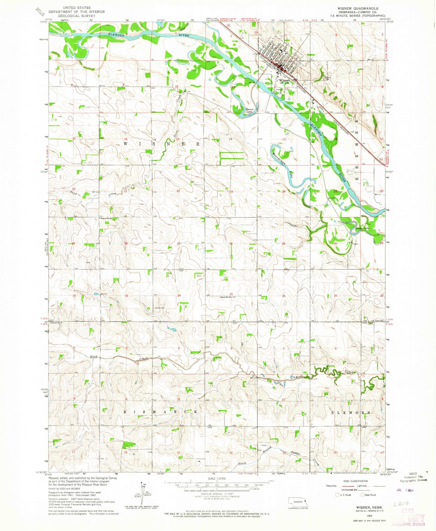
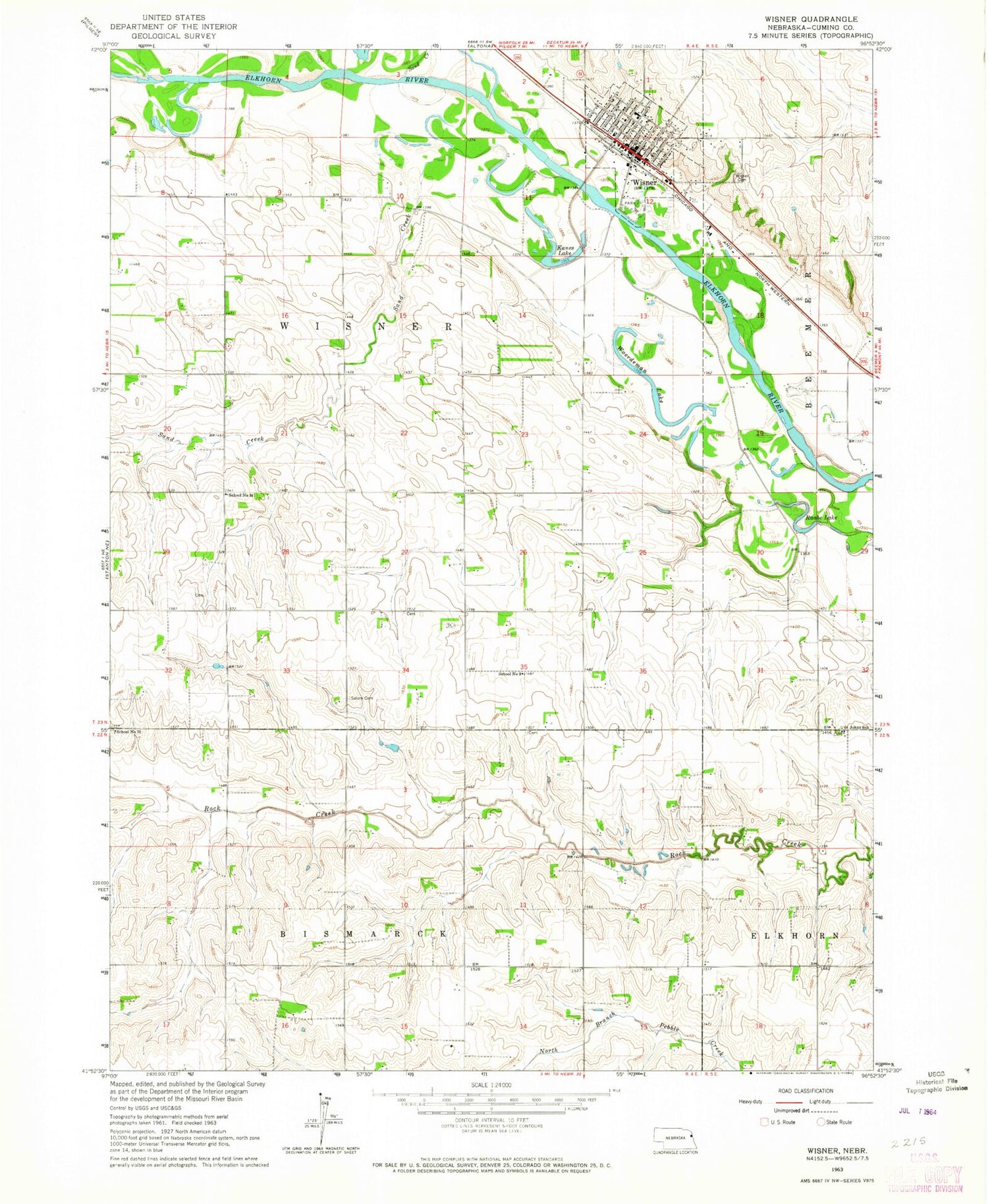
Classic USGS Wisner Nebraska 7.5'x7.5' Topo Map
Couldn't load pickup availability
Historical USGS topographic quad map of Wisner in the state of Nebraska. Map scale may vary for some years, but is generally around 1:24,000. Print size is approximately 24" x 27"
This quadrangle is in the following counties: Cuming.
The map contains contour lines, roads, rivers, towns, and lakes. Printed on high-quality waterproof paper with UV fade-resistant inks, and shipped rolled.
Contains the following named places: Bismarck, Bismark Post Office, Christ Lutheran Church, City of Wisner, Dry Ditch, Family Vision Center, Farmers Elevator Company - Wisner Elevator, Kanes Lake, Nebraska Ag Products Corporation Elevator, Raabe Lake, River Park, River Park Campground, Saint Johns School, Saint Joseph Catholic Church, Saint Pauls Lutheran Church, Salem Cemetery, Sand Creek, School Number 34, School Number 70, School Number 9, Stover Chiropractic Center, Township of Wisner, United Methodist Church, Wisner, Wisner Cemetery, Wisner Dental Care Center, Wisner Elementary School, Wisner Family Practice, Wisner Feedlots, Wisner Heritage Museum, Wisner Manor, Wisner Medical Clinic, Wisner Police Department, Wisner Post Office, Wisner Public Library, Wisner Volunteer Fire Department, Wisner-Pilger High School, Woerdeman Lake, ZIP Code: 68791