MyTopo
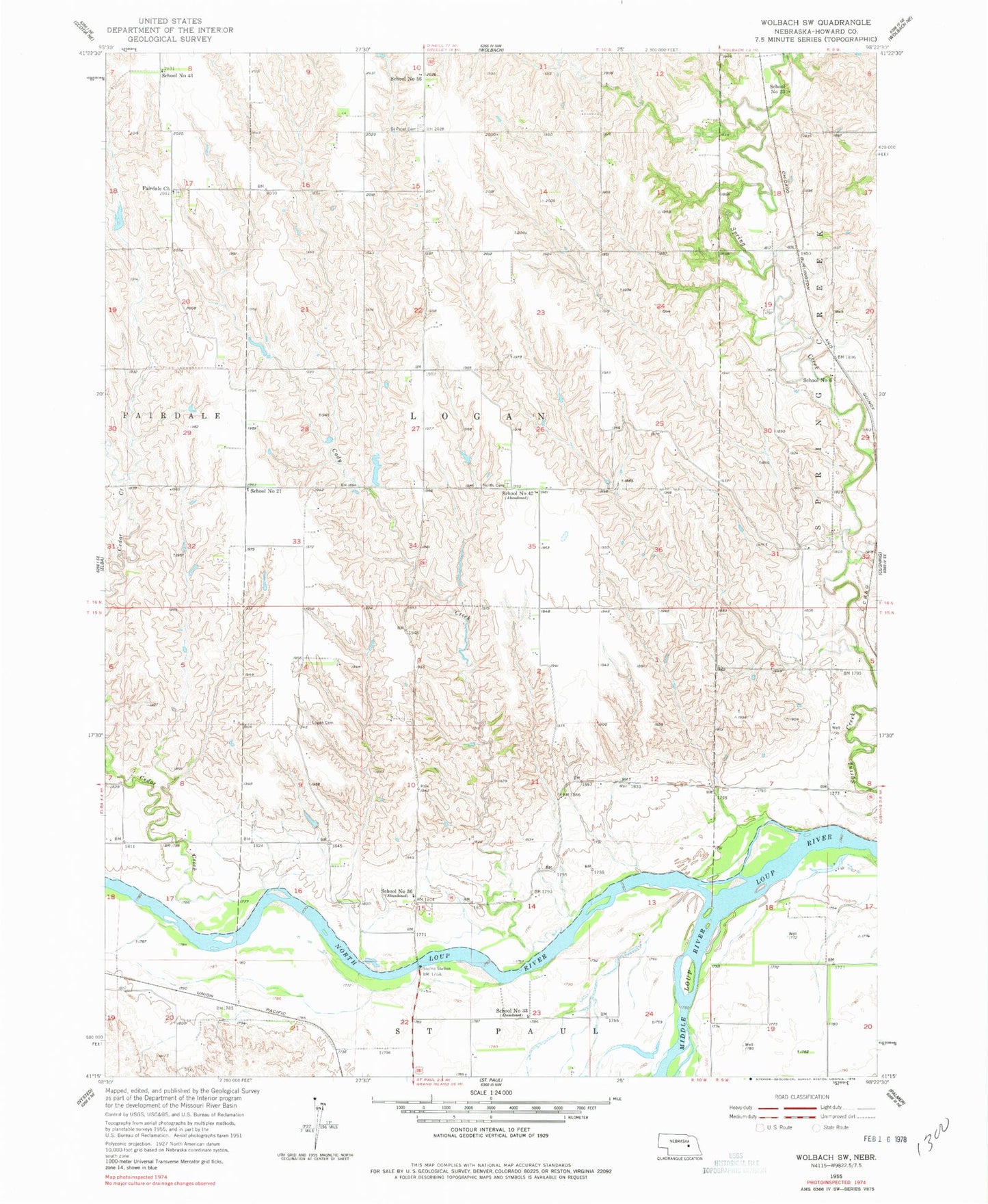
Classic USGS Wolbach SW Nebraska 7.5'x7.5' Topo Map
Couldn't load pickup availability
Historical USGS topographic quad map of Wolbach SW in the state of Nebraska. Map scale may vary for some years, but is generally around 1:24,000. Print size is approximately 24" x 27"
This quadrangle is in the following counties: Howard.
The map contains contour lines, roads, rivers, towns, and lakes. Printed on high-quality waterproof paper with UV fade-resistant inks, and shipped rolled.
Contains the following named places: Cady Creek, Cedar Creek, Fairdale Church, Fairdale-Logan Election Precinct, Hamm Cemetery, Kolar Dam, Kolar Reservoir, Lake Creek, Loup Junction State Wildlife Management Area, Middle Loup River, Miller Dam, Miller Reservoir, North Cemetery, North Logan Cemetery, North Loup River, North Loup State Recreation Area, Petersen Dam, Petersen Reservoir, School Number 21, School Number 23, School Number 33, School Number 36, School Number 42, School Number 43, School Number 56, School Number 6, Township of Logan