MyTopo
Classic USGS Wolf Butte Nebraska 7.5'x7.5' Topo Map
Regular price
$16.95
Regular price
Sale price
$16.95
Unit price
per
Couldn't load pickup availability
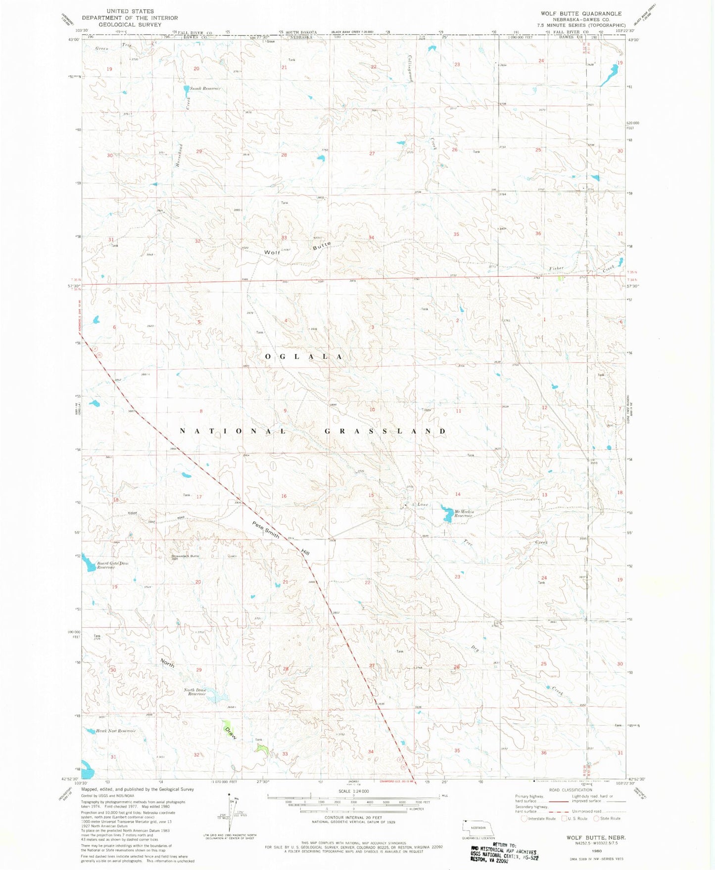
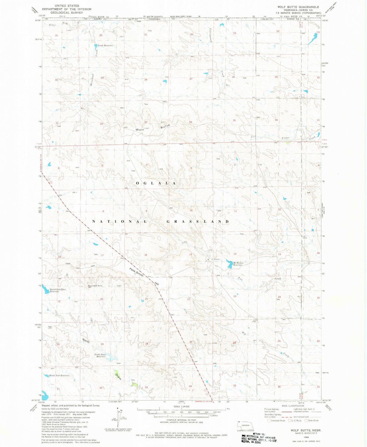
Historical USGS topographic quad map of Wolf Butte in the state of Nebraska. Map scale may vary for some years, but is generally around 1:24,000. Print size is approximately 24" x 27"
This quadrangle is in the following counties: Dawes.
The map contains contour lines, roads, rivers, towns, and lakes. Printed on high-quality waterproof paper with UV fade-resistant inks, and shipped rolled.
Contains the following named places: Board Gate Dam Reservoir, Boardgate Dam, Green Tree Creek, Hawk Nest Reservoir, McMeekin Dam, McMeekin Reservoir, Moody Dam, North Draw Dam Number 2, North Draw Reservoir, Pete Smith Hill, Snook Dam-1 Dam, Snook Reservoir, Strawstack Butte, Wolf Butte