
MyTopo
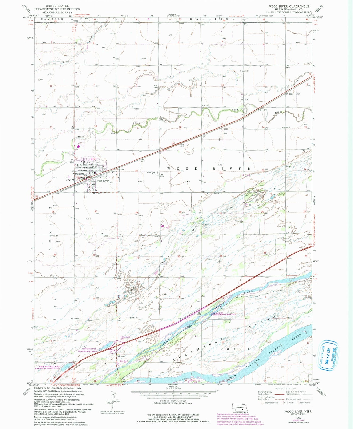
Classic USGS Wood River Nebraska 7.5'x7.5' Topo Map
Couldn't load pickup availability
Historical USGS topographic quad map of Wood River in the state of Nebraska. Map scale may vary for some years, but is generally around 1:24,000. Print size is approximately 24" x 27"
This quadrangle is in the following counties: Hall.
The map contains contour lines, roads, rivers, towns, and lakes. Printed on high-quality waterproof paper with UV fade-resistant inks, and shipped rolled.
Contains the following named places: Albeville, Albeville Post Office, Cattail State Wildlife Management Area, Cheyenne State Wildlife Management Area, City of Wood River, First United Methodist Church, First United Presbyterian Church, Good Samaritan Center, Grace Lutheran Church, Hall County, Maltman Memorial Public Library, Saint Marys Catholic Church, School Number 25, School Number 63, Shoemaker Island, Thelen Grain Company Elevator, Township of Wood River, Wood River, Wood River Camp, Wood River Cemetery, Wood River Country Club, Wood River Elementary School, Wood River Family Medicine, Wood River Police Department, Wood River Post Office, Wood River Rural High School, Wood River Volunteer Fire and Rescue, Wood River West State Wildlife Management Area, Woodland School, Woodriver Valley Mobile Park, ZIP Code: 68883


