MyTopo
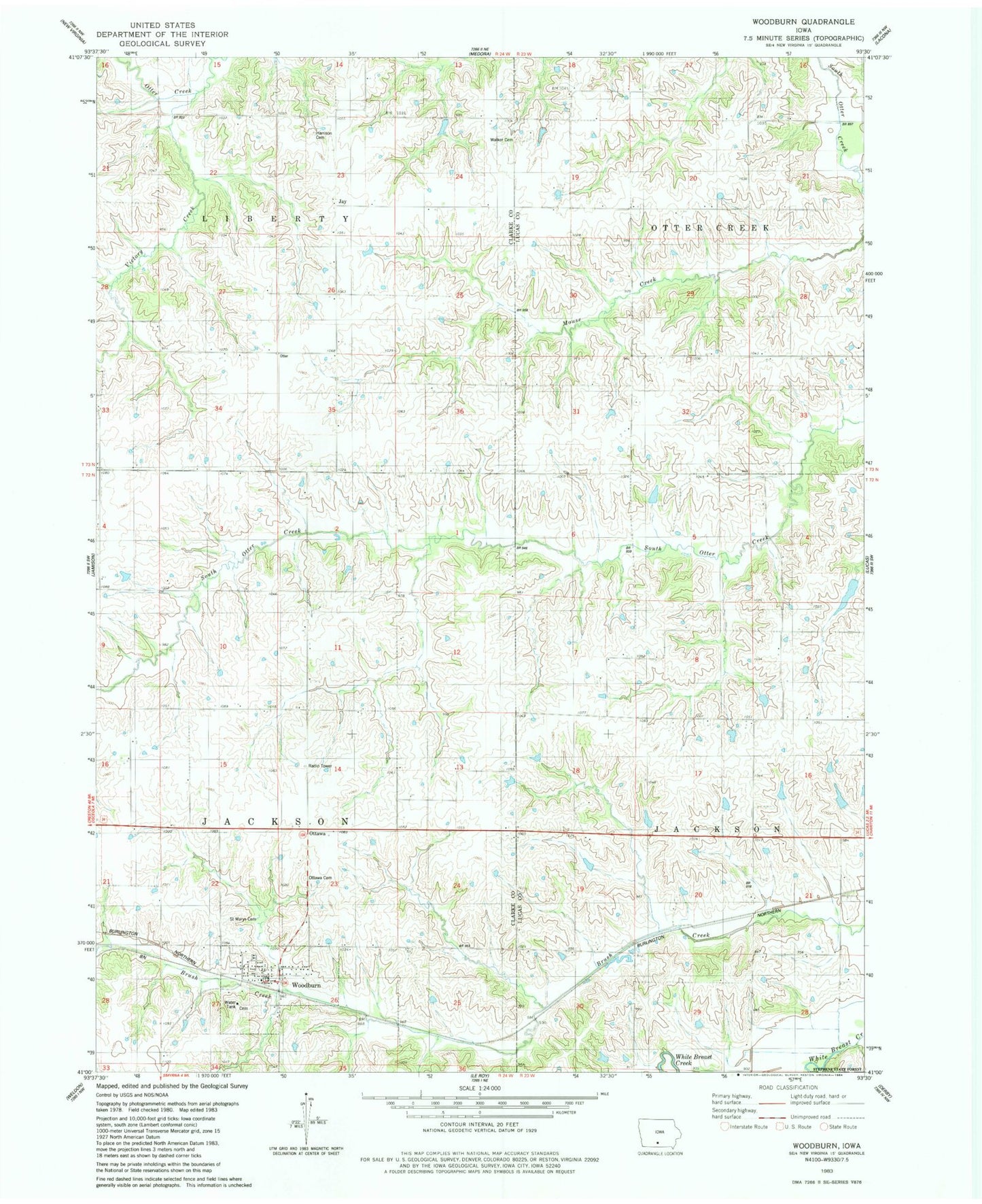
Classic USGS Woodburn Iowa 7.5'x7.5' Topo Map
Couldn't load pickup availability
Historical USGS topographic quad map of Woodburn in the state of Iowa. Map scale may vary for some years, but is generally around 1:24,000. Print size is approximately 24" x 27"
This quadrangle is in the following counties: Clarke, Lucas.
The map contains contour lines, roads, rivers, towns, and lakes. Printed on high-quality waterproof paper with UV fade-resistant inks, and shipped rolled.
Contains the following named places: Box Elder School, Brush Creek, Center Star School, Chinquapin School, City of Woodburn, Cleveland, Cleveland Post Office, Fox School, Harrison Cemetery, Hill School, Jacksonville, Jay, Jay Post Office, Liberty Center School, Middleport Post Office, North Star School, Ottawa, Ottawa Cemetery, Ottawa School, Palestine School, Pleasant Ridge School, Powell School, Saint Marys Cemetery, Spring Hill School, Township of Jackson, Township of Liberty, Victor School, Victory Creek, Walker Cemetery, Woodburn, Woodburn Cemetery, Woodburn Christian Church, Woodburn City Hall, Woodburn Fire and Rescue Department, Woodburn Post Office, Wren Hill Cemetery, Wren School, ZIP Codes: 50151, 50275