MyTopo
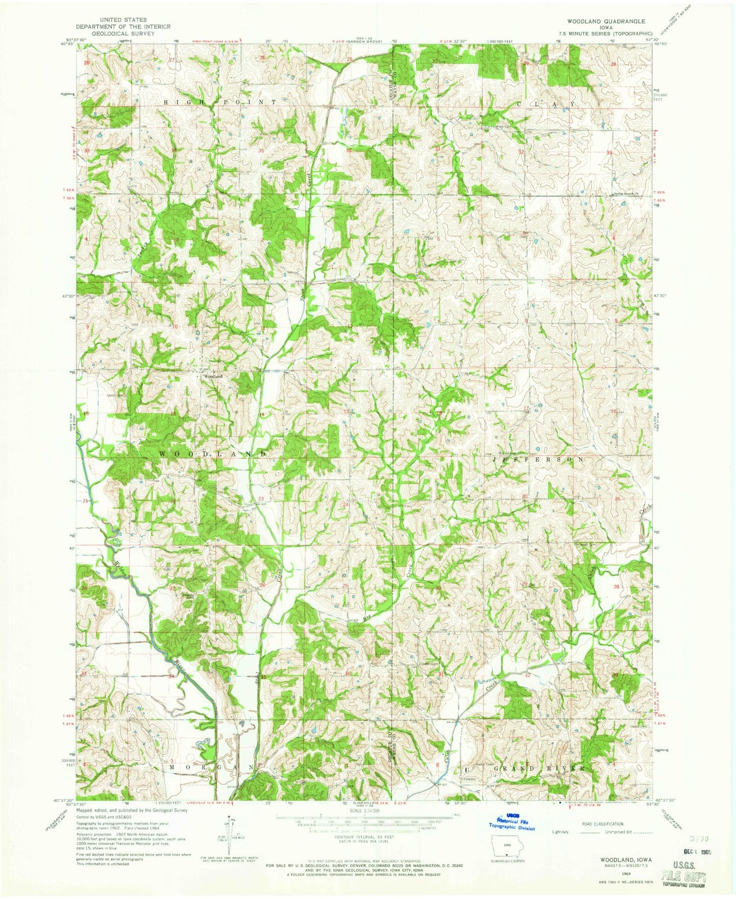
Classic USGS Woodland Iowa 7.5'x7.5' Topo Map
Couldn't load pickup availability
Historical USGS topographic quad map of Woodland in the state of Iowa. Map scale may vary for some years, but is generally around 1:24,000. Print size is approximately 24" x 27"
This quadrangle is in the following counties: Decatur, Wayne.
The map contains contour lines, roads, rivers, towns, and lakes. Printed on high-quality waterproof paper with UV fade-resistant inks, and shipped rolled.
Contains the following named places: Big Spring, Big Spring Post Office, Big Springs Cemetery, Corder Cemetery, Cunningham Cemetery, Hayes Cemetery, Hog Creek, Lentz Cemetery, Shield Goff Cemetery, Shields Cemetery, Spring Branch Church, Township of Woodland, Turkey Creek, Woodland, Woodland Post Office, ZIP Code: 50147