MyTopo
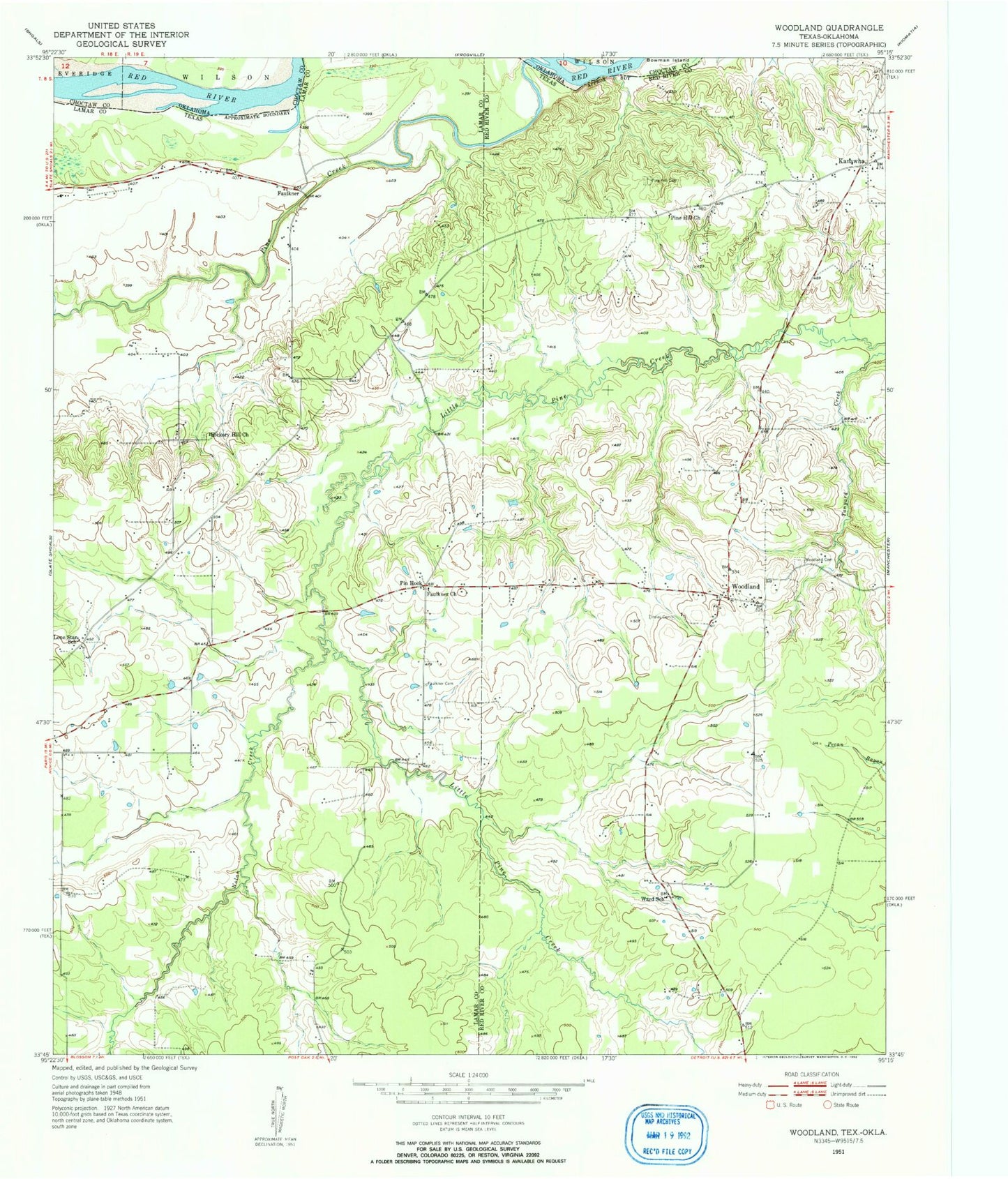
Classic USGS Woodland Texas 7.5'x7.5' Topo Map
Couldn't load pickup availability
Historical USGS topographic quad map of Woodland in the state of Texas. Map scale may vary for some years, but is generally around 1:24,000. Print size is approximately 24" x 27"
This quadrangle is in the following counties: Choctaw, Lamar, Red River.
The map contains contour lines, roads, rivers, towns, and lakes. Printed on high-quality waterproof paper with UV fade-resistant inks, and shipped rolled.
Contains the following named places: Faulkner, Faulkner Church, Fought Creek, Hall Lake, Hall Lake Dam, Hickory Hill Church, Kanawha, Lone Star School, Nolan Creek, Pin Hook, Pine Creek, Pine Hill Cemetery, Pine Hill Church, Rogers Lake, Rogers Lake Dam, S David Ramsey Lake, S David Ramsey Lake Dam, Tinsley Cemetery, Ward School, Woodland, Woodland Cemetery