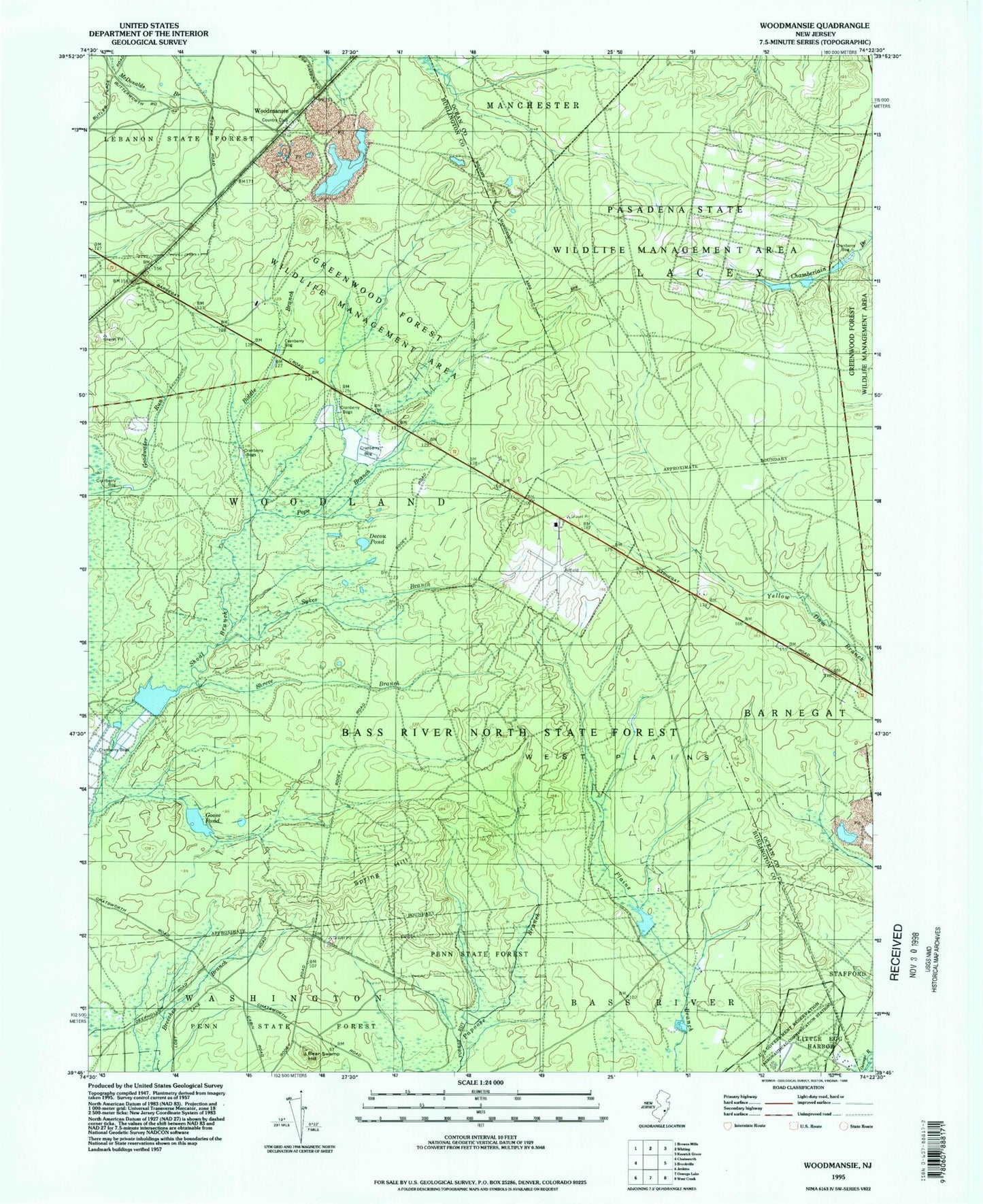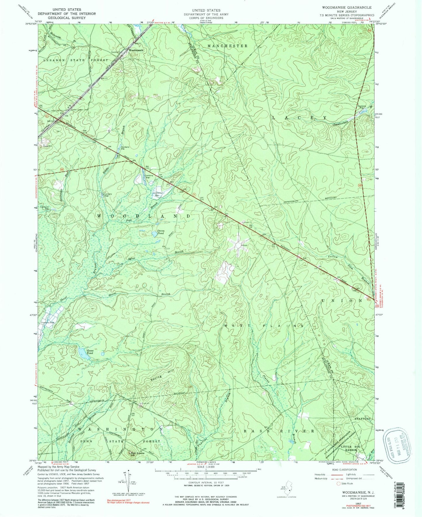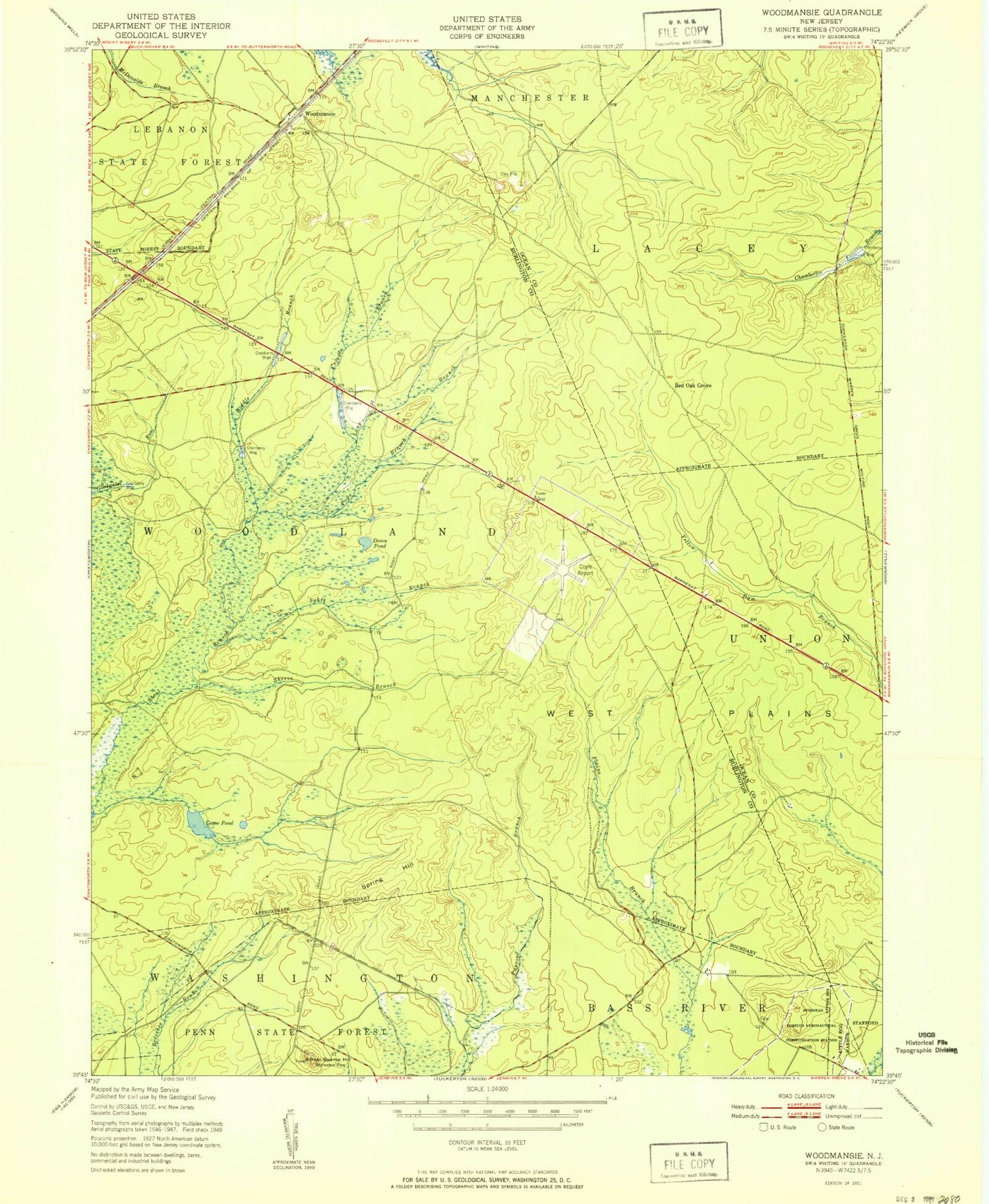
MyTopo
Classic USGS Woodmansie New Jersey 7.5'x7.5' Topo Map
Couldn't load pickup availability
Historical USGS topographic quad map of Woodmansie in the state of New Jersey. Typical map scale is 1:24,000, but may vary for certain years, if available. Print size: 24" x 27"
This quadrangle is in the following counties: Burlington, Ocean.
The map contains contour lines, roads, rivers, towns, and lakes. Printed on high-quality waterproof paper with UV fade-resistant inks, and shipped rolled.
Contains the following named places: Bear Swamp Hill, Biddle Branch, Decou Pond, Goodwater Run, Goose Pond, Pope Branch, Shreve Branch, Spring Hill, Sykes Branch, Woodmansie, Red Oak Grove, Long Causeway, Greenwood Forest Wildlife Management Area, Old Halfway, Coyle Field, Lentine South Airport (historical), Off Road Vehicle Park Ambulance, Bear Swamp Hill, Biddle Branch, Decou Pond, Goodwater Run, Goose Pond, Pope Branch, Shreve Branch, Spring Hill, Sykes Branch, Woodmansie, Red Oak Grove, Long Causeway, Greenwood Forest Wildlife Management Area, Old Halfway, Coyle Field, Lentine South Airport (historical), Off Road Vehicle Park Ambulance