MyTopo
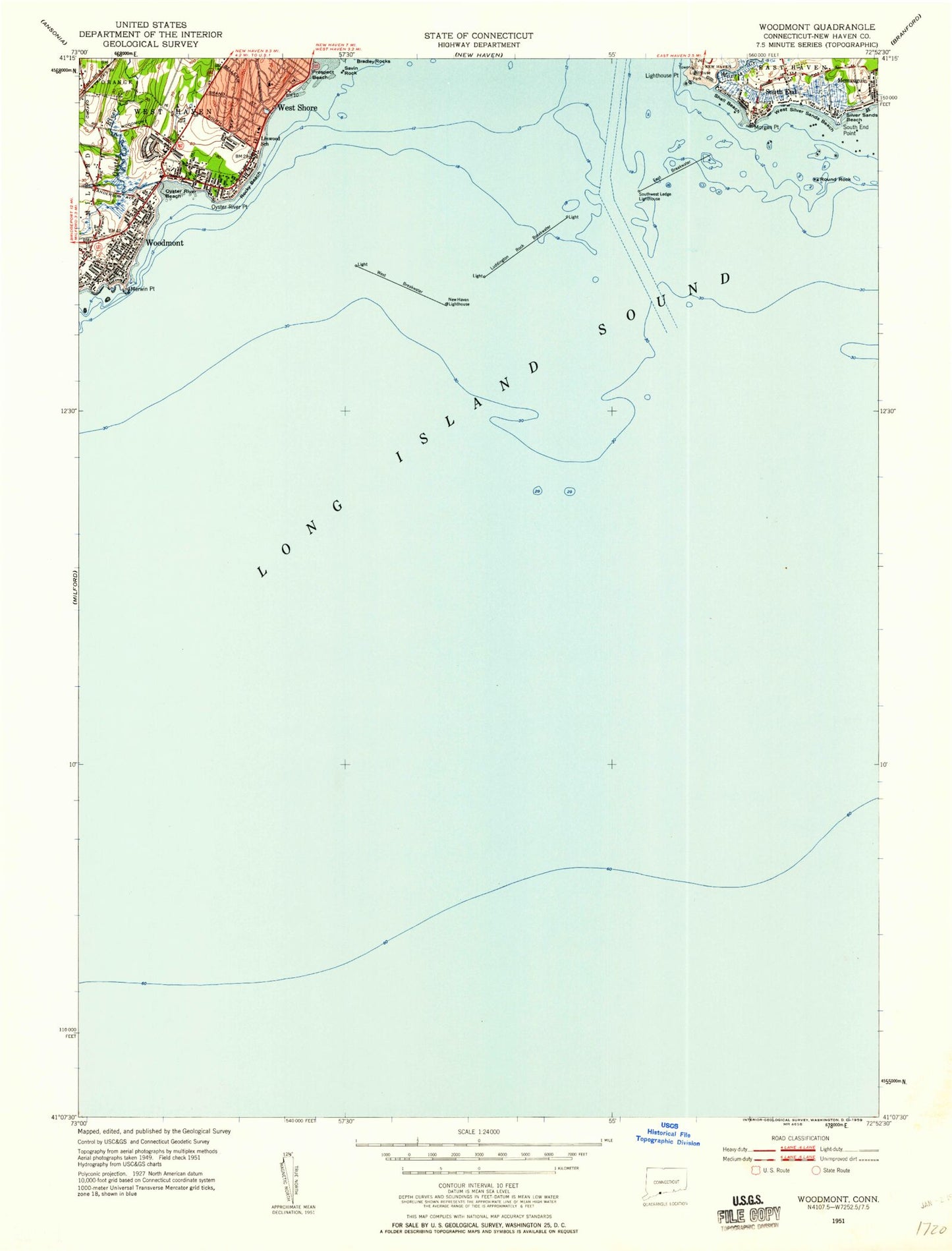
Classic USGS Woodmont Connecticut 7.5'x7.5' Topo Map
Couldn't load pickup availability
Historical USGS topographic quad map of Woodmont in the state of Connecticut. Map scale may vary for some years, but is generally around 1:24,000. Print size is approximately 24" x 27"
This quadrangle is in the following counties: New Haven.
The map contains contour lines, roads, rivers, towns, and lakes. Printed on high-quality waterproof paper with UV fade-resistant inks, and shipped rolled.
Contains the following named places: Adams Fall, Alma E Pagels School, Baybrook Station Post Office, Bayshore Shopping Center, Big Boil, Borough of Woodmont, Colonial Park, Dick Rock, East Breakwater, Fannie Beach Community Center, Five Mile Point Lighthouse, Grancentral Plaza Shopping Center, Hawley Avenue Playground, Jones Hill, Lake Dawson Dam, Lighthouse Marina, Lighthouse Point, Linwood School, Live Oaks School, Luddington Rock Breakwater, Mary Rock, Merwin Point, Middle Rock, Milford Fire Department Station 5, Morgan Point, Morris Creek, New Haven Harbor Entrance Channel, New Haven Lighthouse, Old Head Reef, Oyster River, Oyster River Beach, Oyster River Point, Prospect Beach, Quixes Ledge, Rocky Beach, Round Rock, Saint Johns By-The-Sea Episcopal Church, Savin Rock, Seth G Haley School, Shell Beach, Silver Sands Beach, South End, South End Point, South West Ledge, Southwest Ledge Lighthouse, The Chimneys, Twin Rocks, West Breakwater, West Breakwater Lighthouse, West Haven Airport, West Shore, West Shore Fire District Benham Hill Station, West Shore Fire District Headquarters, West Silver Sands Beach, Woodmont, Woodmont Station, Woodmont Station Post Office