MyTopo
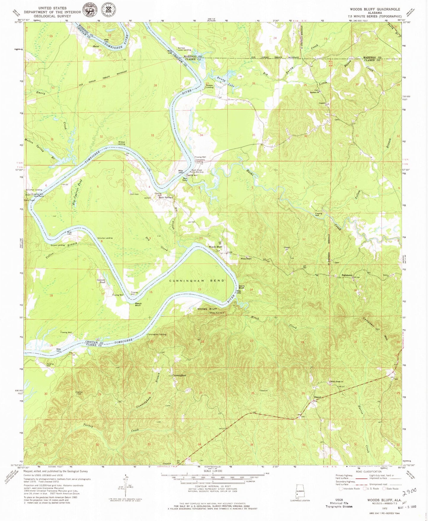
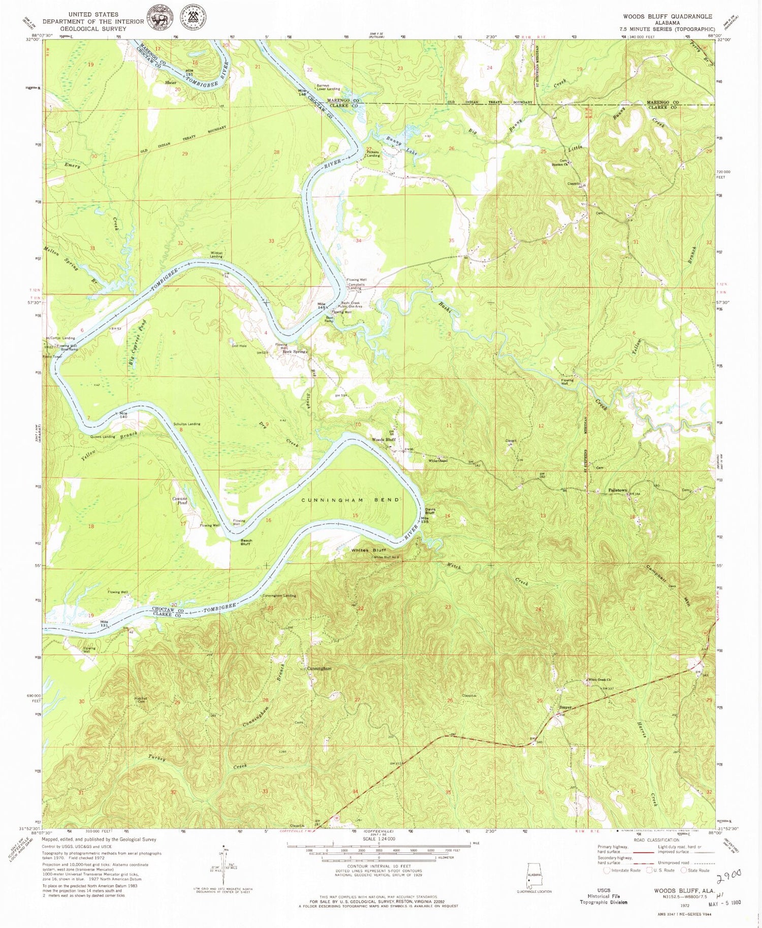
Classic USGS Woods Bluff Alabama 7.5'x7.5' Topo Map
Couldn't load pickup availability
Historical USGS topographic quad map of Woods Bluff in the state of Alabama. Map scale may vary for some years, but is generally around 1:24,000. Print size is approximately 24" x 27"
This quadrangle is in the following counties: Choctaw, Clarke, Marengo.
The map contains contour lines, roads, rivers, towns, and lakes. Printed on high-quality waterproof paper with UV fade-resistant inks, and shipped rolled.
Contains the following named places: Barneys Lower Landing, Barneys Shoals, Bashi Creek, Bashi Creek Public Use Area, Beach Bluff, Big Bunny Creek, Big Cypress Pond, Big Slough, Bunny Lake, Buttonwood Branch, Buxtion Church, Cade Bar, Cade Bend, Cade Bend Landing, Campbell Mountain, Campbells Landing, Cowans Gin, Cowans Pond, Cunningham, Cunningham Bend, Cunningham Branch, Cunningham Landing, Davis Bluff, Dry Creek, Emery Creek, Failetown, Ferrell Branch, Grangers Bar, Hatchet Cemetery, Little Bunny Creek, Log Landing, McCartys Bluff, McCartys Ferry, McCartys Landing, McNeiders, Melton Spring Branch, Mitchells Woodyard Landing, Morvin Junior High School, Nobles Gin Landing, Pickens, Pickens Landing, Quinn, Quinns Landing, Rock Springs, Rocky Branch, Schultys Landing, Slater, Slaters Landing, Smyer, Whites Bluff, Wicks Chapel, Wildcat Landing, Witch Creek, Witch Creek Church, Woods Bluff, Woods Bluff Public Use Area, Woods Bluff Shoal, Yellow Bluff, Yellow Branch, ZIP Code: 36727