

MyTopo
Classic USGS Woods Hole Massachusetts 7.5'x7.5' Topo Map
Couldn't load pickup availability
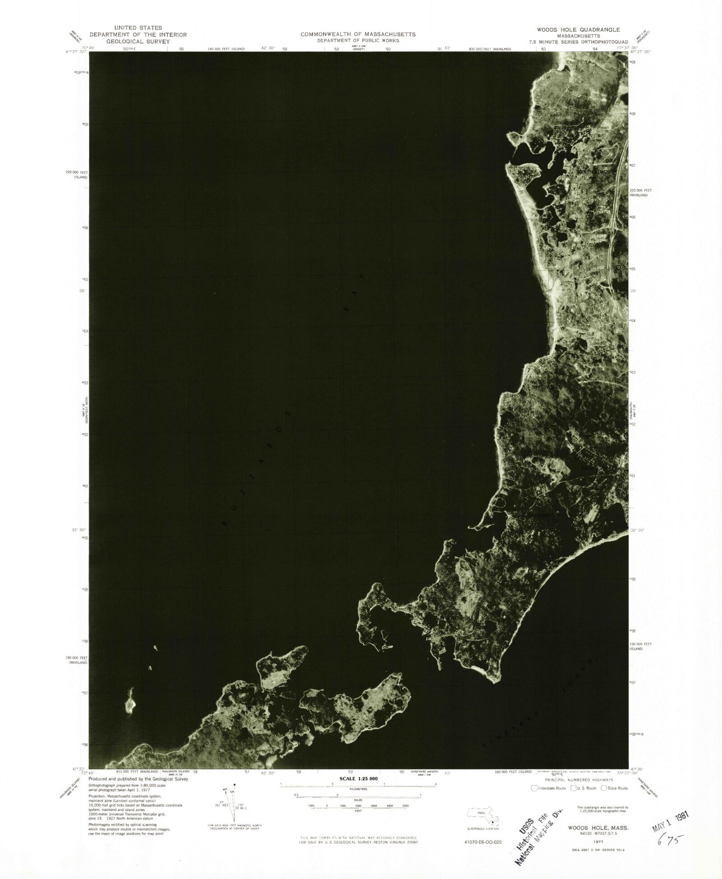
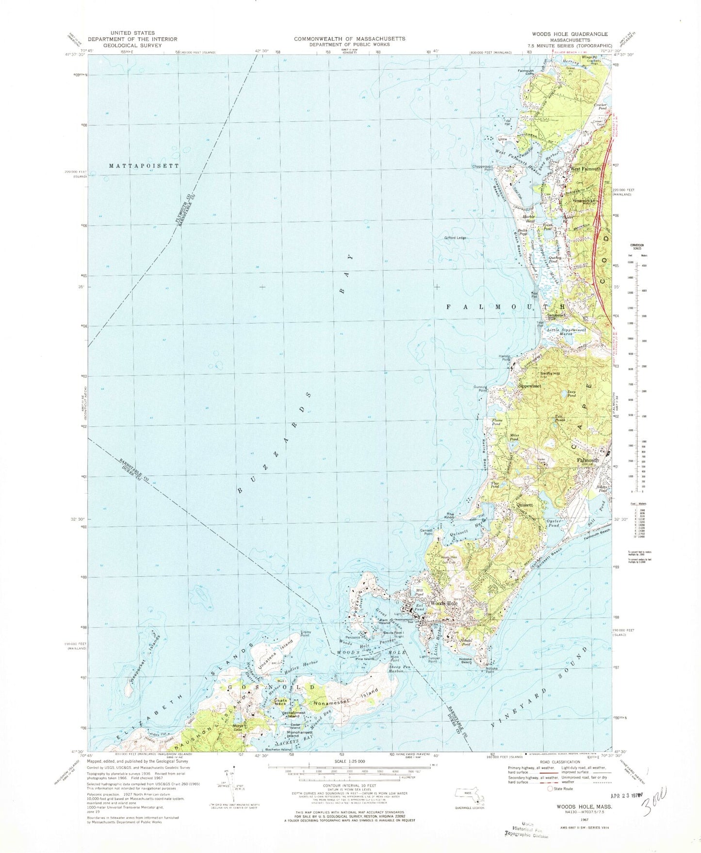
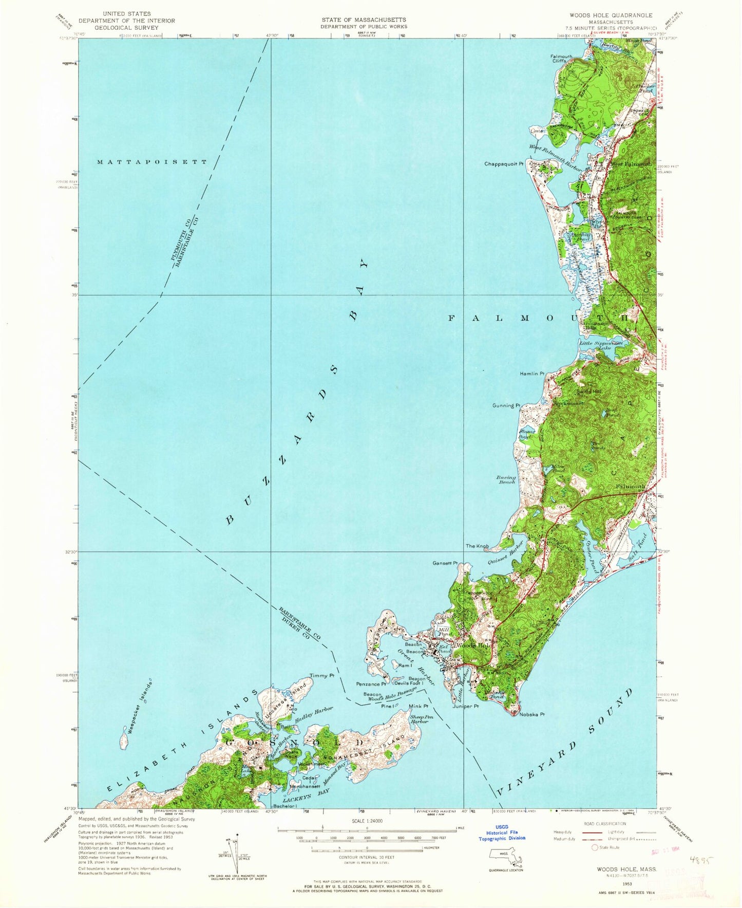
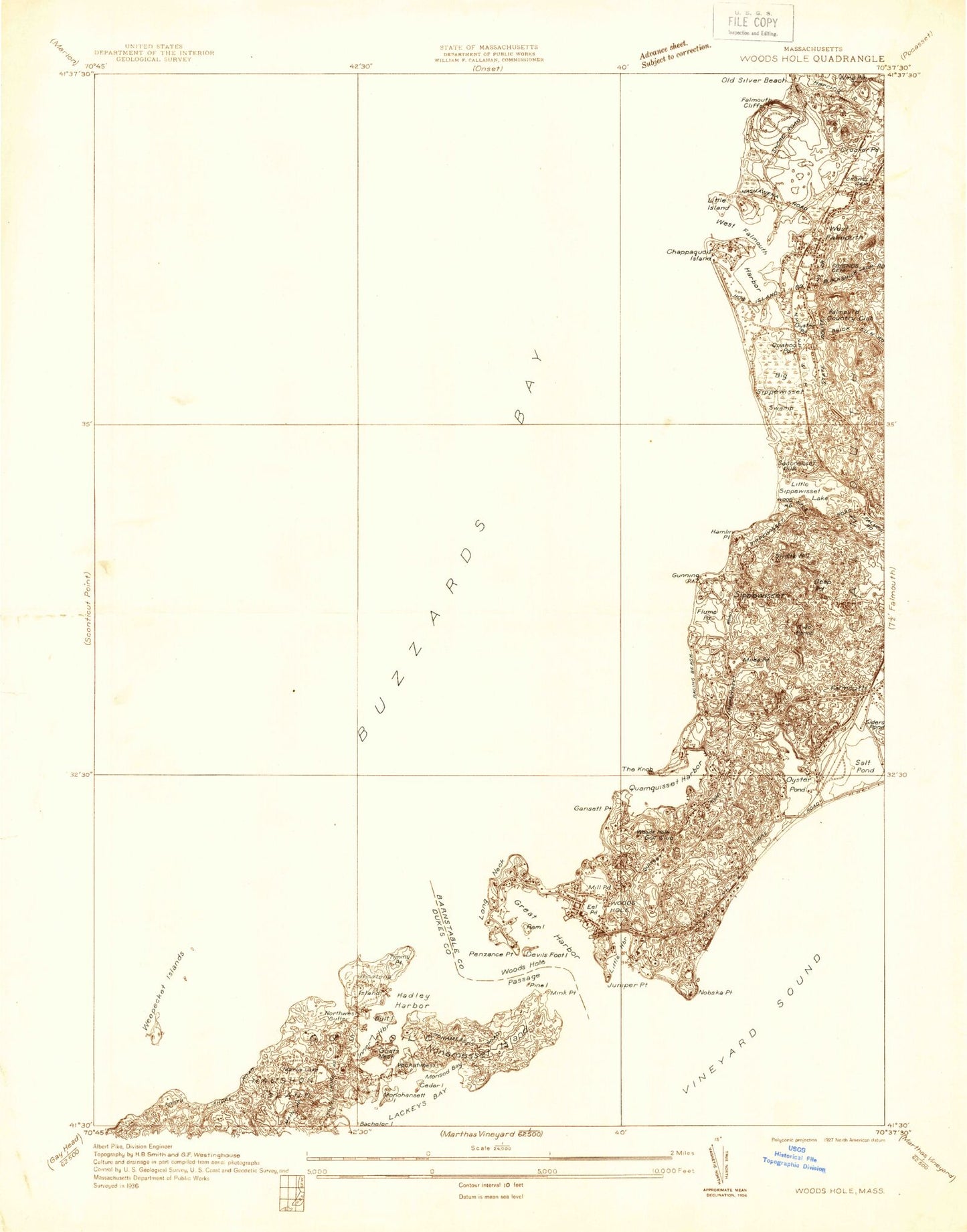
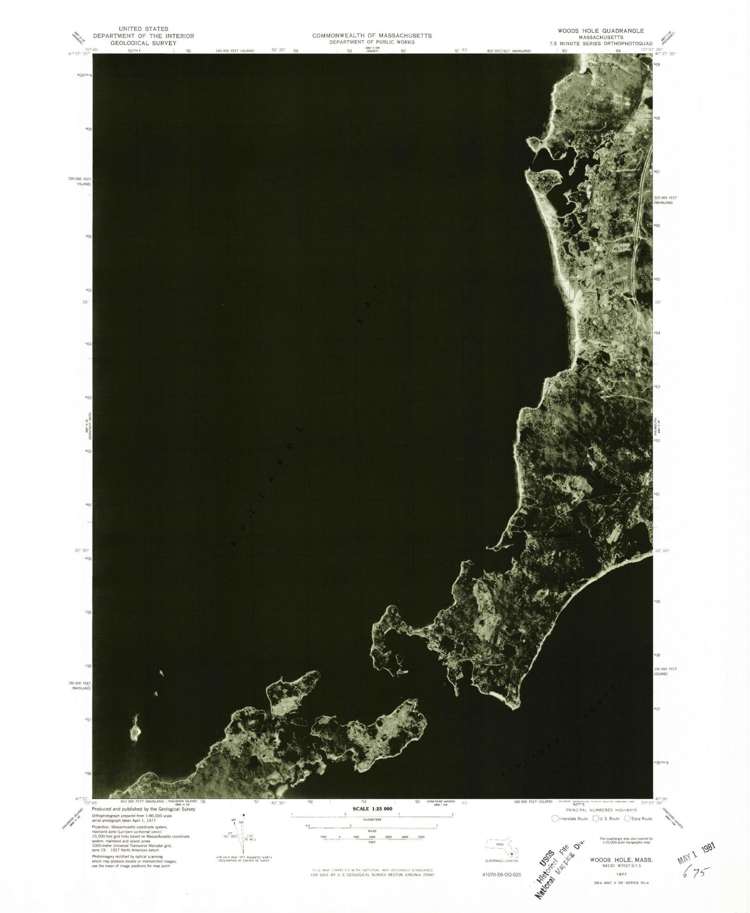
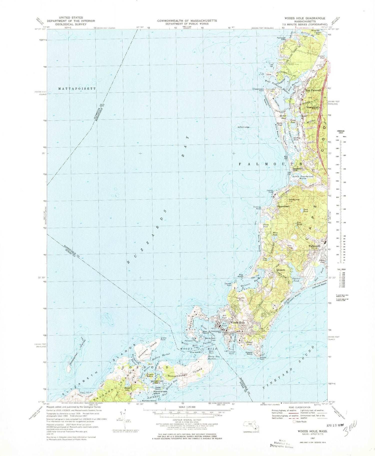
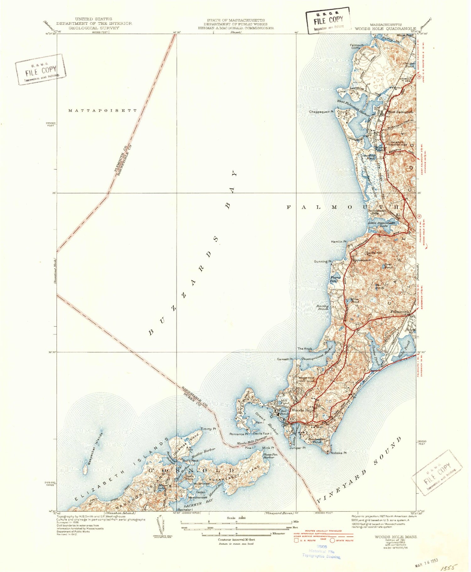
Historical USGS topographic quad map of Woods Hole in the state of Massachusetts. Typical map scale is 1:24,000, but may vary for certain years, if available. Print size: 24" x 27"
This quadrangle is in the following counties: Barnstable, Dukes, Plymouth.
The map contains contour lines, roads, rivers, towns, and lakes. Printed on high-quality waterproof paper with UV fade-resistant inks, and shipped rolled.
Contains the following named places: Quahog Pond, Holy Cross Fathers Church, Branch, Broadway, Great Sippewisset Rock, Hadley Rock, Red Ledge, Woods Hole Passage Light, Nobaska Point Light, Great Harbor Range Light, Juniper Point Light, Great Harbor Ferry Slip Light, Oceanographic Pier Light, Grassy Island Ledge Light, Oceanographic Institute, Crowell Cemetery, Woods Hole Golf Club, Grassy Island, Saconesset Homestead and Museum, Nobska Lighthouse, Woods Hole Aquarium, Telegraph Hill, Riddle Hill, National Marine Fisheries Service, Marine Biological Laboratory, Falmouth Heights, Mount Sod, Hursell Rock, Bachelor Island, Beach Pond, Black Beach, Gate of Canso, Cedar Island, Chappaquoit, Chappaquoit Beach, Chappaquoit Point, Coffin Rock, Deep Pond, Devils Foot Island, East Gutter, Eel Pond, Falmouth Beach, Falmouth Cliffs, Flax Pond, Flume Pond, Fresh Pond, Gansett Point, Gifford Ledge, Goats Neck, Great Harbor, Great Ledge, Great Sippewisset Creek, Great Sippewisset Marsh, Gunning Point, Hadley Harbor, Hamlin Point, Harbor Head, Herring Brook, Juniper Point, The Knob, Lackeys Bay, Little Island, Little Sippewisset Marsh, Marys Lake, Middle Gate, Miles Pond, Mill Pond, Mink Point, Mink Pond, Monohansett Island, Nobska Beach, Nobska Point, Nobska Point Ledge, Nobska Pond, Nonamesset Island, Nonamesset Shoal, Northwest Gutter, Oyster Pond, Parker Flats, Penzance Point, Penzance, Pine Island, Pulpit Rock, Quissett, Quissett Beach, Quissett Harbor, Racing Beach, Ram Island, Saconesset Hills, Salt Pond, Sippewisset, Swifts Hill, Timmy Point, Timmy Point Shoal, Two Ponds, Uncatena Island, Veckatimest Island, Weepecket Island, Weepecket Islands, West Falmouth, West Falmouth Harbor, West Gutter, Woods Hole, Weepecket Rock, Bull Island, Woods Hole, Woods Hole Passage, Middle Ledge, Nobska Hill, Nonamesset Point, Inner Harbor, Little Harbor, Monsod Bay, Sheep Pen Harbor, Snug Harbor, Woods Hole Oceanographic Institute Seaplane Base, Buzzards Bay, North Falmouth Elementary School Library, Falmouth Academy, West Falmouth Library, Woods Hole Public Library, West Falmouth Census Designated Place, Woods Hole Census Designated Place, Falmouth Fire Department Station 4, Falmouth Fire Department Station 2, Woods Hole Post Office, West Falmouth Post Office, Quahog Pond, Holy Cross Fathers Church, Branch, Broadway, Great Sippewisset Rock, Hadley Rock, Red Ledge, Woods Hole Passage Light, Nobaska Point Light, Great Harbor Range Light, Juniper Point Light, Great Harbor Ferry Slip Light, Oceanographic Pier Light, Grassy Island Ledge Light, Oceanographic Institute, Crowell Cemetery, Woods Hole Golf Club, Grassy Island, Saconesset Homestead and Museum, Nobska Lighthouse, Woods Hole Aquarium, Telegraph Hill, Riddle Hill, National Marine Fisheries Service, Marine Biological Laboratory, Falmouth Heights, Mount Sod, Hursell Rock, Bachelor Island, Beach Pond, Black Beach, Gate of Canso, Cedar Island, Chappaquoit, Chappaquoit Beach, Chappaquoit Point, Coffin Rock, Deep Pond, Devils Foot Island, East Gutter, Eel Pond, Falmouth Beach, Falmouth Cliffs, Flax Pond, Flume Pond, Fresh Pond, Gansett Point, Gifford Ledge, Goats Neck, Great Harbor, Great Ledge, Great Sippewisset Creek, Great Sippewisset Marsh, Gunning Point, Hadley Harbor, Hamlin Point, Harbor Head, Herring Brook, Juniper Point, The Knob, Lackeys Bay, Little Island, Little Sippewisset Marsh, Marys Lake, Middle Gate, Miles Pond, Mill Pond, Mink Point, Mink Pond, Monohansett Island, Nobska Beach, Nobska Point, Nobska Point Ledge, Nobska Pond, Nonamesset Island, Nonamesset Shoal, Northwest Gutter, Oyster Pond, Parker Flats, Penzance Point, Penzance, Pine Island, Pulpit Rock, Quissett, Quissett Beach, Quissett Harbor, Racing Beach, Ram Island, Saconesset Hills, Salt Pond, Sippewisset, Swifts Hill, Timmy Point, Timmy Point Shoal, Two Ponds, Uncatena Island, Veckatimest Island, Weepecket Island, Weepecket Islands, West Falmouth, West Falmouth Harbor, West Gutter, Woods Hole, Weepecket Rock, Bull Island, Woods Hole, Woods Hole Passage, Middle Ledge, Nobska Hill