MyTopo
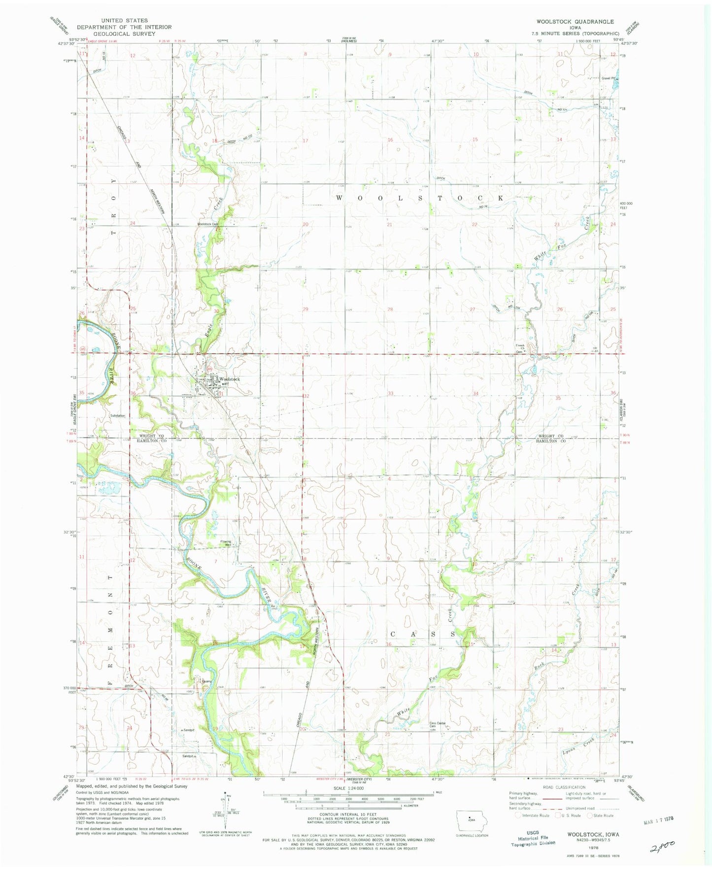
Classic USGS Woolstock Iowa 7.5'x7.5' Topo Map
Couldn't load pickup availability
Historical USGS topographic quad map of Woolstock in the state of Iowa. Map scale may vary for some years, but is generally around 1:24,000. Print size is approximately 24" x 27"
This quadrangle is in the following counties: Hamilton, Wright.
The map contains contour lines, roads, rivers, towns, and lakes. Printed on high-quality waterproof paper with UV fade-resistant inks, and shipped rolled.
Contains the following named places: Cass Center Cemetery, City of Woolstock, Ditch Number 124, Ditch Number 130, Ditch Number 149, Ditch Number 171, Ditch Number 172, Ditch Number 68, Eagle Creek, French Church, French Church Cemetery, Grandgeorge Quarry, Mark and Sadie Bishop Conservation Area, Saint Peters Lutheran Church, Saratoga Post Office, Township of Cass, Township of Woolstock, United Methodist Church, Wool Stock Post Office, Woolstock, Woolstock Cemetery, Woolstock City Hall, Woolstock Community Fire Department, Woolstock Community Hall, Woolstock Post Office, ZIP Code: 50599