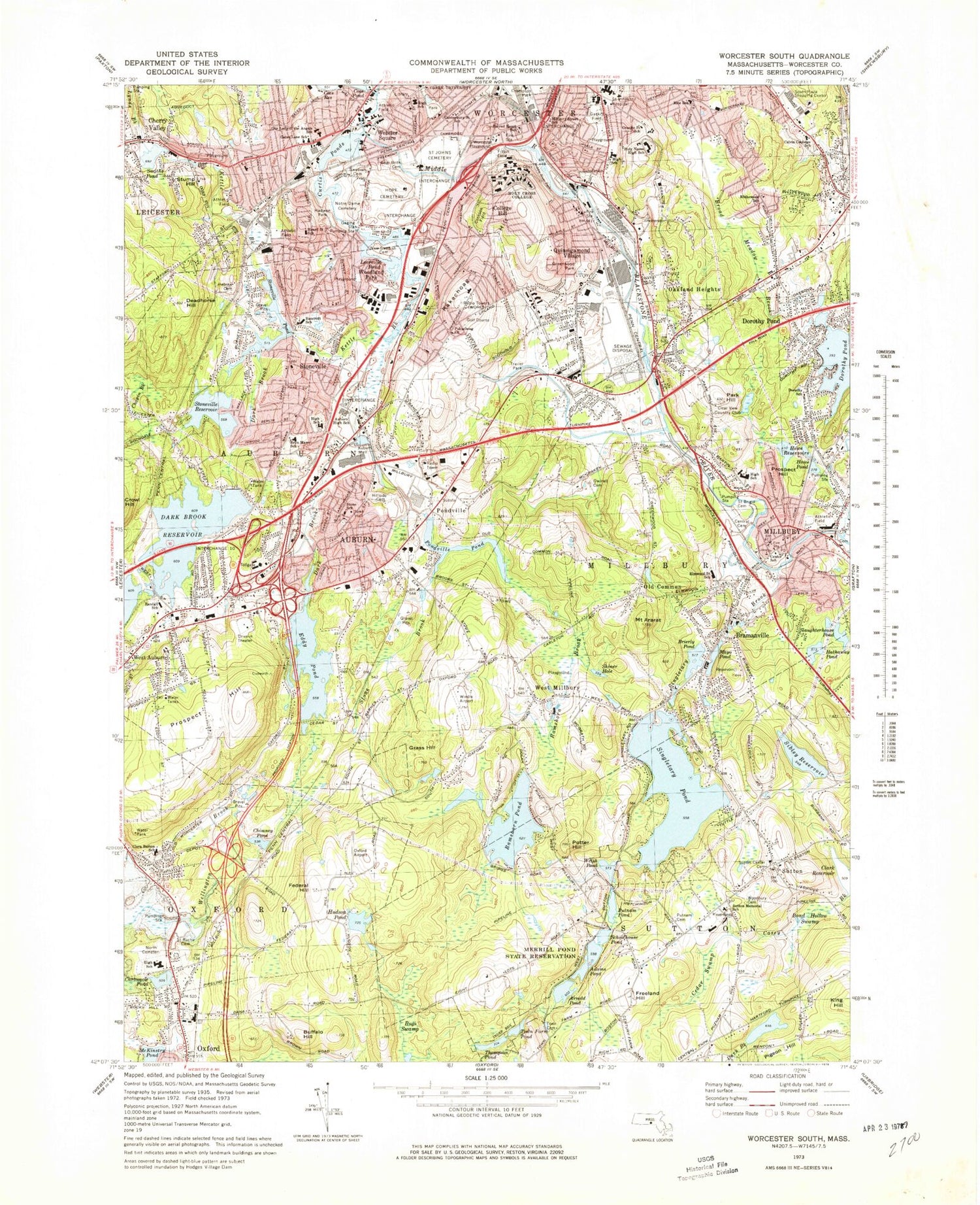
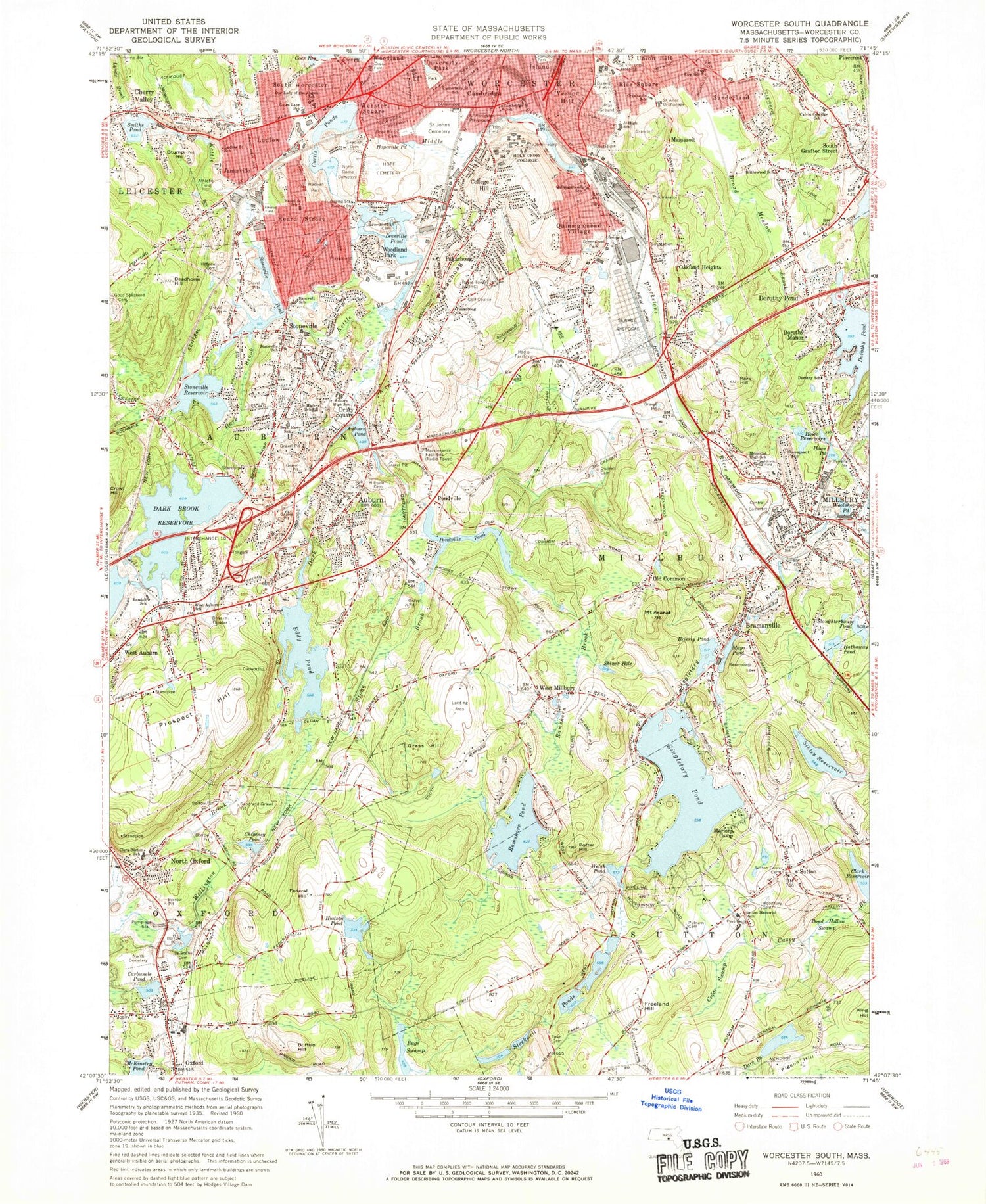
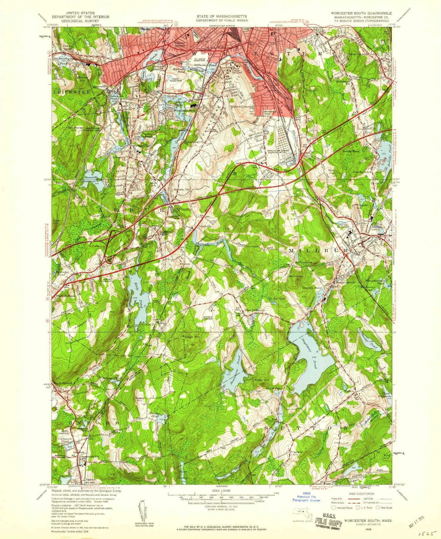
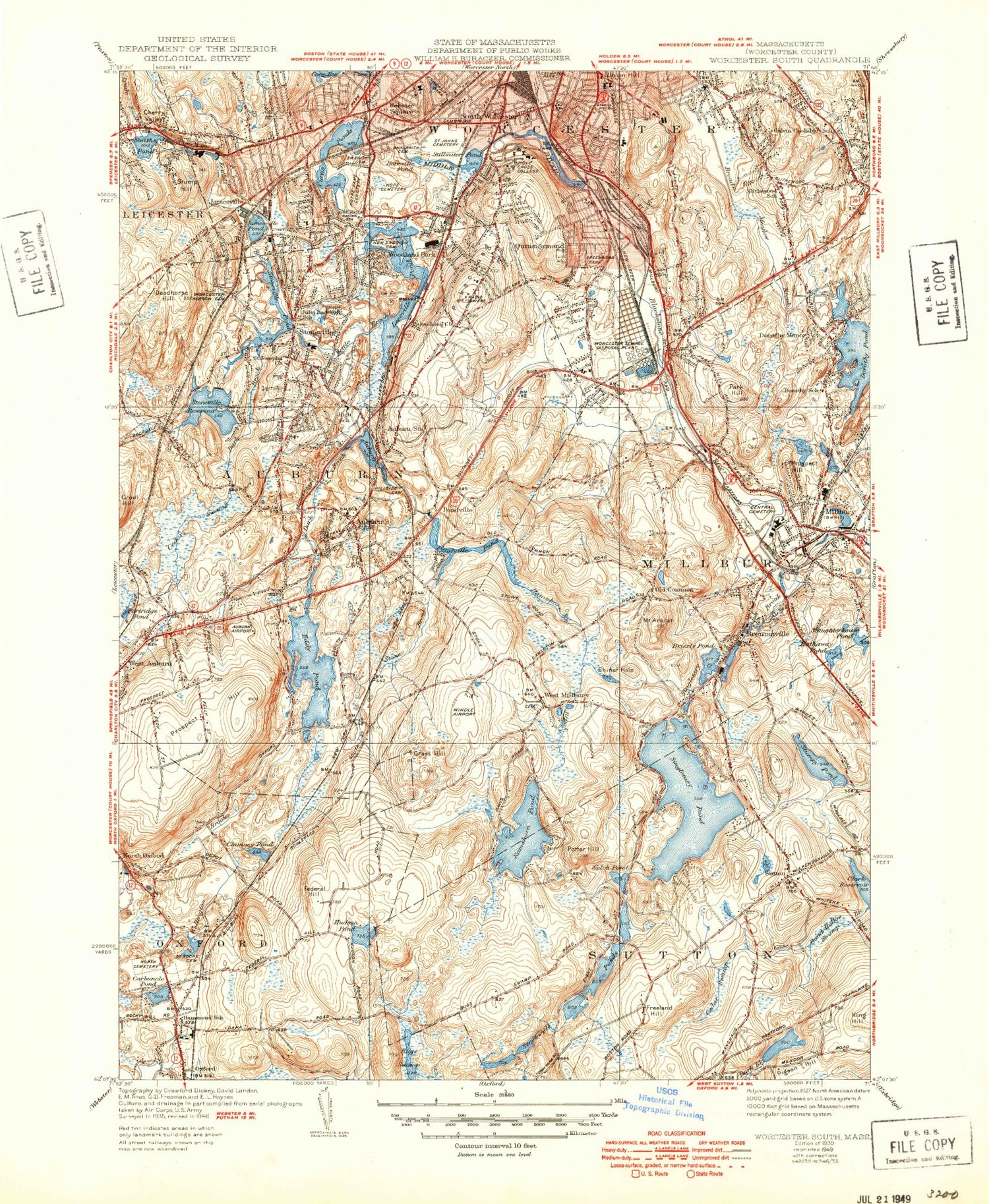
MyTopo
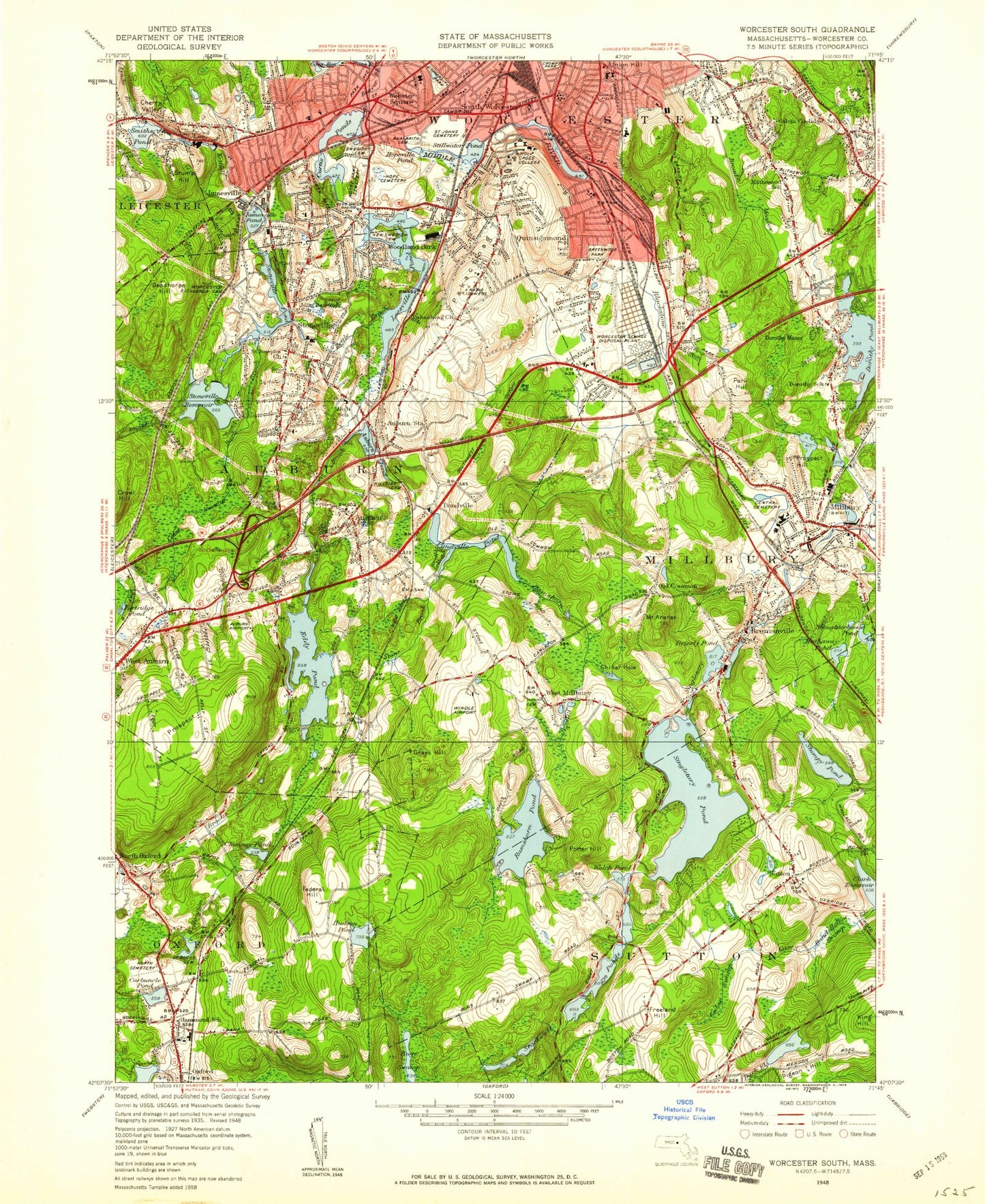
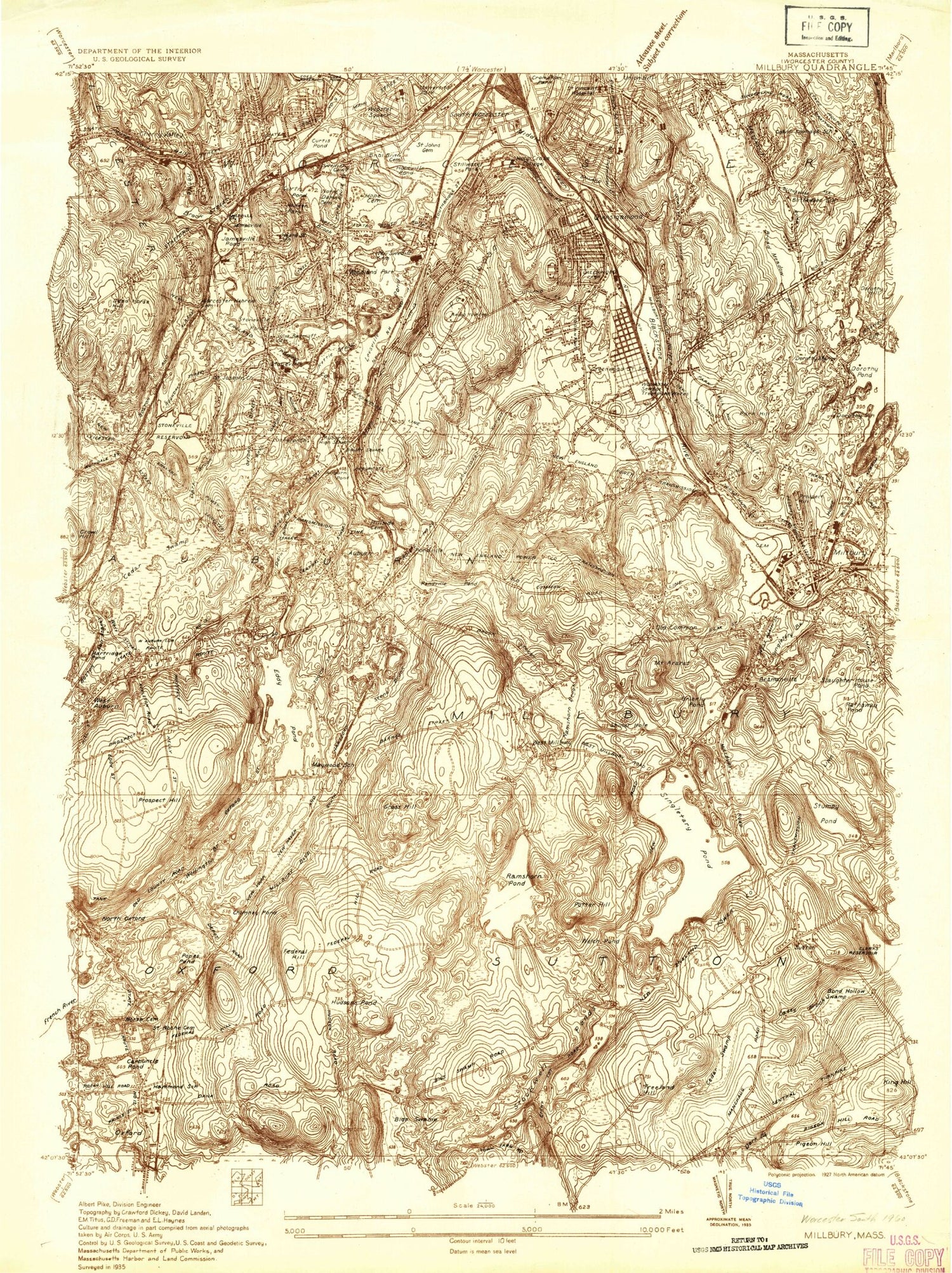
Classic USGS Worcester South Massachusetts 7.5'x7.5' Topo Map
Couldn't load pickup availability
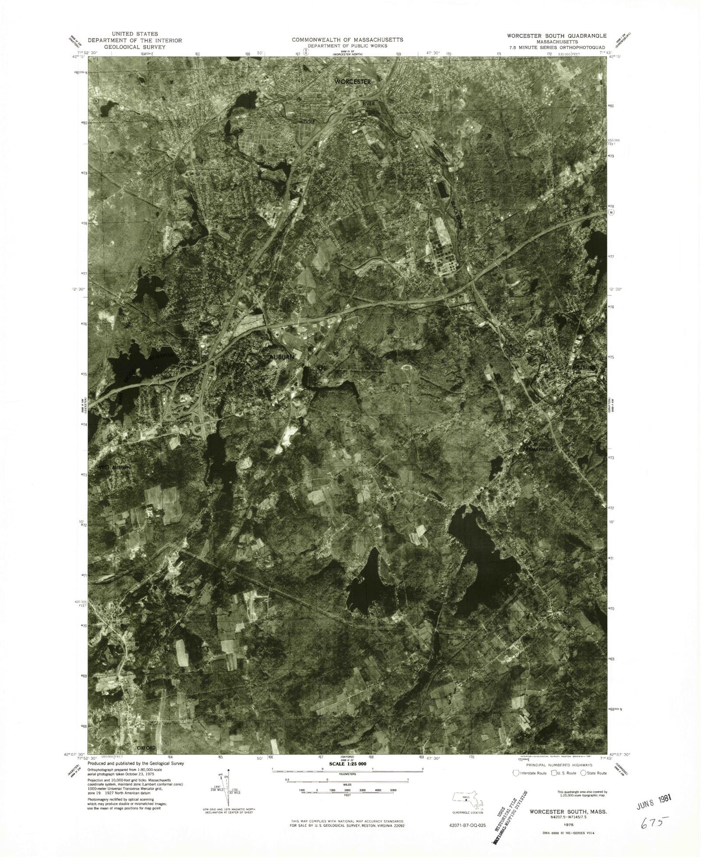
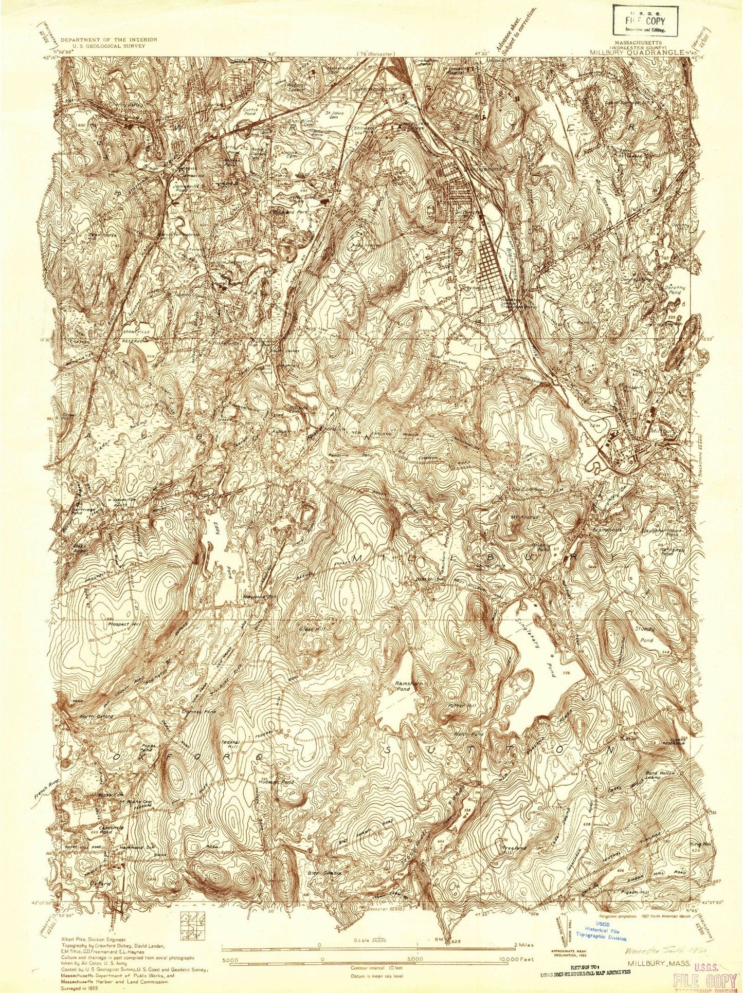
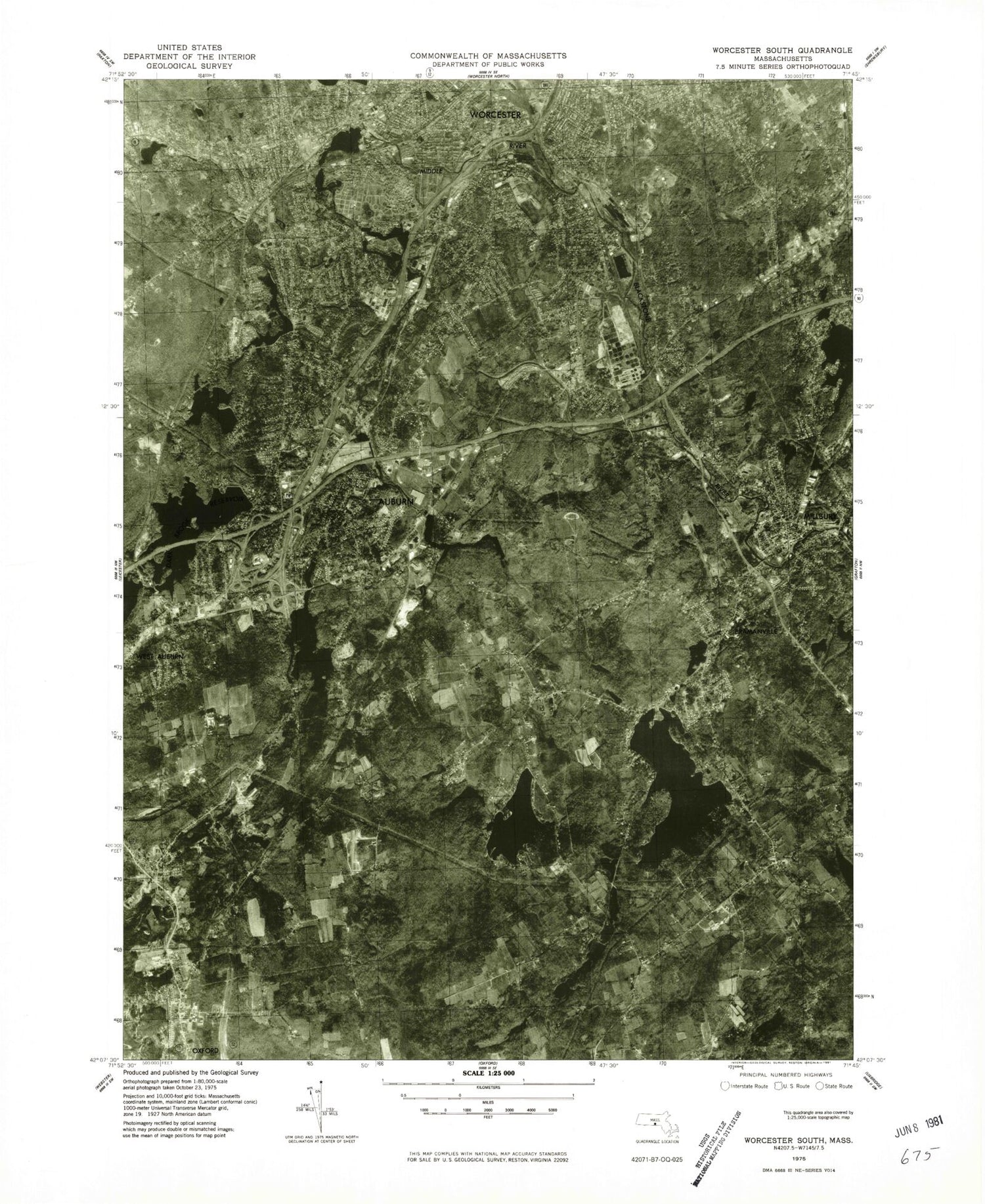
Historical USGS topographic quad map of Worcester South in the state of Massachusetts. Typical map scale is 1:24,000, but may vary for certain years, if available. Print size: 24" x 27"
This quadrangle is in the following counties: Worcester.
The map contains contour lines, roads, rivers, towns, and lakes. Printed on high-quality waterproof paper with UV fade-resistant inks, and shipped rolled.
Contains the following named places: Sunderland, Hadwen Park, All Faiths Cemetery and Crematory, Our Lady of the Angles School, Worcester High School, Sacred Heart School, Saint Johns Cemetery, Hope Cemetery, Clear View Country Club, Dorthy School, Millbury Memorial High School, Millbury Center School, Central Cemetery, Saint Brigid Cemetery, Dwinell Cemetery, Gates Lane Elementary School, Worcester Junior High School, Putnam Cemetery, Sutton Center Cemetery, Sutton Memorial School, Elmwood Street School, Oxford High School, Bryn Mawr Elementary School, Stoneville High School, Auburn High School, Pakachoag Church, Heard Street Elementary School, Notre Dame Cemetery, Old Swedish Cemetery, Saint Roch's Cemetery, Auburn Town Hall, Julia Bancroft School, College of the Holy Cross, Canterbury Street School, Bnai Brith Cemetery, Worcester Hebrew Cemetery, Mary D Stone School, Calvin Coolidge School, Rice School, Holy Name Center Catholic High School, Military Street School, Greenwood Park, Blithewood School, Clara Barton School, North Cemetery, Randall School, The Fair Plaza, Auburn Plaza, Drury Square, The Fair Shopping Center, Federal Plaza, South Worcester Playground, Fitton, Cookson Field, Crompton Park, Gaskin Field, Middle River Park, South Plaza Shopping Center, Mernill Pond State Reservation, Sutton Town Cemetery, Arnold Pond Dam, Hudson Pond Dam, Chimney Pond Dam, Ramshorn Pond Dam, Singletary Pond Dam, Brierly Pond Dam, Mayo Mill Number One Pond Dam, Dark Dam, Pondville Pond Dam, Dark Brook Reservoir Dike, Dark Brook Reservoir Dam, Auburn Pond Dam, Upper Stoneville Reservoir Dam, Stoneville Pond Dam, Leesville Pond Dam, Quinsigamond Pond Dam, Quinsigamond Pond, Curtis Ponds Dam, Wheelerville (historical), South Worcester, Valley Falls (historical), New Worcester (historical), Jamesville (historical), Dorothy Hill, Pratt Brook, Tatnuck Brook, Mount Ararat, Auburn, Auburn Pond, Beaver Brook, Bond Hollow Swamp, Bramanville, Brierly Pond, Broad Meadow Brook, Buffalo Hill, Bugs Swamp, Cambridge, Carbuncle Pond, Casey Brook, Cedar Swamp, Cherry Valley, Chimney Pond, College Hill, Curtis Ponds, Deadhorse Hill, Dorothy Manor, Dorothy Pond, Drury Square, Eddy Pond, Federal Hill, Freeland Hill, Grass Hill, Hathaway Pond, Heard Street, Hopeville Pond, Howe Pond, Howe Reservoirs, Hudson Pond, Island, Jamesville, Kettle Brook, Leesville Pond, Ludlow, Lynde Brook, McKinstry Pond, Marions Camp, Massasoit, Mayo Pond, Middle River, Millbury, North Oxford, Oakland Heights, Old Common, Pakachoag, Pakachoag Hill, Park Hill, Pigeon Hill, Pondville, Pondville Pond, Potter Hill, Prospect Hill, Prospect Hill, Quinsigamond Village, Ramshorn Brook, Ramshorn Pond, Rice Square, Shiner Hole, Sibley Reservoir, Singletary Brook, Singletary Pond, Slaughterhouse Pond, Smiths Pond, South Grafton Street, Stone Brook, Stoneville, Stoneville Pond, Stoneville Reservoir, Stump Hill, Sutton, Vernon Hill, Webster Square, Welsh Pond, West Auburn, West Millbury, Woodland Park, Dorothy Brook, Dark Brook, Dark Brook, Dark Brook, Chapin Brook, Crystal Pond, Stoneville Brook, Mill Brook (historical), Union Hill, Jamesville Pond, Kinnear Brook, Stillwater Pond, Town of Millbury, Town of Oxford, Hillside Cemetery, WORC-AM (Worcester), WCHC-FM (Worcester), Millbury Savings - West Heliport, Oxford Airport (historical), Town of Auburn, Town of Sutton, Adriatic Mills (historical), Apricot Street Playground, Assumption Church, Assumption School, Center Burial Ground, Auburn Industrial Park, Auburn Mall Shopping Center, Auburn Middle School, Auburn Plaza Shopping Center, Auburn Post Office, Auburn Senior High School, Beacon Street Firehouse, Bennett Field, Berean Baptist Church, Bethany Christian Parish Church, Bethel Lutheran Church, Bethlehem Covenant Church, Bible Way Baptist Church, Boyce Street Park, Cambridge Street Firehouse, Cambridge Street School, Christadelphian Chapel, Church of God of Prophecy, Church of God Southern New England, Cornerstone Community Church, Crystal Street Historic District, Doctor J Dumphy Memorial Library, Emanuel Lutheran Church, Euclid Avenue-Montrose Street Historic District, Faith Baptist Church, Federal Plaza Shopping Center, First Congregational Church, First Congregational Church, First Congregational Church, Freegrace Marble Farm Historic District, Freeland Street School (historical), Goddard School of Science and Technology, Grace Baptist Church, Greenwood Industrial Park, Hadwen Park Congregational Church, Happy Day Child Care Center, Heritage Mall Shopping Center, Horgan Skating Arena, Hosanna Christian Fellowship Church, Iglesia Evangelical Apostolic Church, Jamesville Station (historical), Kingdom Hall of Jehovahs Witnesses Church, Malvern School, McGrath Education Center, Milbury Street School