
MyTopo
Classic USGS Worthington Massachusetts 7.5'x7.5' Topo Map
Couldn't load pickup availability
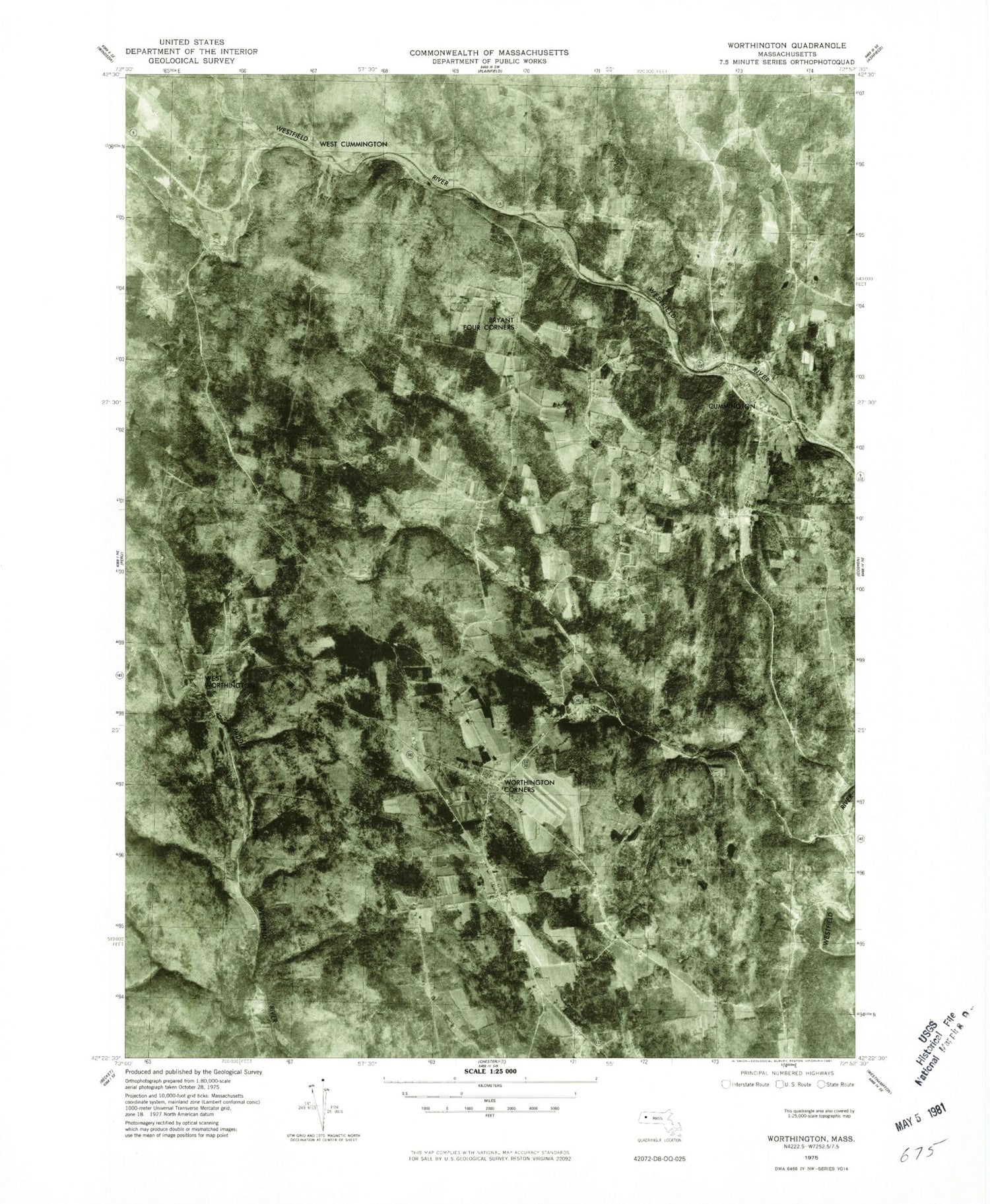
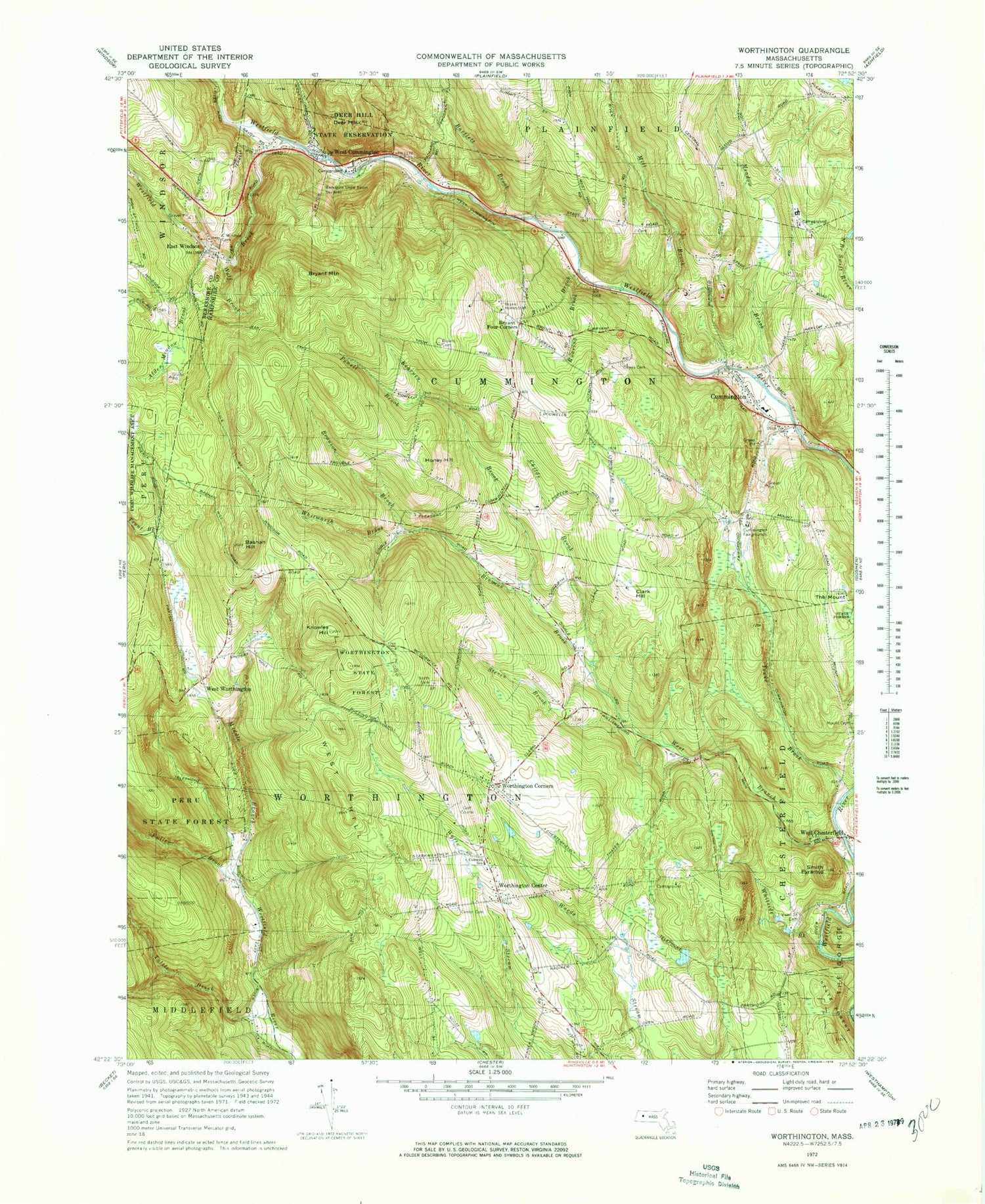
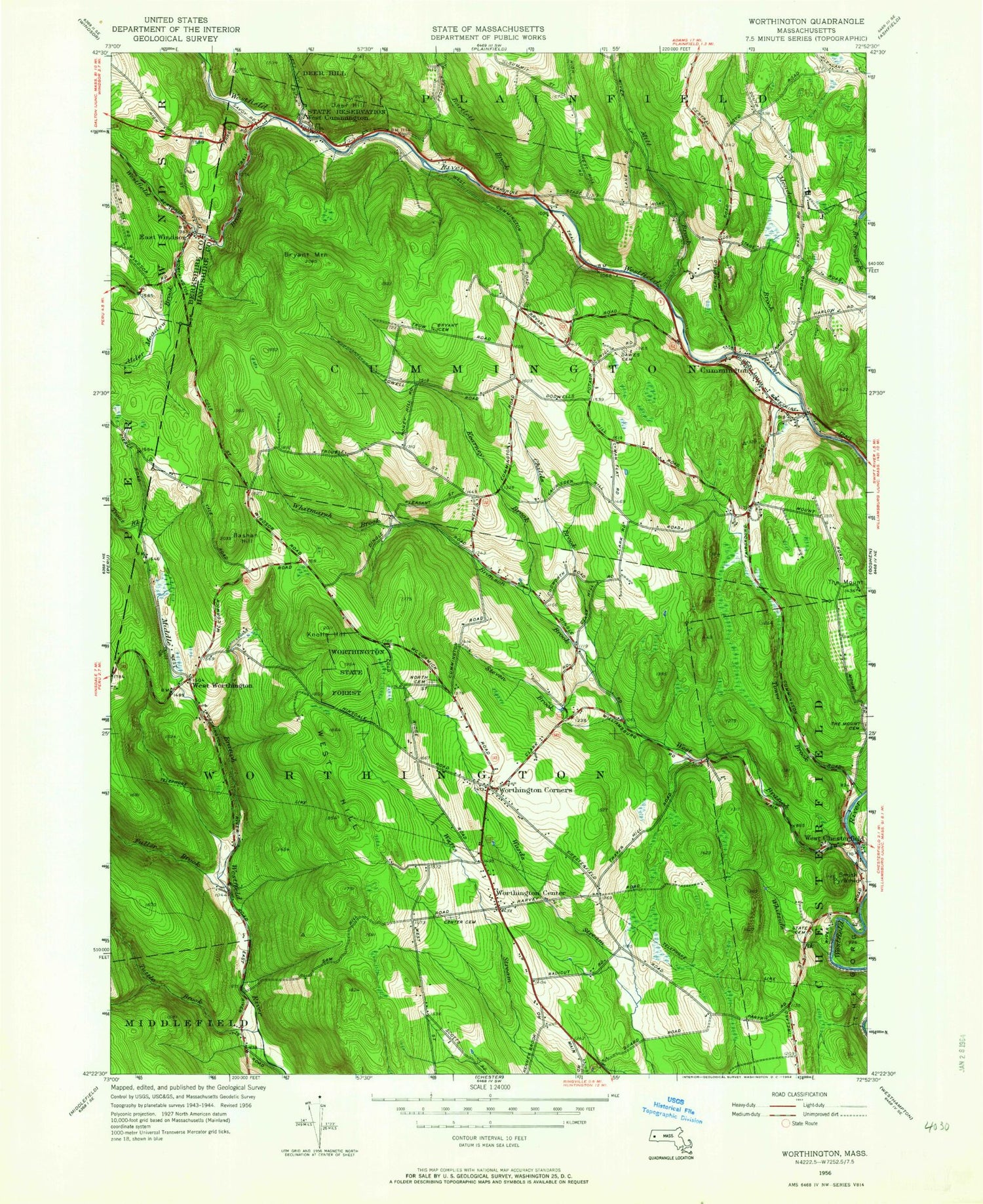
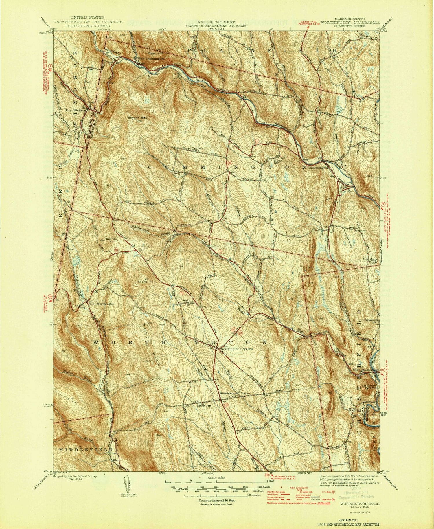
Historical USGS topographic quad map of Worthington in the state of Massachusetts. Typical map scale is 1:24,000, but may vary for certain years, if available. Print size: 24" x 27"
This quadrangle is in the following counties: Berkshire, Hampshire.
The map contains contour lines, roads, rivers, towns, and lakes. Printed on high-quality waterproof paper with UV fade-resistant inks, and shipped rolled.
Contains the following named places: North Cemetery, Gate Cemetery, East Windsor Cemetery, Dawes Cemetery, Russell H Conwell School, Bryant Cemetery, Deer Hill State Reservation, Berkshire Show Basin Ski Area, Bryant Homestead, Cummington Fairgrounds, Watson Road Dam, Kingman Tavern Museum, Cummington Farm Village, Jordansville, Parsons Hill, Alder Meadow Brook, Bartlett Brook, Bashan Hill, Bronson Brook, Bryant Mountain, Childs Brook, Cummington, East Windsor, Fuller Brook, Indian Oven, Kearney Brook, Knowles Hill, Meadow Brook, Mill Brook, Mongue Meadow Brook, The Mount, Smith Pyramid, Steven Brook, Tower Brook, Trout Brook, Tuttle Brook, West Cummington, West Chesterfield, Westfield Brook, West Hill, West Worthington, Whitmarsh Brook, Whiteside Brook, Worthington Center, Worthington Corners, Bryant Four Corners, Wolf Brook, Powell Brook, Rivulet Brook, Roaring Brook, Honey Hill, Town of Cummington, Town of Worthington, Dubois Landing Strip (historical), Chesterfield Gorge State Forest, Deer Hill, Clark Hill, Albert Farms Airport, Berkshire Trail Elementary School, Cummington Post Office, Cummington Town Hall, Worthington Golf Course, Worthington Post Office, Worthington Town Hall, Academy at Swift River, Worthington Library, Worthington Fire and Rescue, Cummington Fire Department, Joyner Dairy Farm, Cummington Police Department, Worthington Police Department, North Cemetery, Gate Cemetery, East Windsor Cemetery, Dawes Cemetery, Russell H Conwell School, Bryant Cemetery, Deer Hill State Reservation, Berkshire Show Basin Ski Area, Bryant Homestead, Cummington Fairgrounds, Watson Road Dam, Kingman Tavern Museum, Cummington Farm Village, Jordansville, Parsons Hill, Alder Meadow Brook, Bartlett Brook, Bashan Hill, Bronson Brook, Bryant Mountain, Childs Brook, Cummington, East Windsor, Fuller Brook, Indian Oven, Kearney Brook, Knowles Hill, Meadow Brook, Mill Brook, Mongue Meadow Brook, The Mount, Smith Pyramid, Steven Brook, Tower Brook, Trout Brook, Tuttle Brook, West Cummington, West Chesterfield, Westfield Brook, West Hill, West Worthington, Whitmarsh Brook, Whiteside Brook, Worthington Center, Worthington Corners, Bryant Four Corners, Wolf Brook, Powell Brook, Rivulet Brook, Roaring Brook, Honey Hill, Town of Cummington, Town of Worthington, Dubois Landing Strip (historical), Chesterfield Gorge State Forest, Deer Hill, Clark Hill, Albert Farms Airport, Berkshire Trail Elementary School, Cummington Post Office, Cummington Town Hall, Worthington Golf Course, Worthington Post Office, Worthington Town Hall, Academy at Swift River, Worthington Library, Worthington Fire and Rescue, Cummington Fire Department, Joyner Dairy Farm, Cummington Police Department, Worthington Police Department, North Cemetery, Gate Cemetery, East Windsor Cemetery, Dawes Cemetery, Russell H Conwell School, Bryant Cemetery, Deer Hill State Reservation, Berkshire Show Basin Ski Area, Bryant Homestead, Cummington Fairgrounds, Watson Road Dam, Kingman Tavern Museum, Cummington Farm Village, Jordansville, Parsons Hill, Alder Meadow Brook, Bartlett Brook, Bashan Hill, Bronson Brook, Bryant Mountain, Childs Brook, Cummington, East Windsor, Fuller Brook, Indian Oven, Kearney Brook, Knowles Hill, Meadow Brook, Mill Brook, Mongue Meadow Brook, The Mount, Smith Pyramid, Steven Brook, Tower Brook, Trout Brook, Tuttle Brook, West Cummington, West Chesterfield, Westfield Brook, West Hill, West Worthington, Whitmarsh Brook, Whiteside Brook, Worthington Center, Worthington Corners, Bryant Four Corners, Wolf Brook, Powell Brook, Rivulet Brook, Roaring Brook, Honey Hill, Town of Cummington, Town of Worthington, Dubois Landing Strip (historical), Chesterfield Gorge State Forest, Deer Hill, Clark Hill, Albert Farms Airport, Berkshire Trail Elementary School, Cummington Post Office, Cummington Town Hall, Worthington Golf Course, Worthington Post Office, Worthington Town Hall, Academy at Swift River, Worthington Library, Worthington Fire and Rescue, Cummington Fire Department, Joyner Dairy Farm, Cummington Police Department, Worthington Police Department


