MyTopo
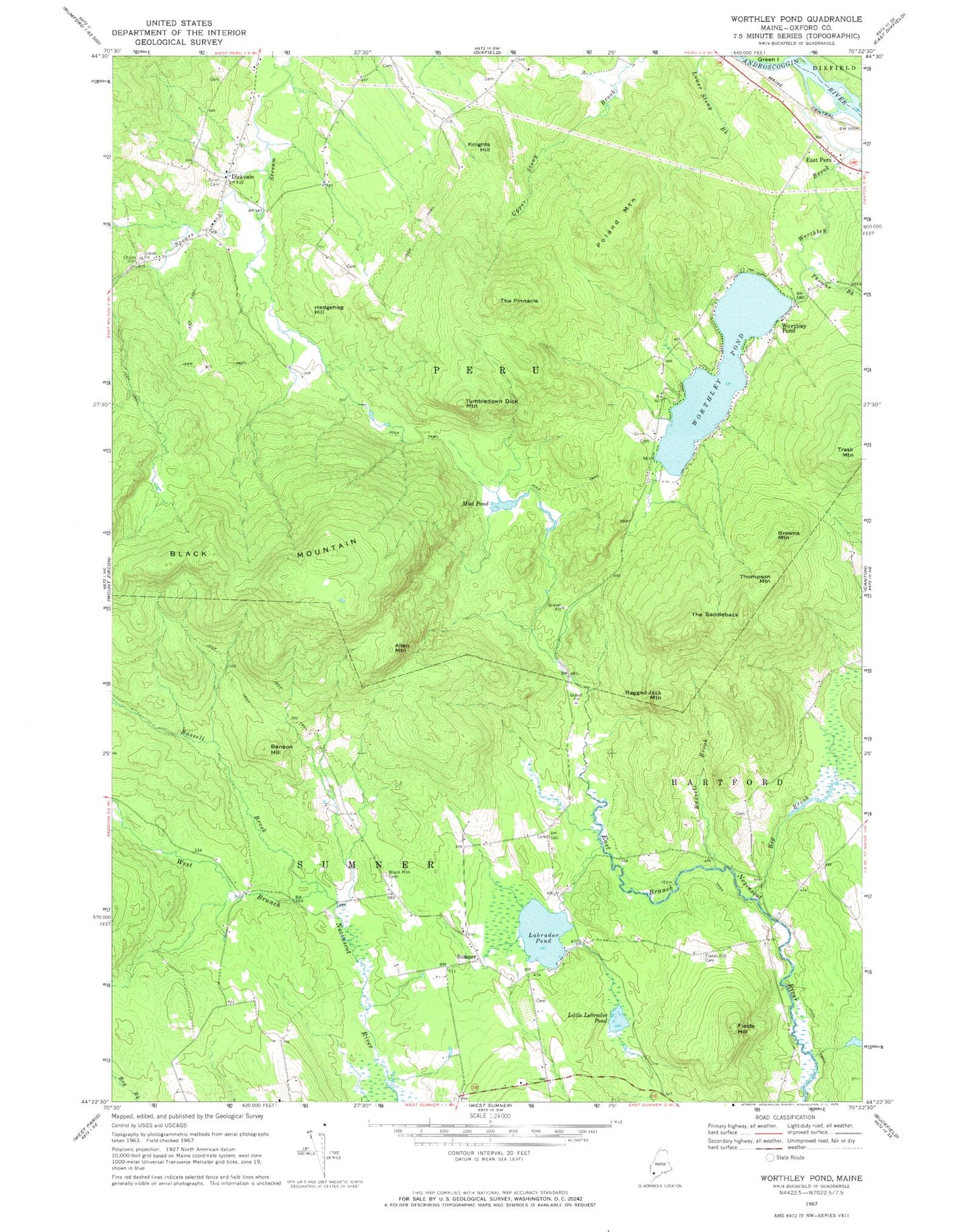
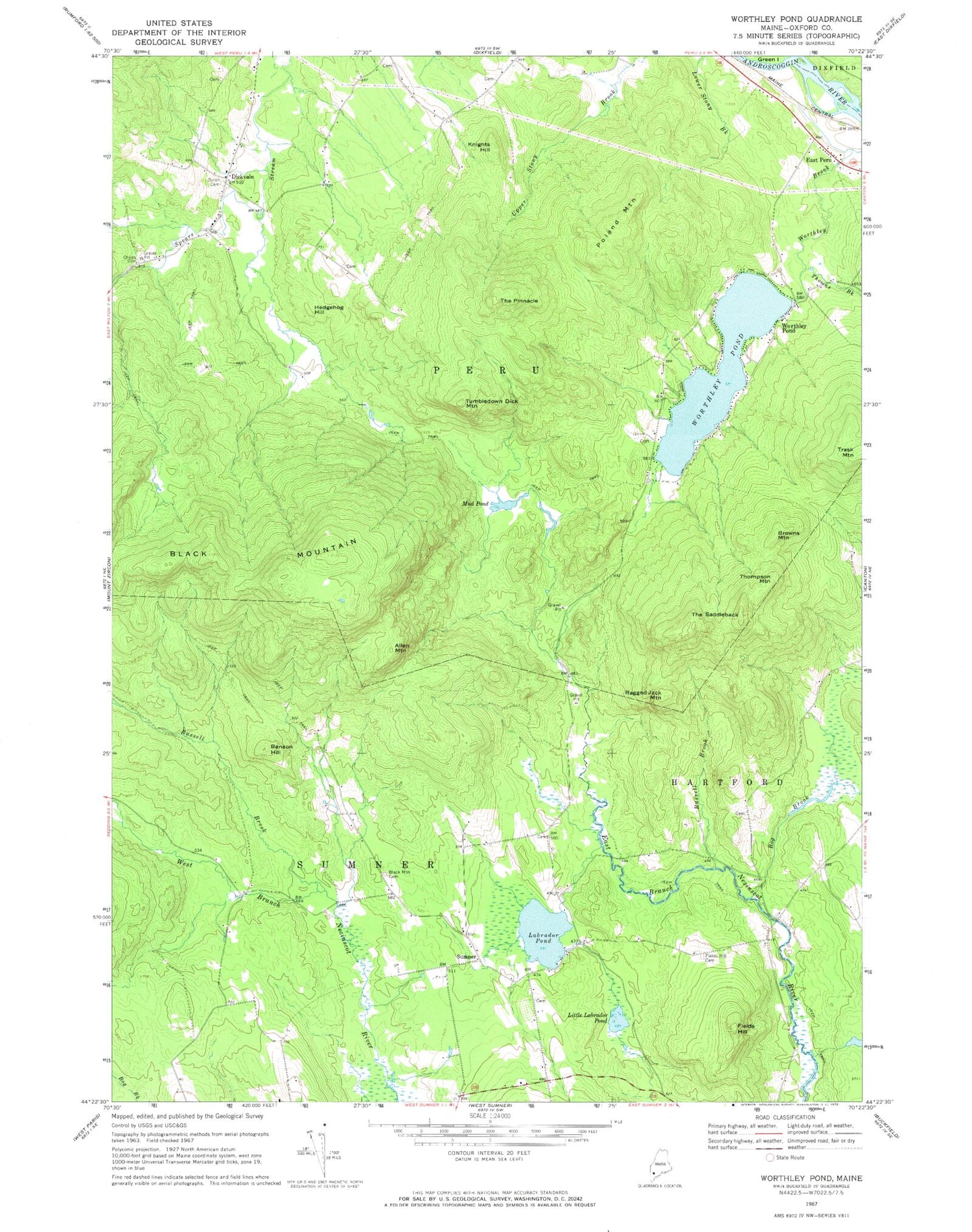
Classic USGS Worthley Pond Maine 7.5'x7.5' Topo Map
Couldn't load pickup availability
Historical USGS topographic quad map of Worthley Pond in the state of Maine. Typical map scale is 1:24,000, but may vary for certain years, if available. Print size: 24" x 27"
This quadrangle is in the following counties: Oxford.
The map contains contour lines, roads, rivers, towns, and lakes. Printed on high-quality waterproof paper with UV fade-resistant inks, and shipped rolled.
Contains the following named places: Allen Mountain, Benson Hill, Black Mountain, Black Mountain Cemetery, Bog Brook, Browns Mountain, Dickvale Cemetery, East Peru, Fields Hill, Fields Hill Cemetery, Hedgehog Hill, Knights Hill, Labrador Pond, Little Labrador Pond, Mud Pond, Poland Mountain, Ragged Jack Mountain, Russell Brook, Russell Brook, The Pinnacle, The Saddleback, Thomas Brook, Thompson Mountain, Tumbledown Dick Mountain, Worthley Pond, Worthley Pond, Dickvale, Sumner, Town of Peru, Worthley Pond Dam, Sumner Volunteer Fire Department, Peru Fire Department Substation, Franklin Cemetery, Glover Young Cemetery, Hammon Cemetery, Keene Cemetery, Knox Cemetery, Oldham Cemetery, Bisbee Cemetery, Brackett Cemetery, Waite Cemetery, Sumner Post Office