MyTopo
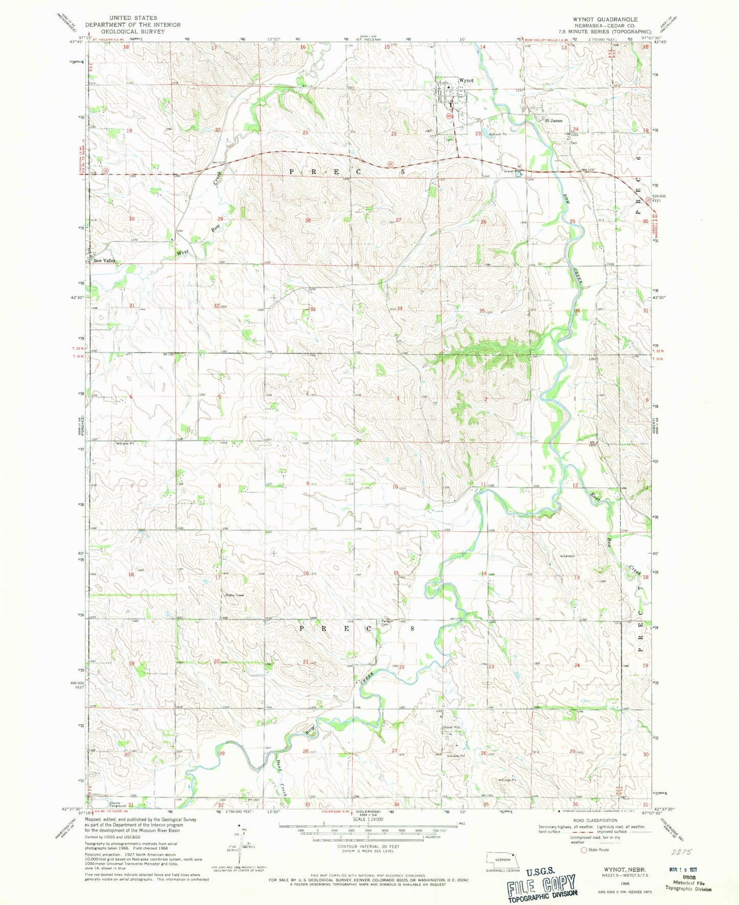
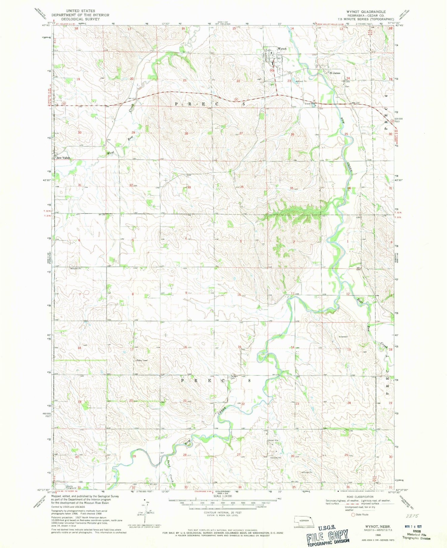
Classic USGS Wynot Nebraska 7.5'x7.5' Topo Map
Couldn't load pickup availability
Historical USGS topographic quad map of Wynot in the state of Nebraska. Map scale may vary for some years, but is generally around 1:24,000. Print size is approximately 24" x 27"
This quadrangle is in the following counties: Cedar.
The map contains contour lines, roads, rivers, towns, and lakes. Printed on high-quality waterproof paper with UV fade-resistant inks, and shipped rolled.
Contains the following named places: Bow Valley, Bow Valley Post Office, Cedar County Fairground, Dead Creek, East Bow Creek, Election Precinct 5, Election Precinct 8, Paragon Cemetery, Precinct Eight, Precinct Five, Saint Jamed Post Office, Saint James, Village of Wynot, Wynot, Wynot Ambulance Service, Wynot Cemetery, Wynot City Park, Wynot Fire Department, Wynot Post Office, Wynot Public Schools