MyTopo
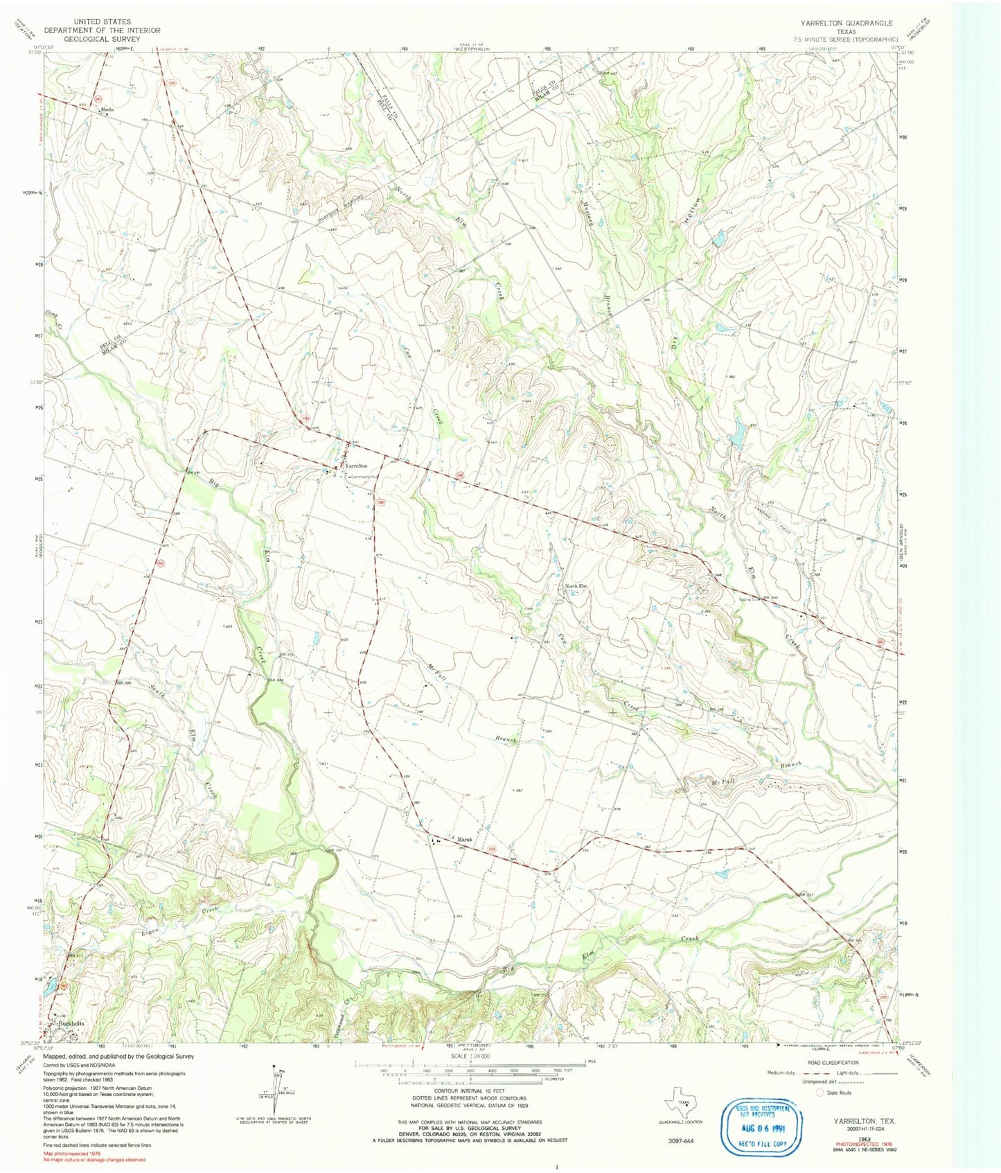
Classic USGS Yarrelton Texas 7.5'x7.5' Topo Map
Regular price
$16.95
Regular price
Sale price
$16.95
Unit price
per
Couldn't load pickup availability
Historical USGS topographic quad map of Yarrelton in the state of Texas. Map scale may vary for some years, but is generally around 1:24,000. Print size is approximately 24" x 27"
This quadrangle is in the following counties: Bell, Falls, Milam.
The map contains contour lines, roads, rivers, towns, and lakes. Printed on high-quality waterproof paper with UV fade-resistant inks, and shipped rolled.
Contains the following named places: Camp Creek, Cottonwood Creek, Cow Creek, Dry Hollow, Glaser Field, Lipan Creek, Marak, Marak Catholic and Methodius Cemetery, McFall Branch, Meeks, Mustang Creek, North Elm, Saints Cyril and Methodius Cemetery, South Elm Creek, Yarrelton