MyTopo
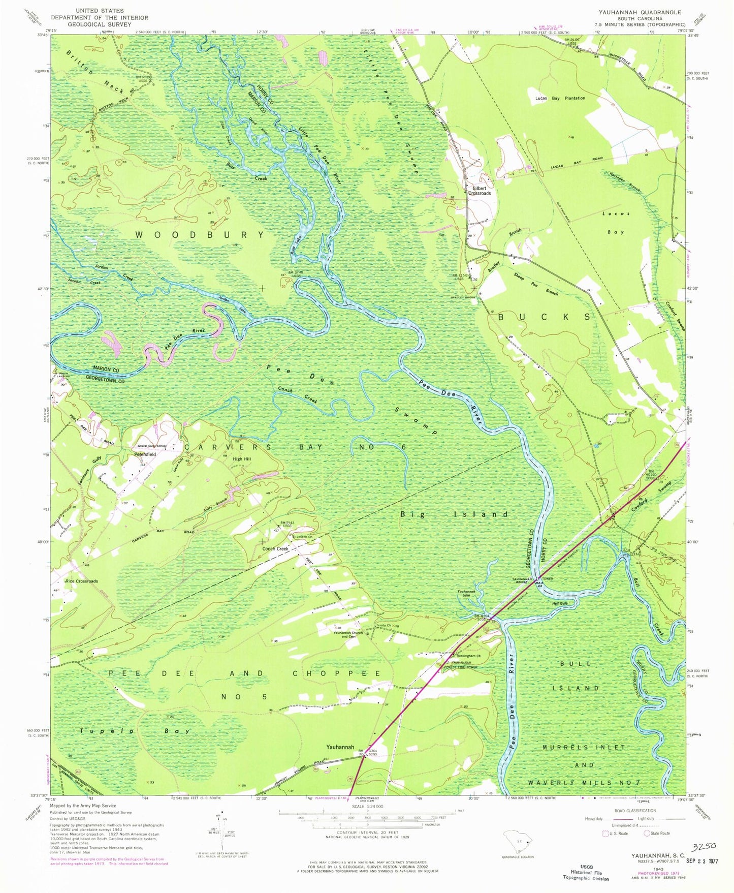
Classic USGS Yauhannah South Carolina 7.5'x7.5' Topo Map
Couldn't load pickup availability
Historical USGS topographic quad map of Yauhannah in the state of South Carolina. Map scale may vary for some years, but is generally around 1:24,000. Print size is approximately 24" x 27"
This quadrangle is in the following counties: Georgetown, Horry, Marion.
The map contains contour lines, roads, rivers, towns, and lakes. Printed on high-quality waterproof paper with UV fade-resistant inks, and shipped rolled.
Contains the following named places: Big Island, Black Lake, Bradley Branch, Bradley Bridge, Conch Creek, Cowford Swamp, Dead River, Eddy Lake, Georgetown Fire Department Station 14, Gilbert Crossroads, Gravel Gully, Gravel Gully Church, Gravel Gully School, Hell Gate, High Hill, Horsepen Branch, Inland School, Jacobs Creek, Jiles Creek, Jordan Creek, Jordan Lake, Larrimore Gully, Little Pee Dee River, Lucas Bay, Lucas Bay Plantation, Parker Landing, Pee Dee Park, Pee Dee Swamp, Petersfield, Port Harrelson Ferry, Rice Crossroads, Rockingham Church, Russ Creek, Russ Lake, Saint Joseph Church, Sally Branch, Sanders Landing, Sheep Pen Branch, Trinity Church, Tupelo Bay, Yahany Ferry, Yauhannah, Yauhannah Bridge, Yauhannah Cemetery, Yauhannah Church, Yauhannah Creek, Yauhannah Forest Fire Tower, Yauhannah Lake