MyTopo
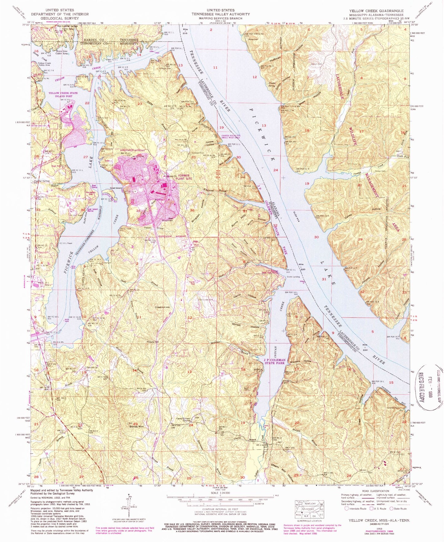
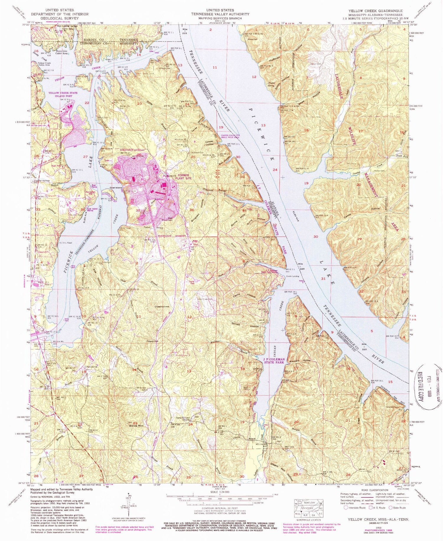
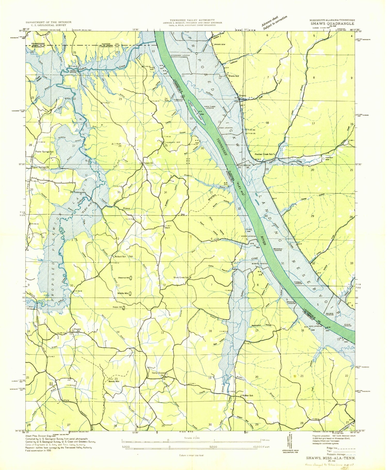
Classic USGS Yellow Creek Mississippi 7.5'x7.5' Topo Map
Couldn't load pickup availability
Historical USGS topographic quad map of Yellow Creek in the states of Mississippi, Tennessee, Alabama. Typical map scale is 1:24,000, but may vary for certain years, if available. Print size: 24" x 27"
This quadrangle is in the following counties: Hardin, Lauderdale, Tishomingo.
The map contains contour lines, roads, rivers, towns, and lakes. Printed on high-quality waterproof paper with UV fade-resistant inks, and shipped rolled.
Contains the following named places: Ada Hollow, Arnold Branch, Beall Cemetery, Bee Mountain, Blackard Hollow, Bonds Mountain, Boo Hollow, Brogdan Hollow, Bullard Branch, Burns Hills, Burns Hollow, Camp Ground Church, Camp Hollow, Caney Hollow, Chalk Hollow, Charlie Branch, Chestnut Hill, Clement Cemetery, Cooper Hollow, Curtis Cemetery, Dixon Hollow, Fred Hollow, Glade Branch, Goat Island, Hicks Hollow, Hubbard Branch, Hubbard Cemetery, Hurricane Branch, Indian Creek, J P Coleman State Park, Johnson Cemetery, Kreamer Branch, Lard Branch, Meat Hollow, Morgan Branch, Morgan Branch, Owens Hollow, Patrick Church, Popular Springs Church, Potato Hill, Salem Church, Scruggs Branch, Shop Hollow, Short Creek, Short Creek Cemetery, Slick Rock Branch, State Line Cabin Area, Steam Mill Hollow, Stinett Hollow, Tackett Branch, Tanyard Branch, Whetstone Branch, Yellow Creek, Yellow Creek Cabin Area, Zippy Branch, Goat Island Recreation Area, Greenwater Marina, Bugg Landing (historical), Bullard School (historical), Busbys Landing (historical), Camp Ground Cemetery, Camp Hollow Creek, Ferry Bridge (historical), Goat Island Marina, Hamptons Mill (historical), Hubbard Landing (historical), Iuka Landing (historical), Mawres Landing (historical), Middle Mountain, Patrick Cemetery, Patrick School (historical), Poplar Springs Baptist Church Cemetery, Popular Springs School (historical), Prairie (historical), Scruggs Bridge Overlook Area, Short, Short Creek School (historical), Smith Branch, Walker School (historical), Yellow Creek Nuclear Power Plant, Yellow Creek State Inland Port, Cooks Landing, High Point, Martin Branch, Tylers Landing (historical), Supervisor District 1, Colman Park Fire Department, Red Sulphur Springs Branch, Red Sulphur Springs Cabin Area, Caney Hollow, Carson Cemetery, Cedar Fork, Hitchcock Hollow, Huffman Hollow, Johnny Hollow, North Fork Panther Creek, Panther Creek, Parker Cemetery, Poplar Spring, Shaw Hollow, Smith Hollow, South Fork Panther Creek, Union Hollow, Panther Creek School (historical), Poplar Springs School (historical), Shaw (historical), Shaw Branch, Shaw Cemetery, State Line Ferry (historical), Baugh Creek, Baughs Landing (historical), Burns Landing (historical), Evans Landing (historical), Hitchcock Branch, Huffman Branch, Johnny Creek, Johnny Landing, Robinson Landing (historical), Shaw Landing (historical), State Line Island, Wates Cemetery, Hitchcock Landing (historical), Smith Landing (historical), Thomas Landing (historical), Beckham Landing (historical), Hard Times Landing (historical), Lauderdale State Wildlife Management Area, Parker Landing, Haddock (historical), Haddock Post Office (historical)