MyTopo
Classic USGS Yeoman Indiana 7.5'x7.5' Topo Map
Couldn't load pickup availability
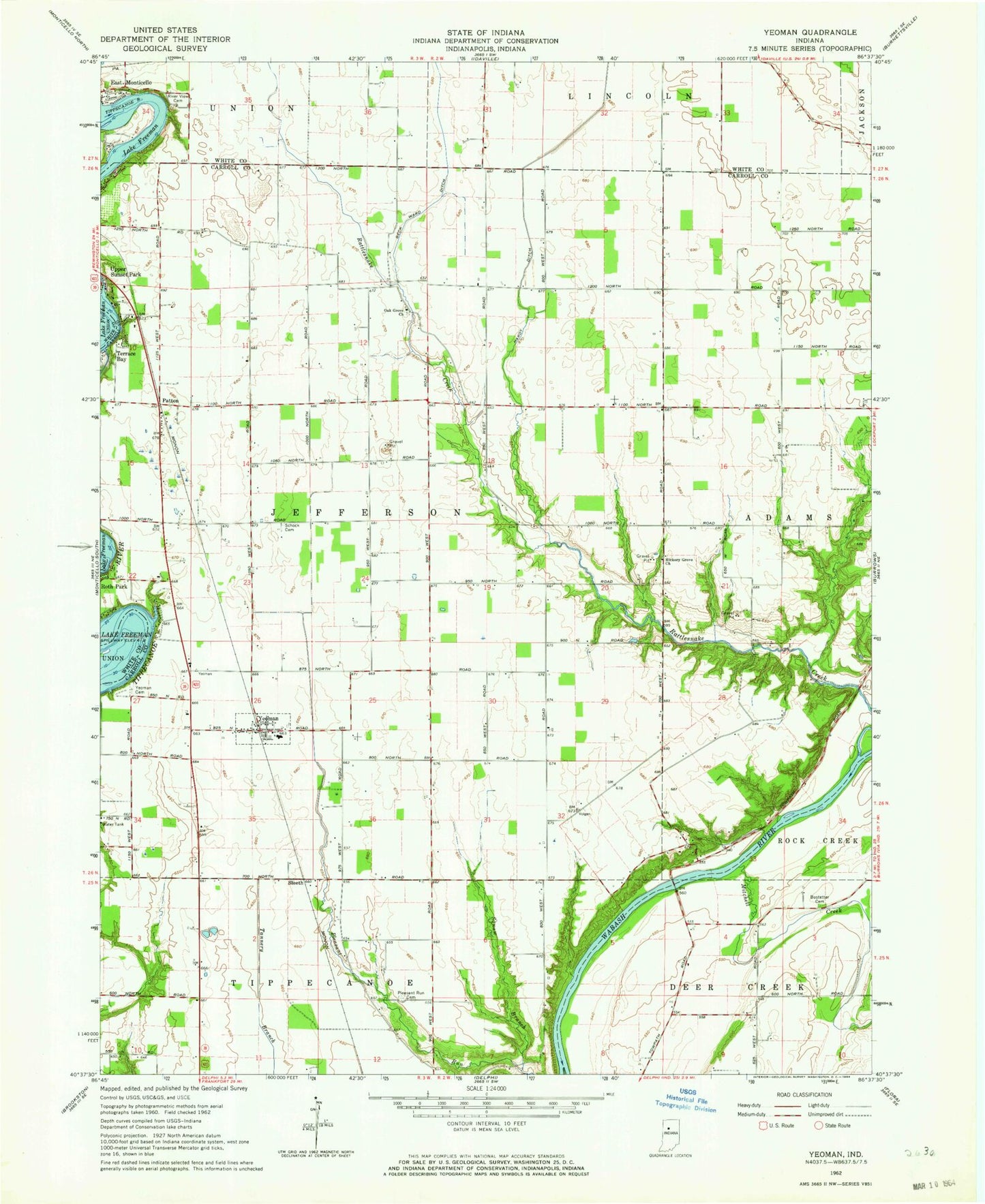
Historical USGS topographic quad map of Yeoman in the state of Indiana. Map scale may vary for some years, but is generally around 1:24,000. Print size is approximately 24" x 27"
This quadrangle is in the following counties: Carroll, White.
The map contains contour lines, roads, rivers, towns, and lakes. Printed on high-quality waterproof paper with UV fade-resistant inks, and shipped rolled.
Contains the following named places: Beck Ward Ditch, Bostetter Cemetery, Hardy Ditch, Hickory Grove Church, Lake Freeman, Mitchell Creek, Oak Grove Church, O'Farrell Hog Farm, Patton, Pleasant Run Cemetery, Riverview Cemetery, Roth Park, Schock Cemetery, Sleeth, Squaw Branch, Terrace Bay, Town of Yeoman, Township of Jefferson, Yeoman, Yeoman Cemetery, Yeoman Elementary School, ZIP Code: 47997