
MyTopo
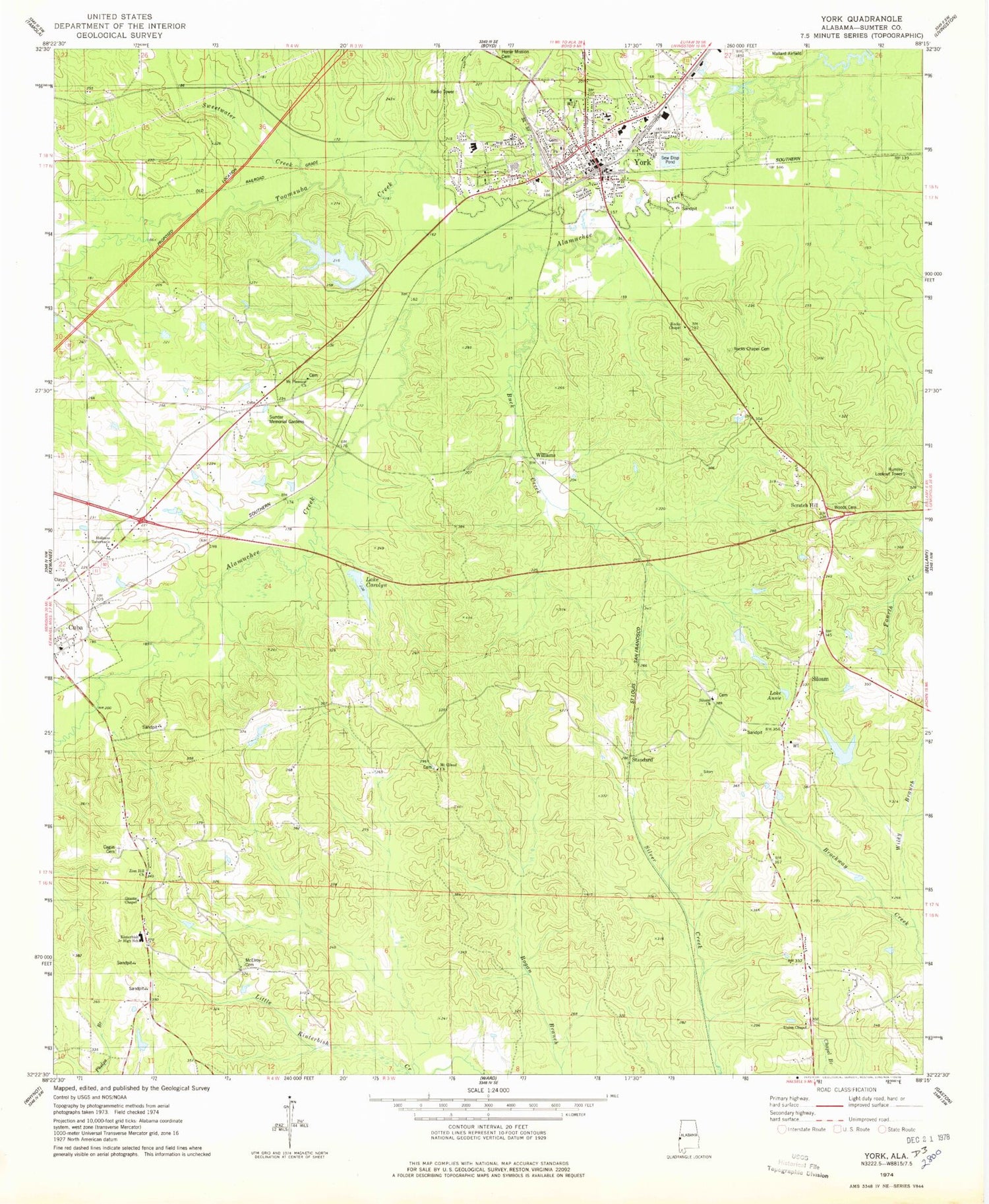
Classic USGS York Alabama 7.5'x7.5' Topo Map
Couldn't load pickup availability
Historical USGS topographic quad map of York in the state of Alabama. Map scale may vary for some years, but is generally around 1:24,000. Print size is approximately 24" x 27"
This quadrangle is in the following counties: Sumter.
The map contains contour lines, roads, rivers, towns, and lakes. Printed on high-quality waterproof paper with UV fade-resistant inks, and shipped rolled.
Contains the following named places: Alamuchee Hill, Alamuchee Hunting Club, Buck Creek, Cagus Cemetery, Carolyn Dam, Church of Christ, City of York, Cuba Division, Detain Branch, F N Grant Dam, F N Grant Lake, First Baptist Church, First Methodist Church, First Presbyterian Church, Grant Lake, Grant's Chapel Christian Methodist Episcopal Church, Hill Hospital of Sumter County, Holiness Tabernacle, Home Mission Cemetery, Intercourse School, Kearns, Kinterbish Brunson Volunteer Fire Department, Kinterbish Junior High School, Lake Annie, Lake Carolyn, Lake Louise, Lake Louise Dam, Mallard Airport, McConnell, McElroy Cemetery, McGowan Hunting Club, Mount Gilead Baptist Church, Mount Gilead School, Mount Pleasant Church, Post Oak Hunting Lodge, Rocks Chapel, Rocks Chapel Cemetery, Rumley Lookout Tower, Scratch Hill, Siloam, Siloam Baptist Church, Siloam Volunteer Fire Department, Standard, Sumter County High School, Sumter Memorial Gardens, Sweetwater Creek, Toomsuba Creek, Union Chapel Christian Methodist Episcopal Church, Wildcat Stadium, Wiley Branch, Williams, Woods Cemetery, York, York Cemetery, York Fire Department, York Police Department, York Post Office, York Public School, York West End Junior High School, Zion Hill Baptist Church, ZIP Code: 36907


