MyTopo
Classic USGS Young Valley Nebraska 7.5'x7.5' Topo Map
Regular price
$16.95
Regular price
Sale price
$16.95
Unit price
per
Couldn't load pickup availability
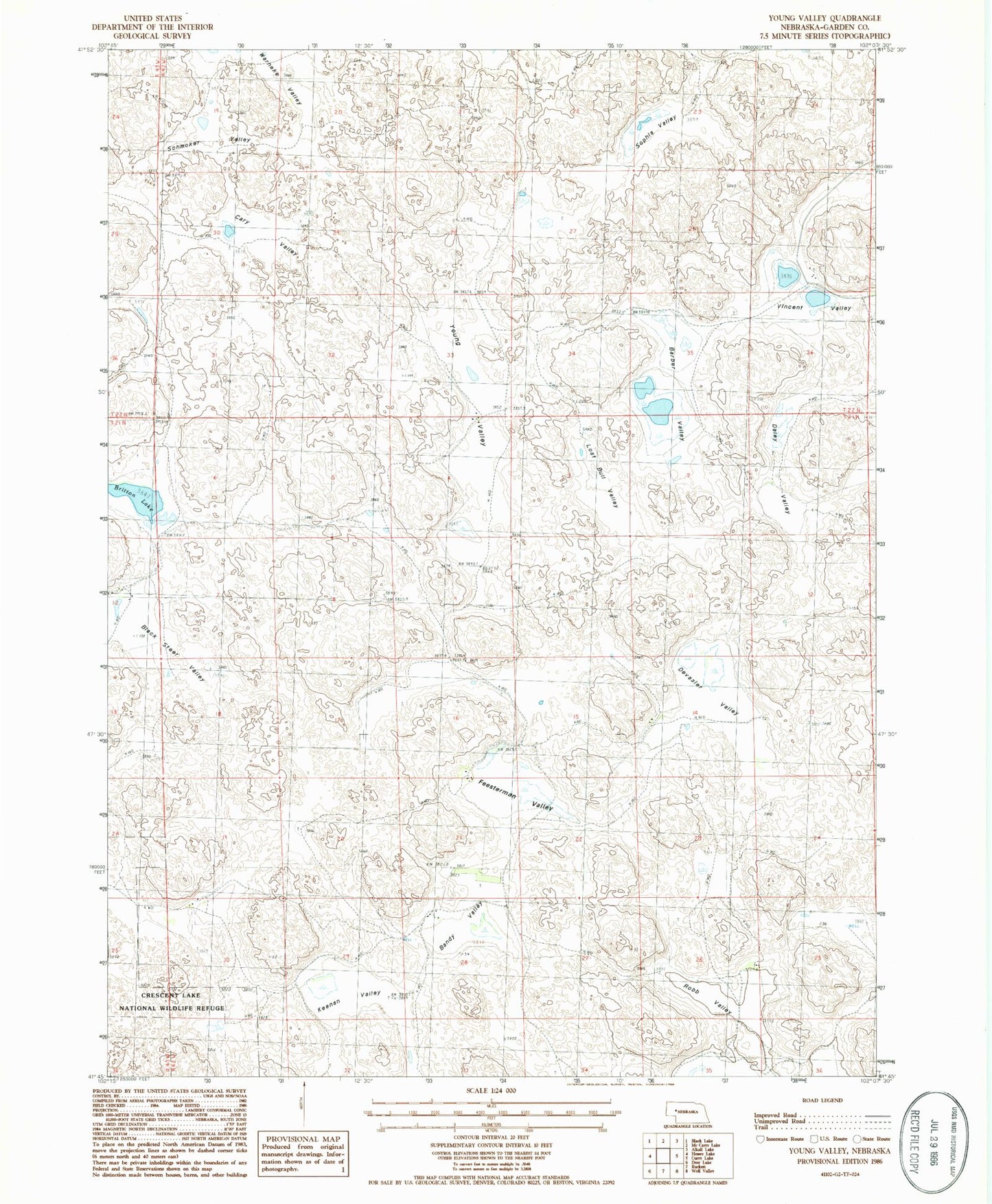
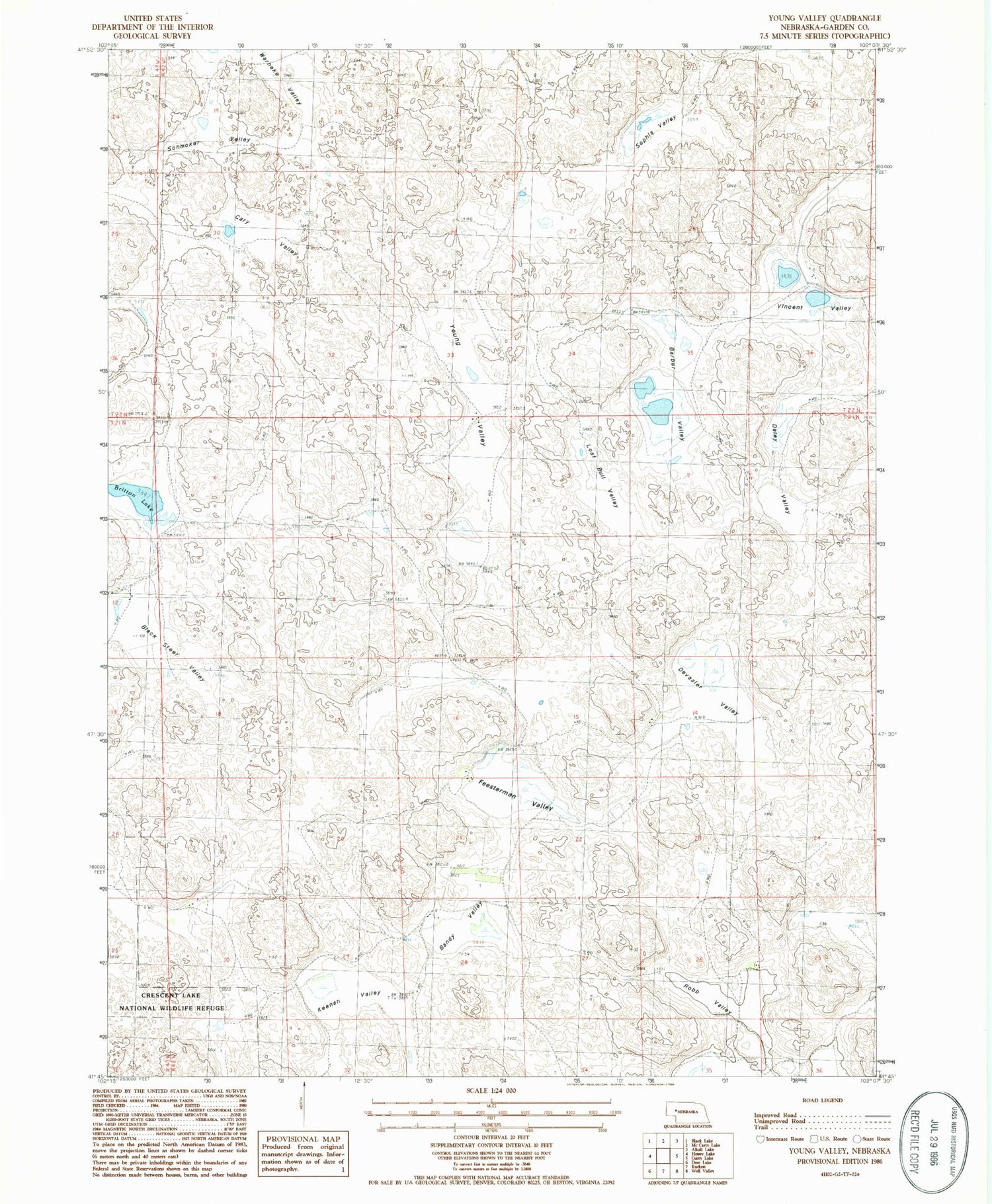
Historical USGS topographic quad map of Young Valley in the state of Nebraska. Map scale may vary for some years, but is generally around 1:24,000. Print size is approximately 24" x 27"
This quadrangle is in the following counties: Garden.
The map contains contour lines, roads, rivers, towns, and lakes. Printed on high-quality waterproof paper with UV fade-resistant inks, and shipped rolled.
Contains the following named places: Bandy Valley, Barber Valley, Black Steer Valley, Britton Lake, Cary Valley, Daley Valley, Devasier Valley, Feesterman Valley, Keenan Valley, Lost Bull Valley, Robb Valley, Schmoker Valley, School Number 71, Sophia Valley, Vincent Valley, Warneke Valley, Young Valley