
MyTopo
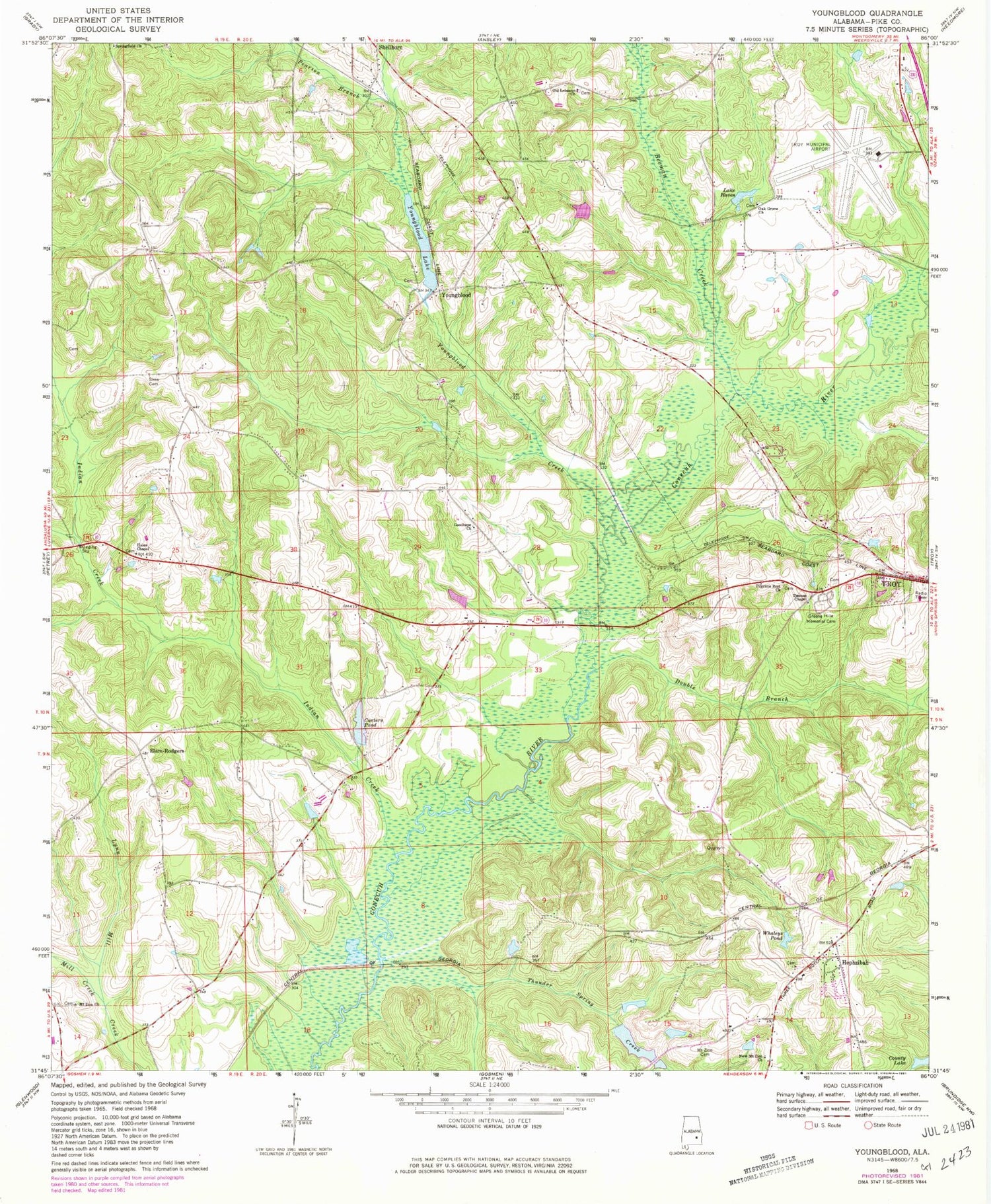
Classic USGS Youngblood Alabama 7.5'x7.5' Topo Map
Couldn't load pickup availability
Historical USGS topographic quad map of Youngblood in the state of Alabama. Map scale may vary for some years, but is generally around 1:24,000. Print size is approximately 24" x 27"
This quadrangle is in the following counties: Pike.
The map contains contour lines, roads, rivers, towns, and lakes. Printed on high-quality waterproof paper with UV fade-resistant inks, and shipped rolled.
Contains the following named places: Allred, Beeman Creek, Boyds Mill Creek, Carters Pond, Double Branch, Elam-Rodgers, Fishtrap Bridge, Good Hope, Good Hope Baptist Church, Good Hope Cemetery, Goshen-Shady Grove Division, Green Hills Memorial Cemetery, Hales Chapel, Hephzibah, Hephzibah Baptist Church, Hepzibah Cemetery, Hillard and Howard Cemetery, Hinson Cemetery, Indian Creek, Israel Cemetery, Jordan Cemetery, Jordan Creek, Lake Haven, Lebanon Baptist Church, Lees Park, Meadow Grove, Meadows Cemetery, Messick Branch, Mill Creek, Milton Carter Dam, Mount Zion Cemetery, Mount Zion Church, New Mount Zion Church, Oak Grove United Methodist Church, Old Lebanon Church, Pearson Branch, Pilgrims Rest Baptist Church, River Ridge, Sims Cemetery, Springfield Church, Thomas Chapel, Thunder Spring Creek, Town and Country Estates, Troy Municipal Airport at North Kenneth Campbell Field, Whaleys Pond, Williams Cemetery, Youngblood, Youngblood Creek, Youngblood Dam, Youngblood Lake


