MyTopo
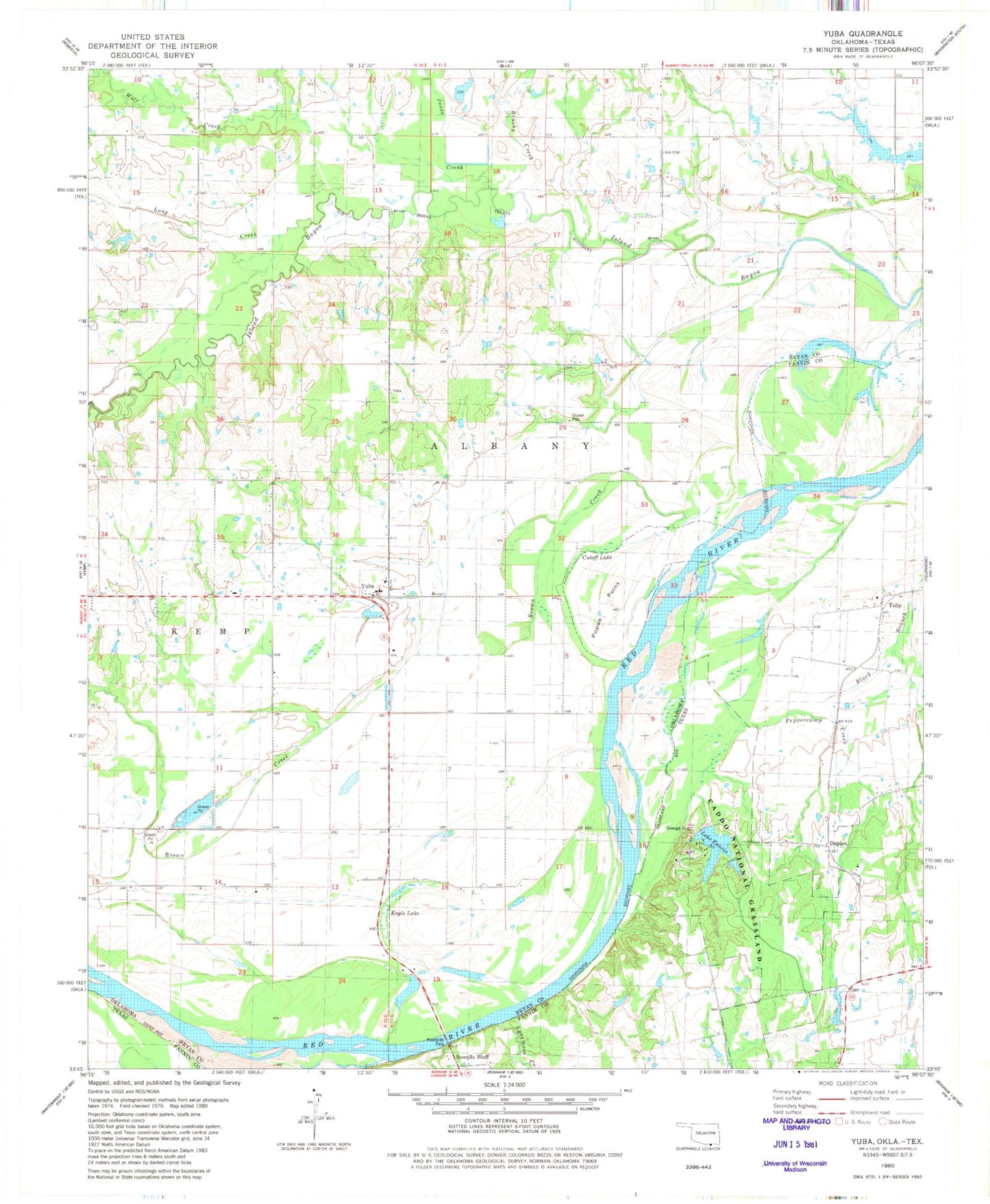
Classic USGS Yuba Oklahoma 7.5'x7.5' Topo Map
Couldn't load pickup availability
Historical USGS topographic quad map of Yuba in the states of Oklahoma, Texas. Map scale may vary for some years, but is generally around 1:24,000. Print size is approximately 24" x 27"
This quadrangle is in the following counties: Bryan, Fannin.
The map contains contour lines, roads, rivers, towns, and lakes. Printed on high-quality waterproof paper with UV fade-resistant inks, and shipped rolled.
Contains the following named places: Blue Lake, Brown Creek, Brushy Creek, Carman Lake Number 1 Dam, Carmen Lake Number 1, Cottonwood Creek, Cutoff Lake, Duplex, Duplex Cemetery, Eagle Lake, Jones Creek, Karma, Lake Fannin, Lake Fannin Dam, Long Creek, Lunt Lake, Lunt Lake Dam, Mitchell Lake, Mitchell Lake Dam, Musgrove Lake Number 1, Musgrove Lake Number 1 Dam, Musgrove Lake Number 2, Musgrove Lake Number 2 Dam, Oknoname 013001 Dam, Oknoname 013001 Reservoir, Oknoname 013010 Dam, Oknoname 013010 Reservoir, Oknoname 013011 Dam, Oknoname 013011 Reservoir, Osborne Lake, Osborne Lake Dam, Osborne Lake Number 1, Osborne Lake Number 1 Dam, Osborne Lake Number 2, Osborne Lake Number 2 Dam, Peppercamp Creek, Popes Paint, Popes Point, Romia, Sandy Creek, Shellenberger Lake Dam, Shellenburger Lake, Southeast Bryan Division, Sowells Bluff, State Highway 78 Bridge, Sycamore Creek, Township of Albany, Tulip, W F Rains Dam, W F Rains Reservoir, Wolf Creek, Yuba, Yuba Elementary School, Yuba Volunteer Fire Department