MyTopo
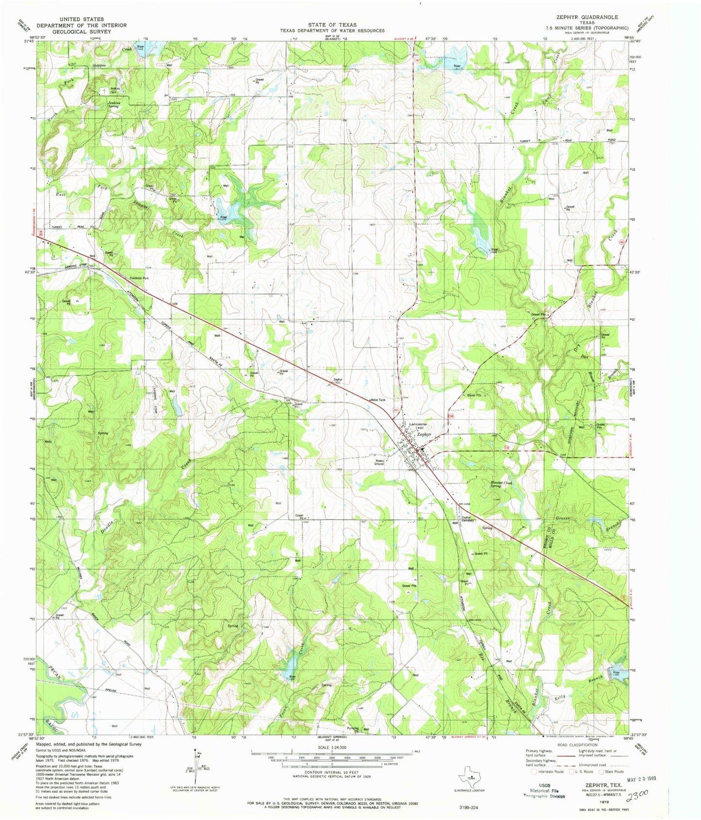
Classic USGS Zephyr Texas 7.5'x7.5' Topo Map
Couldn't load pickup availability
Historical USGS topographic quad map of Zephyr in the state of Texas. Map scale may vary for some years, but is generally around 1:24,000. Print size is approximately 24" x 27"
This quadrangle is in the following counties: Brown, Mills.
The map contains contour lines, roads, rivers, towns, and lakes. Printed on high-quality waterproof paper with UV fade-resistant inks, and shipped rolled.
Contains the following named places: Ashton Lake, Ashton Lake Dam, Bee Branch, Blanket Creek Spring, Blanket Creek Watershed Number 9, Blanket Creek Watershed Number Eight, Blanket Creek Watershed Reservoir Number Twenty, Brownwood Lateral Watershed Number 20, Brownwood Lateral Watershed Number 21, Brownwood Lateral Watershed Number 22, Camp Creek, Clark Lake, Clark Lake Dam, Dirt House Branch, Double Creek, Dry Blanket Creek, Groves Branch, Jenkings Spring, Jenkins Cemetery, Kelly Branch, Lancaster Hill, Sand Spring Branch, Soil Conservation Service Site 20 Dam, Soil Conservation Service Site 20 Reservoir, Soil Conservation Service Site 21 Dam, Soil Conservation Service Site 22 Dam, Soil Conservation Service Site 22 Reservoir, Soil Conservation Service Site 26a-1 Dam, Soil Conservation Service Site 26a-1 Reservoir, Soil Conservation Service Site 8 Dam, Soil Conservation Service Site 9 Dam, Soil Conservation Service Site 9 Reservoir, Soil Conservation Service Site Eight Reservoir, Taylor Dam, Taylor Reservoir, Zephyr, Zephyr Cemetery, Zephyr Census Designated Place, Zephyr Elementary School, Zephyr High School, Zephyr Post Office, Zephyr Volunteer Fire Department, ZIP Code: 76890