MyTopo
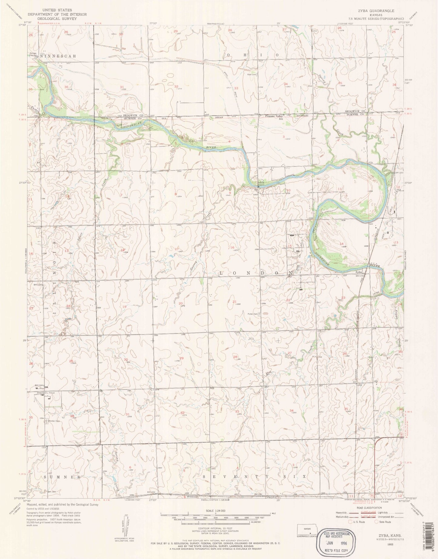
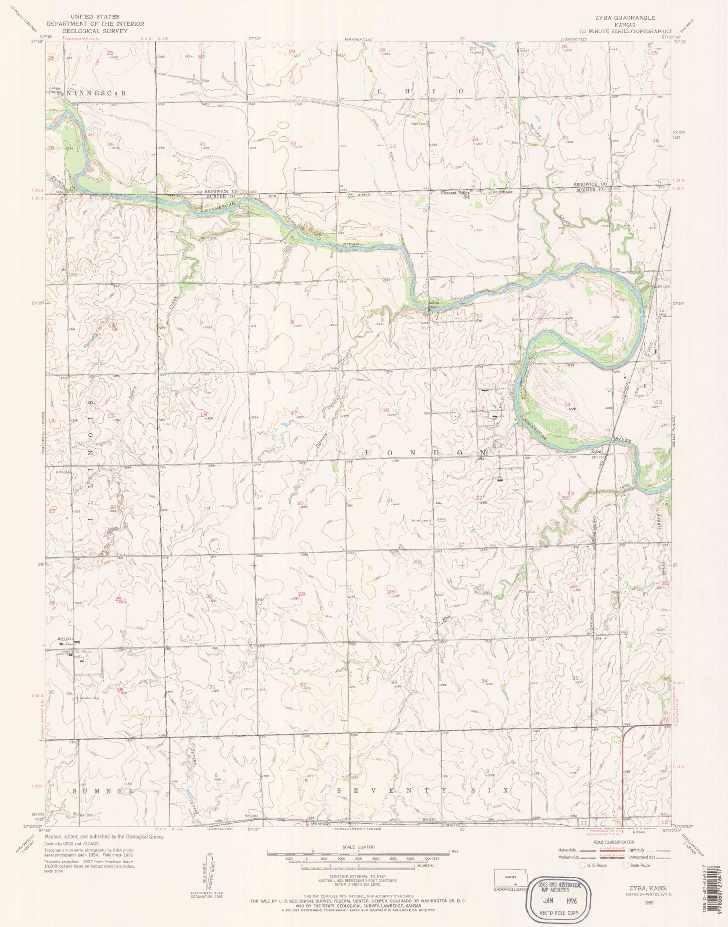
Classic USGS Zyba Kansas 7.5'x7.5' Topo Map
Regular price
$16.95
Regular price
Sale price
$16.95
Unit price
per
Couldn't load pickup availability
Historical USGS topographic quad map of Zyba in the state of Kansas. Map scale may vary for some years, but is generally around 1:24,000. Print size is approximately 24" x 27"
This quadrangle is in the following counties: Sedgwick, Sumner.
The map contains contour lines, roads, rivers, towns, and lakes. Printed on high-quality waterproof paper with UV fade-resistant inks, and shipped rolled.
Contains the following named places: Anson Oil Field, Argyle Creek, Boon, Clearwater Wastewater Treatment Facility, Dublin, Elm Creek, Garvey Creek, Mallory, New Bedford, Noel Cemetery, Peck Oil Field, Porter Cemetery, Silver Creek, Spring Creek, Township of London, Turtle Creek, Worden Cemetery, Zyba, Zyba Oil Field