MyTopo
Wilson Louisiana US Topo Map
Couldn't load pickup availability
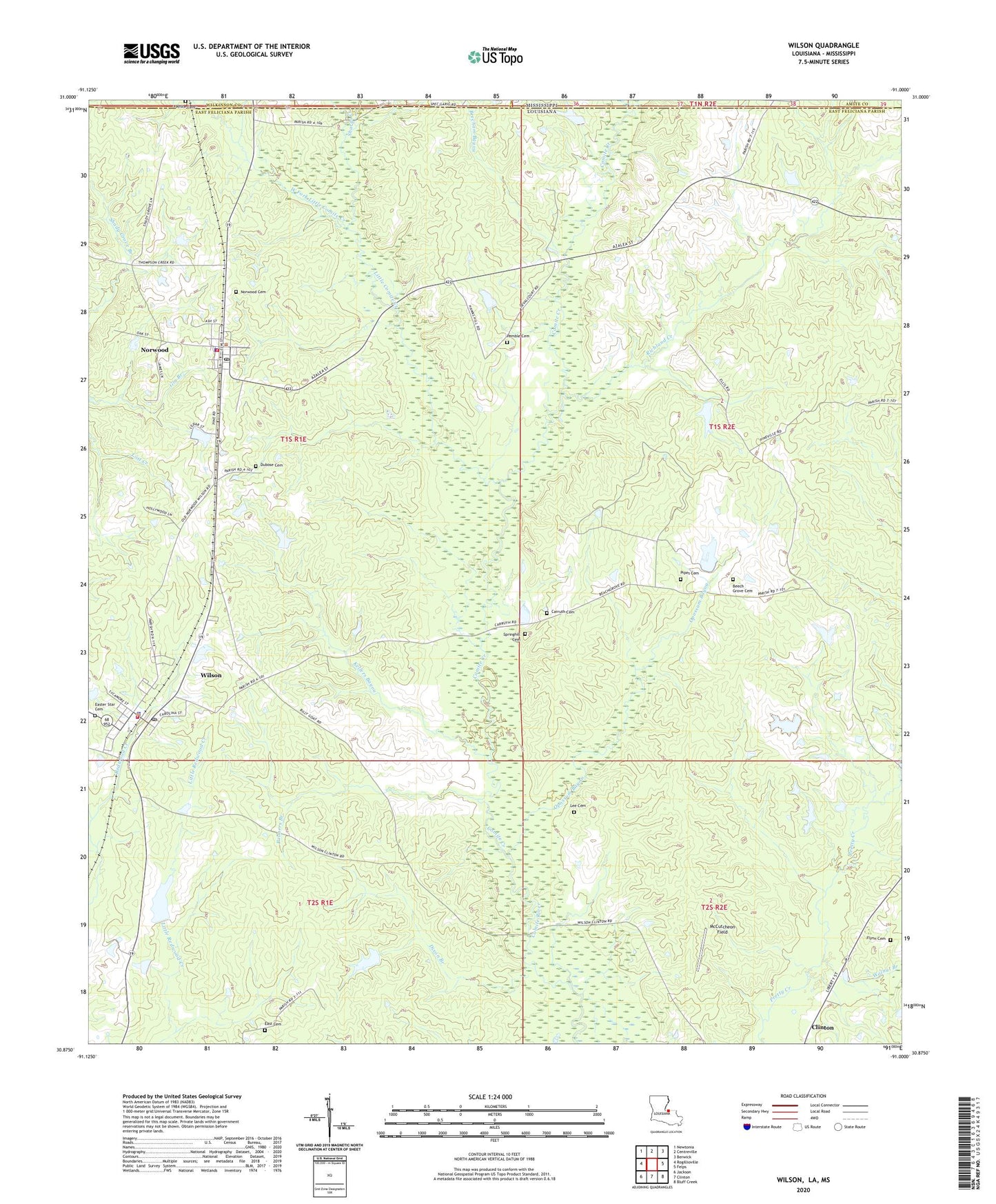
2020 topographic map quadrangle Wilson in the states of Louisiana, Mississippi. Scale: 1:24000. Based on the newly updated USGS 7.5' US Topo map series, this map is in the following counties: East Feliciana, Wilkinson, Amite. The map contains contour data, water features, and other items you are used to seeing on USGS maps, but also has updated roads and other features. This is the next generation of topographic maps. Printed on high-quality waterproof paper with UV fade-resistant inks.
Quads adjacent to this one:
West: Rogillioville
Northwest: Newtonia
North: Centreville
Northeast: Berwick
East: Felps
Southeast: Bluff Creek
South: Clinton
Southwest: Jackson
Contains the following named places: Asbury Church, Asury School, Beech Grove Cemetery, Beecham Bayou, Beechgrove Lake Dam, Bonnie Burn Plantation, Carruth Cemetery, Comite Creek, Dixon Branch, Dubose Cemetery, East Cemetery, Easter Star Cemetery, Flynn Cemetery, Galilee Church, Haynes Lake Dam, Hollywood Lake Dam, Kellers Bayou, Lee Cemetery, Little Comite Creek, McCutcheon Field, Morning Glory Church, New Zion Church, Norwood, Norwood Cemetery, Norwood Police Department, Norwood School, Norwood Volunteer Fire Department, Opossum Bayou, Palmers Branch, Parish Governing Authority District 7, Pemble Cemetery, Pipes Cemetery, Redwood Lake Dam, Richland Church, Richland Creek, Richland Lake Dam, Richland Plantation, Richland School, Saint Paul Church Number 2, Sharps Creek, Springhill Cemetery, Village of Norwood, Village of Wilson, Walnut Branch, Ward Four, Ward Seven, Wesley Church, West Fork Little Comite Creek, White Cemetery, Wilson, Wilson Lookout Tower, Wilson Post Office, Wilson Volunteer Fire Department, WQCK-FM (Clinton), ZIP Codes: 70761, 70789