MyTopo
Yscloskey Louisiana US Topo Map
Couldn't load pickup availability
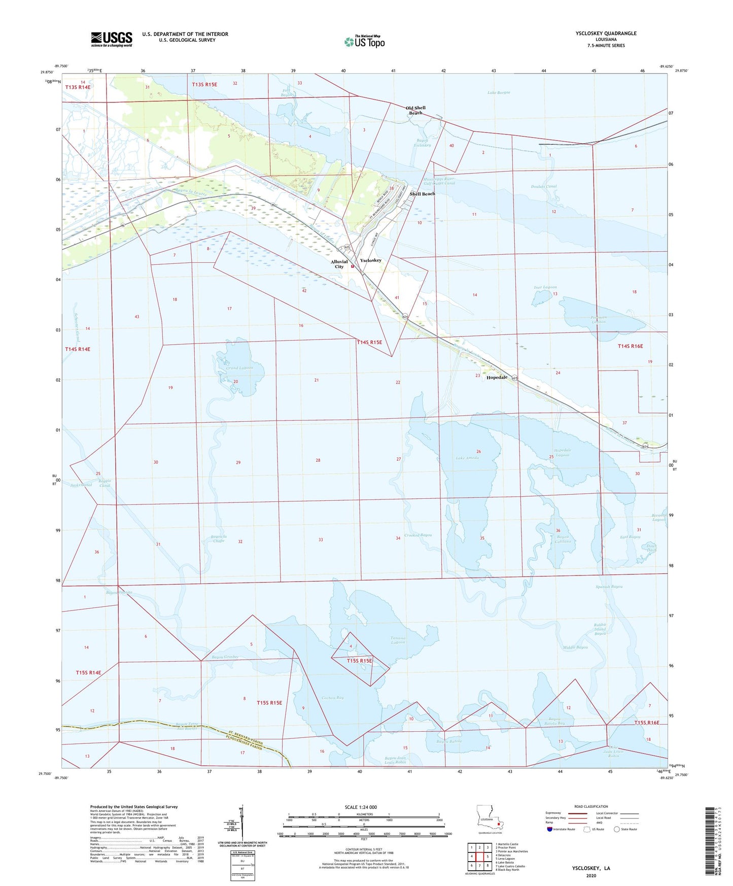
2020 topographic map quadrangle Yscloskey in the state of Louisiana. Scale: 1:24000. Based on the newly updated USGS 7.5' US Topo map series, this map is in the following counties: St. Bernard, Plaquemines. The map contains contour data, water features, and other items you are used to seeing on USGS maps, but also has updated roads and other features. This is the next generation of topographic maps. Printed on high-quality waterproof paper with UV fade-resistant inks.
Quads adjacent to this one:
West: Delacroix
Northwest: Martello Castle
North: Proctor Point
Northeast: Pointe aux Marchettes
East: Lena Lagoon
Southeast: Black Bay North
South: Lake Cuatro Caballo
Southwest: Lake Batola
Contains the following named places: Alluvial City, Antonios Lagoon, Bakers Ditch, Bayou Batola, Bayou Batola Bay, Bayou Catilano, Bayou Grosbec, Bayou Juanita, Bayou la Chape, Bayou Yscloskey, Cochon Bay, Crooked Bayou, Douluts Canal, Dows Ditch, East Bayou, Grand Lagoon, Grass Lagoon, Hopedale, Hopedale Canal, Hopedale Lagoon, Inez Lagoon, Lake Ameda, Middle Bayou, Nicks Lagoon, Old Shell Beach, Oyster Bay, Portman Lagoon, Rabbit Island Bayou, Redfish Bayou, Reggio Canal, Schooner Canal, Shell Beach, Spanish Bayou, Tanasia Lagoon, Tonys Lagoon, Turiano Lagoon, Yscloskey, ZIP Code: 70085