MyTopo
Albion Maine US Topo Map
Couldn't load pickup availability
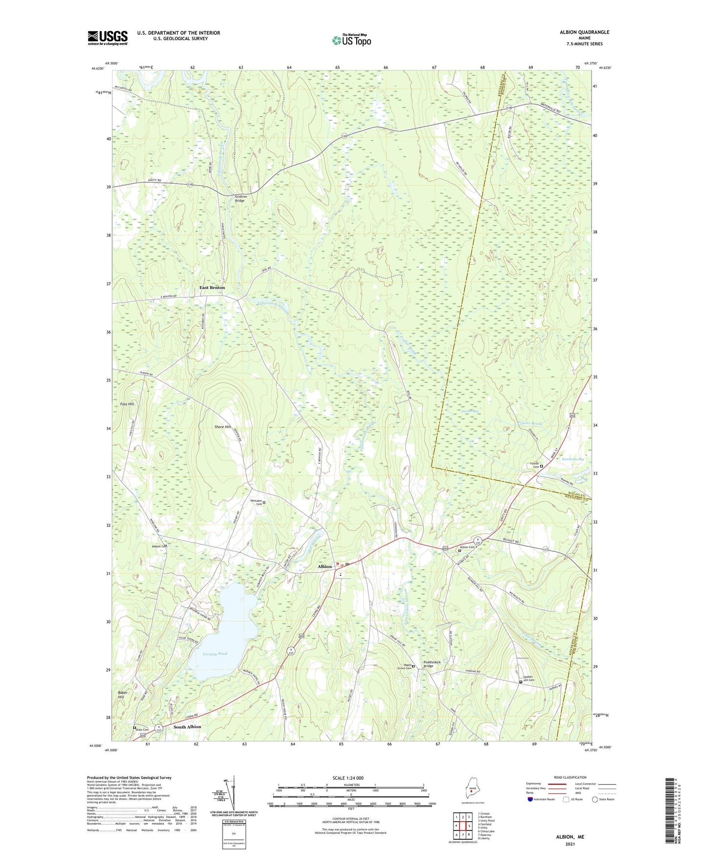
2021 topographic map quadrangle Albion in the state of Maine. Scale: 1:24000. Based on the newly updated USGS 7.5' US Topo map series, this map is in the following counties: Kennebec, Waldo. The map contains contour data, water features, and other items you are used to seeing on USGS maps, but also has updated roads and other features. This is the next generation of topographic maps. Printed on high-quality waterproof paper with UV fade-resistant inks.
Quads adjacent to this one:
West: Fairfield
Northwest: Clinton
North: Burnham
Northeast: Unity Pond
East: Unity
Southeast: Liberty
South: Palermo
Southwest: China Lake
Contains the following named places: Abbott Cemetery, Albion, Albion Cemetery 4, Albion Elementary School, Albion Fire Department, Albion Post Office, Albion Public Library, East Benton, Fifteenmile Stream, Foss Hill, Fowler Bog, Fowler Brook, Fowler Cemetery, Gridiron Bridge, Lovejoy Pond, Maple Grove Cemetery, Mill Stream, Mill Stream Dam, Pratt Stream, Puddledock Bridge, Puddledock Hall, Quaker Hill Cemetery, Shaw Cemetery, Shore Hill, South Albion, Town of Albion, Unorganized Territory of Unity, Whitaker Cemetery, ZIP Code: 04910