MyTopo
Allagash Lake Maine US Topo Map
Couldn't load pickup availability
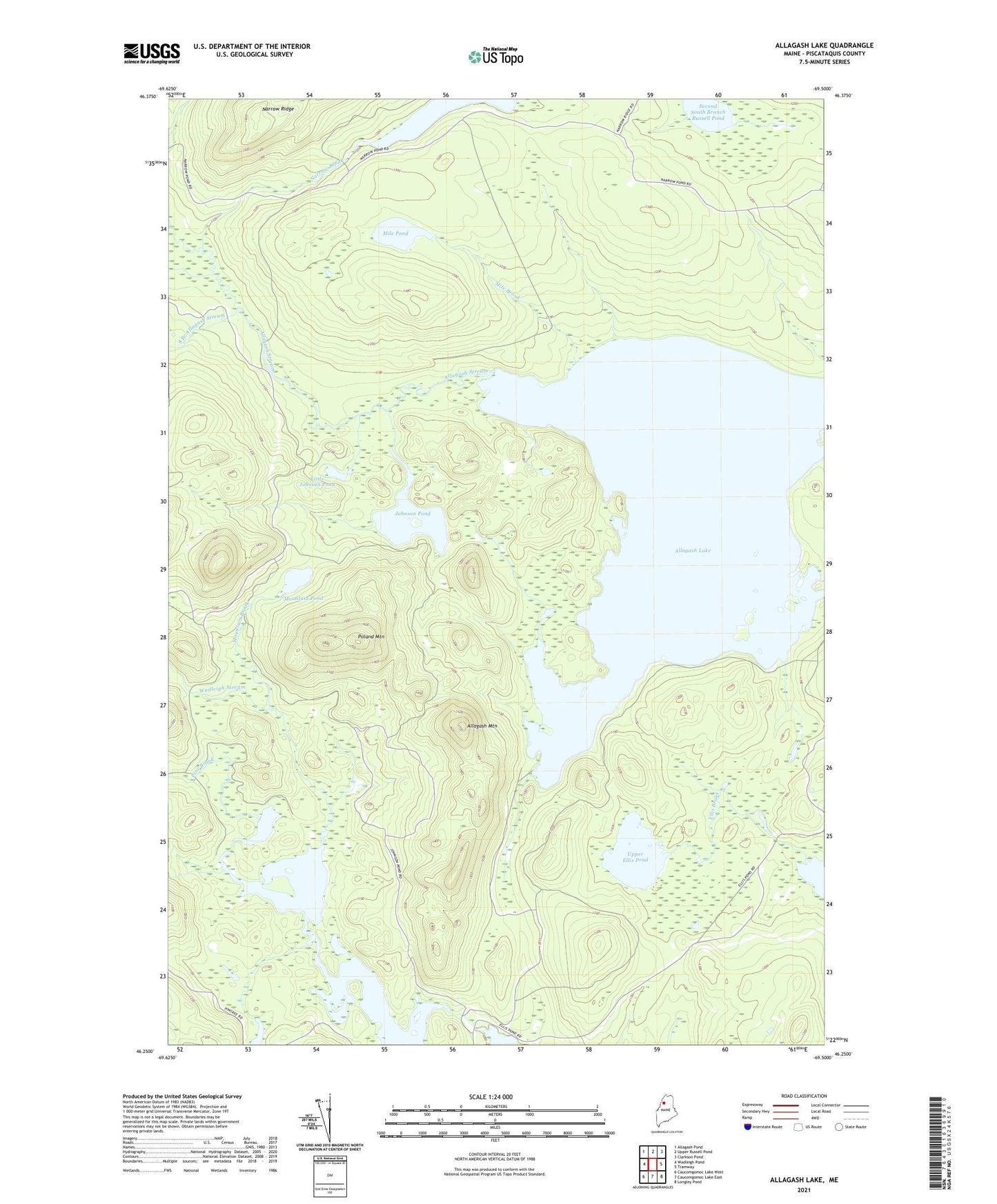
2021 topographic map quadrangle Allagash Lake in the state of Maine. Scale: 1:24000. Based on the newly updated USGS 7.5' US Topo map series, this map is in the following counties: Piscataquis. The map contains contour data, water features, and other items you are used to seeing on USGS maps, but also has updated roads and other features. This is the next generation of topographic maps. Printed on high-quality waterproof paper with UV fade-resistant inks.
Quads adjacent to this one:
West: Wadleigh Pond
Northwest: Allagash Pond
North: Upper Russell Pond
Northeast: Clarkson Pond
East: Tramway
Southeast: Longley Pond
South: Caucomgomoc Lake East
Southwest: Caucomgomoc Lake West
Contains the following named places: Allagash Lake, Allagash Mountain, Carry Trail Campsite, Edes Campsite, Frozen Ocean, Ice Cave Campsite, Johnson Pond, Ledge Point Campsite, Little Johnson Pond, Mile Brook, Mile Pond, Mountain Brook, Mountain Pond, Narrow Brook, Narrow Pond, Narrow Ridge, Pine Brook, Poland Mountain, Poland Pond, Round Pond Inlet Campsite, Round Pond North Campsite, Sandy Point Campsite, Second South Branch Russell Pond, South Branch Allagash Stream, T7 R14 WELS, T8 R14 WELS, Upper Ellis Pond, Wadleigh Stream