MyTopo
Alligator Lake Maine US Topo Map
Couldn't load pickup availability
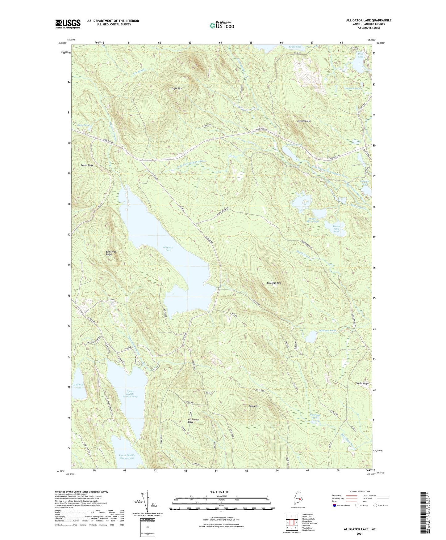
2021 topographic map quadrangle Alligator Lake in the state of Maine. Scale: 1:24000. Based on the newly updated USGS 7.5' US Topo map series, this map is in the following counties: Hancock. The map contains contour data, water features, and other items you are used to seeing on USGS maps, but also has updated roads and other features. This is the next generation of topographic maps. Printed on high-quality waterproof paper with UV fade-resistant inks.
Quads adjacent to this one:
West: Great Pond
Northwest: Brandy Pond
North: West Lake
Northeast: Gassabias Lake
East: Quillpig Mountain
Southeast: Lead Mountain
South: Rocky Pond
Southwest: Amherst
Contains the following named places: Alligator Lake, Baker Ridge, Bamfords Ridge, Blackcap Mountain, Deer Lake, Duds Pond, Eagle Mountain, Halfmile Pond, Haycock Pond, Humpback Bog, Jimmies Mountain, Jimmies Pond, John Brown Brook, Lovejoy Pond, Lower Allen Pond, Lower Middle Branch Pond, Middle Allen Pond, Middle Branch Ridge, Pinnacle, T28 MD BPP, T34 MD BPP, Unorganized Territory of East Hancock, Upper Allen Pond, Upper Middle Branch Pond, Williams Pond