MyTopo
Amherst Maine US Topo Map
Couldn't load pickup availability
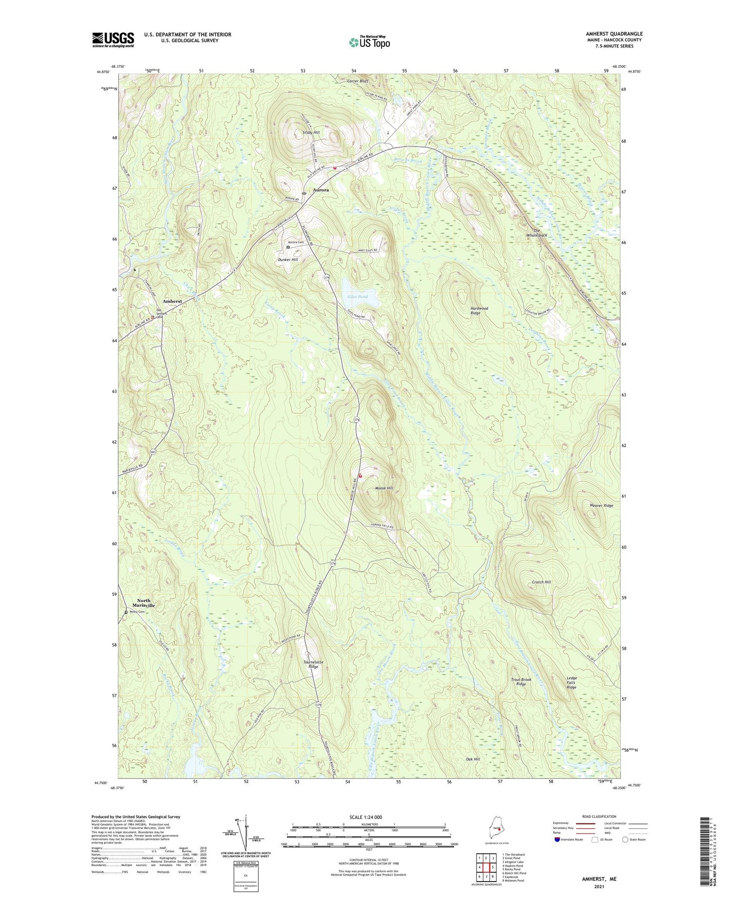
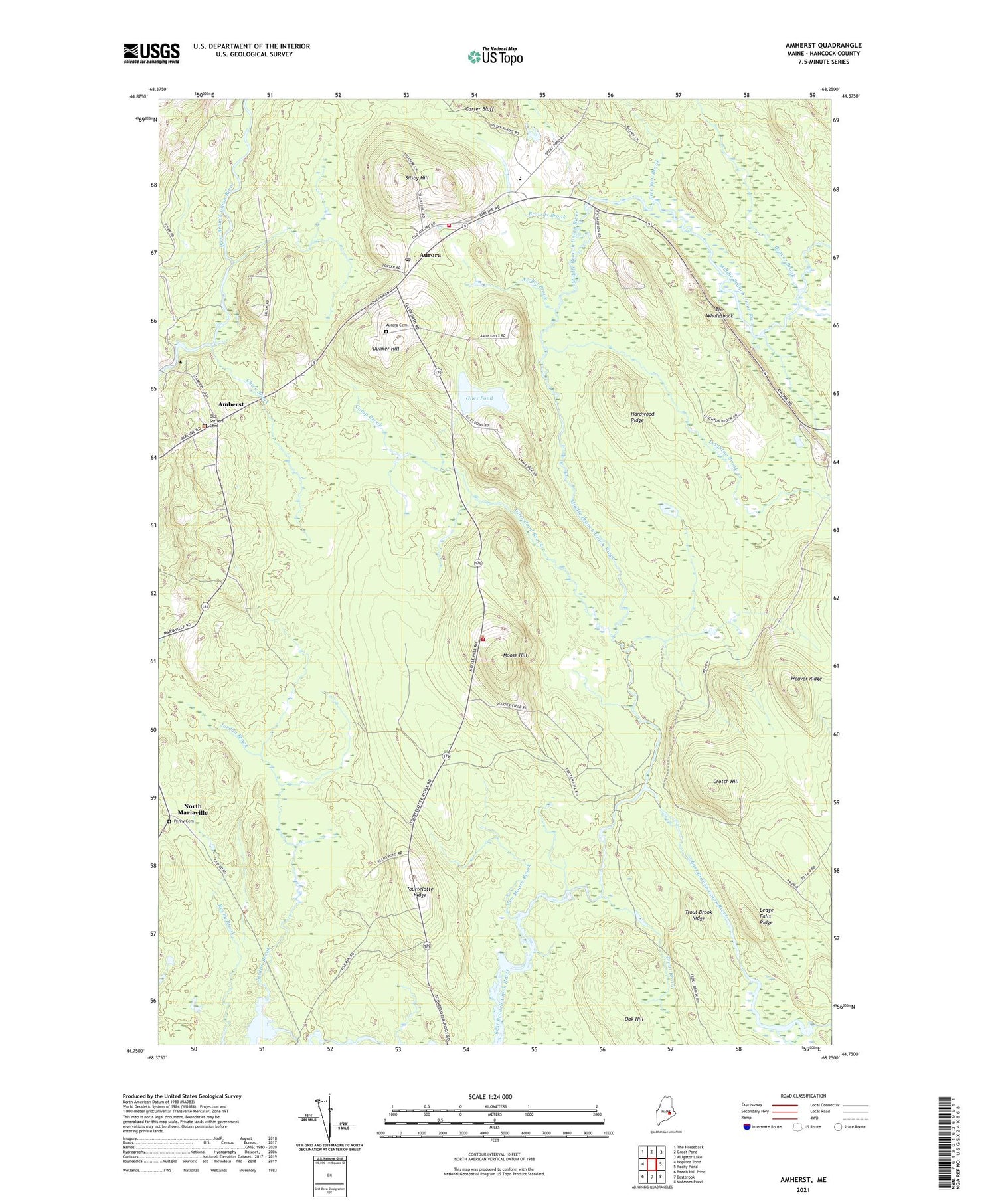
2021 topographic map quadrangle Amherst in the state of Maine. Scale: 1:24000. Based on the newly updated USGS 7.5' US Topo map series, this map is in the following counties: Hancock. The map contains contour data, water features, and other items you are used to seeing on USGS maps, but also has updated roads and other features. This is the next generation of topographic maps. Printed on high-quality waterproof paper with UV fade-resistant inks.
Quads adjacent to this one:
West: Hopkins Pond
Northwest: The Horseback
North: Great Pond
Northeast: Alligator Lake
East: Rocky Pond
Southeast: Molasses Pond
South: Eastbrook
Southwest: Beech Hill Pond
Contains the following named places: Airline Community School, Amherst, Archer Brook, Aurora, Aurora Cemetery, Aurora Post Office, Aurora Volunteer Fire Department, Beaver Brook, Bog River, Browns Brook, Camp Brook, Caruso School, Chick Brook, Crotch Hill, Dunker Hill, Freeman Brook, Giles Pond, Giles Pond Brook, Hardwood Ridge, Harper Meadow Brook, Joe Moore Brook, Jordan Brook, Ledge Falls Dam, Ledge Falls Ridge, Leighton Brook, McKinley School, Middle Branch Union River, Monticello School, Moose Hill, North Mariaville, Oak Hill, Osborn Municipal Volunteer Fire Department, Penny Cemetery, Silsby Hill, The Whalesback, Tourtelotte Ridge, Town of Aurora, Town of Osborn, Trout Brook, Trout Brook Ridge, Weaver Ridge