MyTopo
B Pond Maine US Topo Map
Couldn't load pickup availability
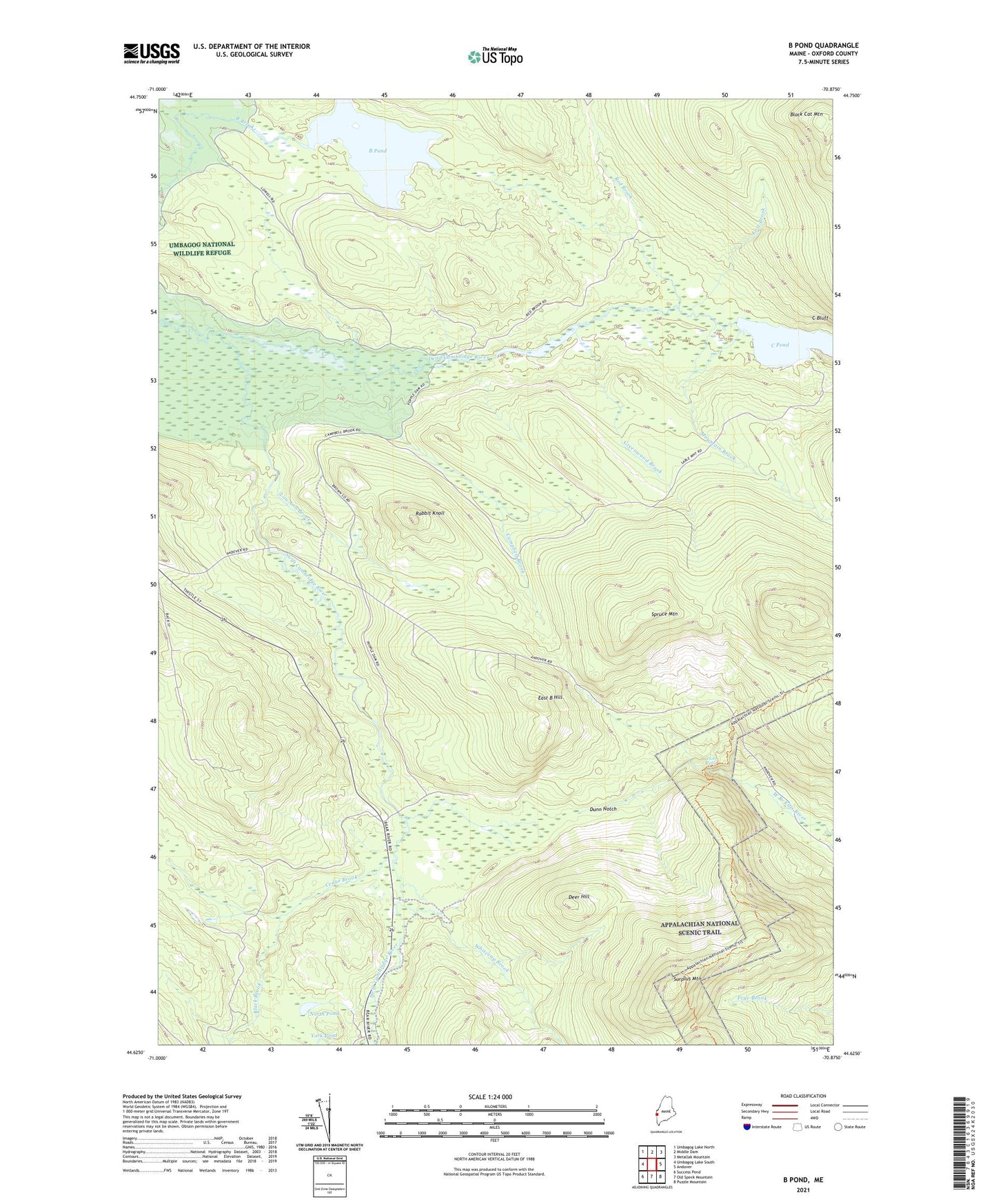
2021 topographic map quadrangle B Pond in the state of Maine. Scale: 1:24000. Based on the newly updated USGS 7.5' US Topo map series, this map is in the following counties: Oxford. The map contains contour data, water features, and other items you are used to seeing on USGS maps, but also has updated roads and other features. This is the next generation of topographic maps. Printed on high-quality waterproof paper with UV fade-resistant inks.
Quads adjacent to this one:
West: Umbagog Lake South
Northwest: Umbagog Lake North
North: Middle Dam
Northeast: Metallak Mountain
East: Andover
Southeast: Puzzle Mountain
South: Old Speck Mountain
Southwest: Success Pond
Contains the following named places: B Pond, Black Brook, Black Cat Mountain, C Pond, C Surplus, Campbell Brook, Cedar Brook, Deer Hill, Dunn Falls, Dunn Notch, East B Hill, Greenwood Brook, Lost Brook, Lou Ann Brook, Mountain Brook, North Pond, Rabbit Knoll, Red Brook, Spruce Mountain, Surplus Mountain, Swift Cambridge River, Town of Upton, Whitecap Brook