MyTopo
Baker Island Maine US Topo Map
Couldn't load pickup availability
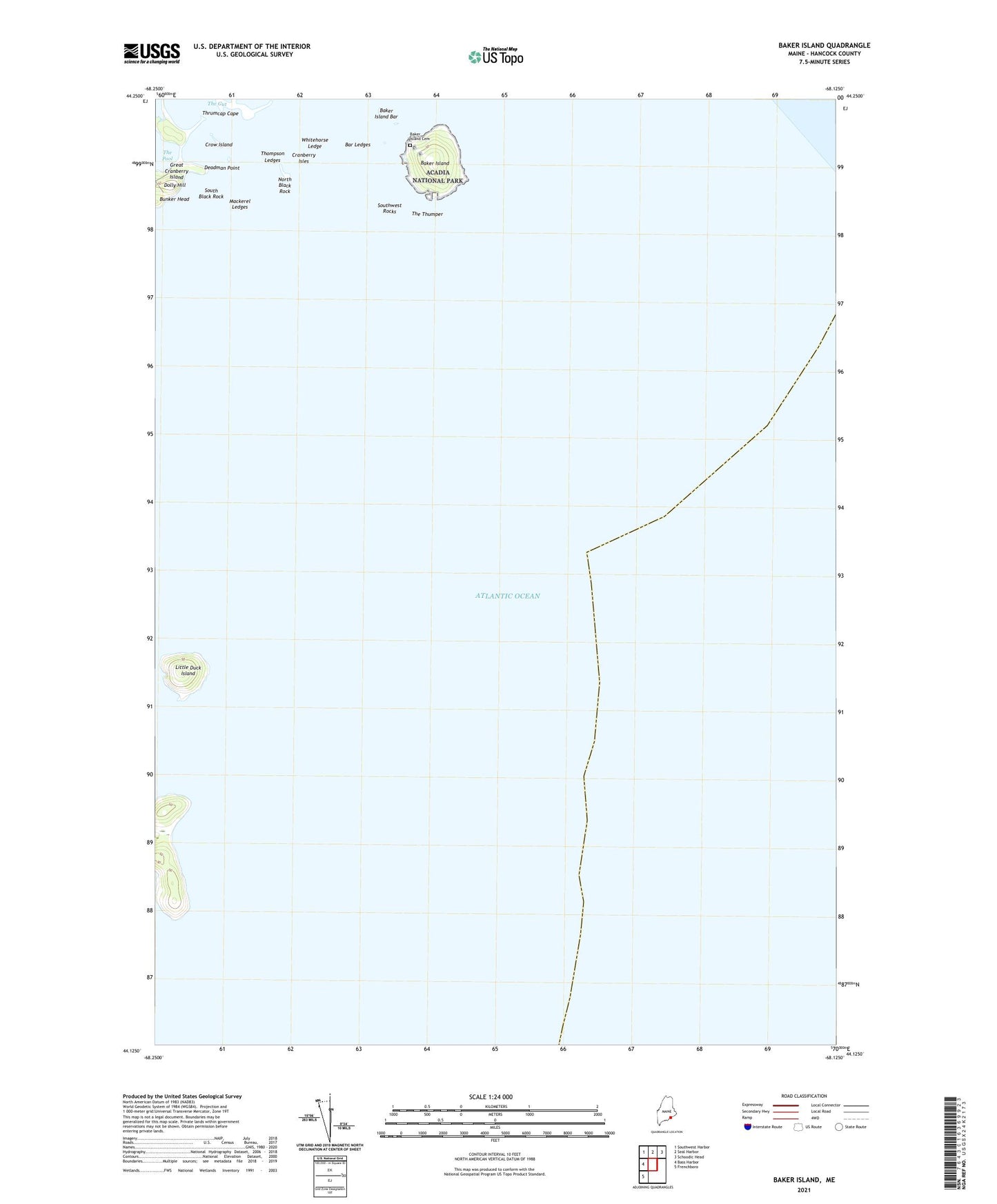
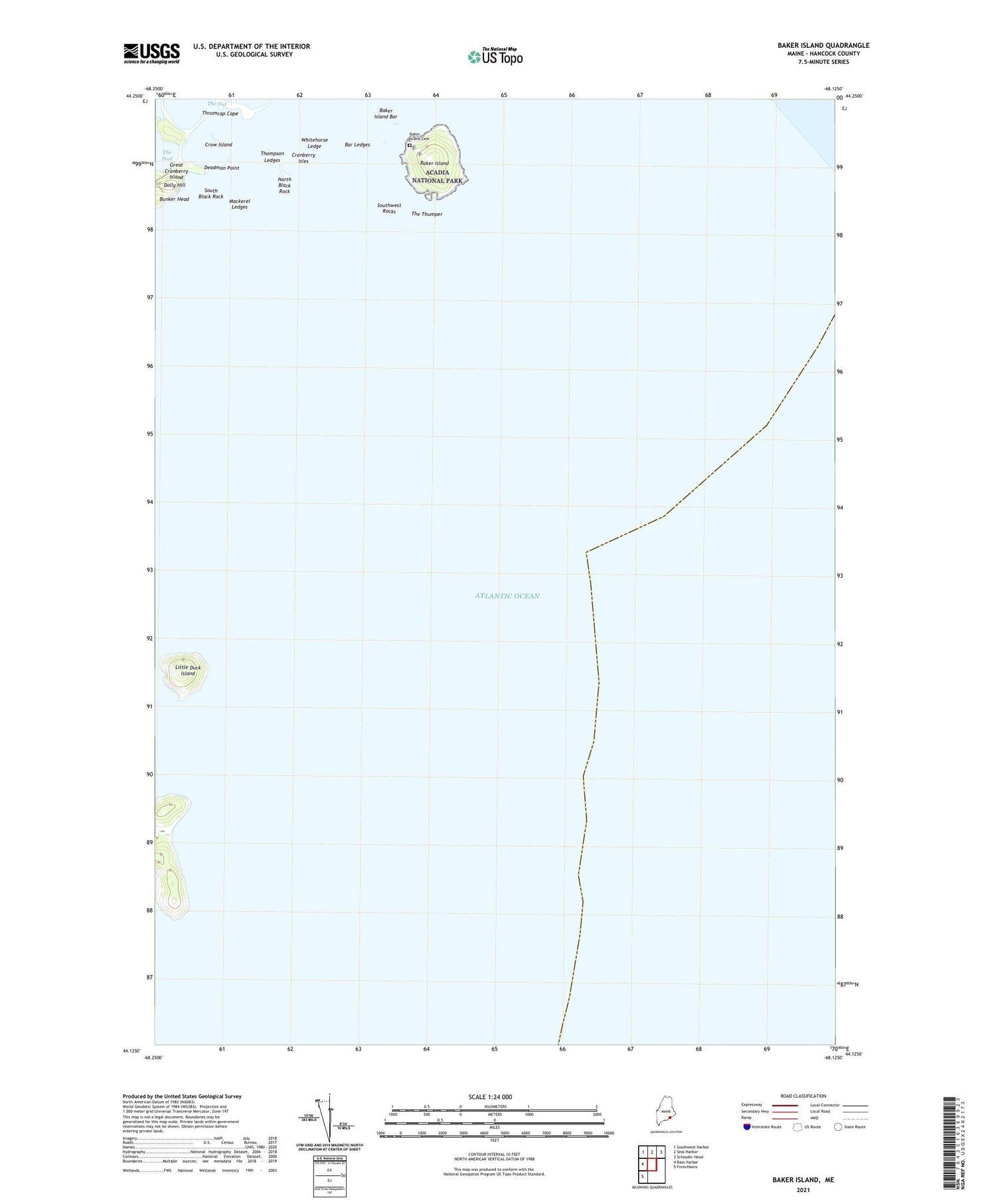
2021 topographic map quadrangle Baker Island in the state of Maine. Scale: 1:24000. Based on the newly updated USGS 7.5' US Topo map series, this map is in the following counties: Hancock. The map contains contour data, water features, and other items you are used to seeing on USGS maps, but also has updated roads and other features. This is the next generation of topographic maps. Printed on high-quality waterproof paper with UV fade-resistant inks.
Quads adjacent to this one:
West: Bass Harbor
Northwest: Southwest Harbor
North: Seal Harbor
Northeast: Schoodic Head
Southwest: Frenchboro
Contains the following named places: Baker Island, Baker Island Cemetery, Baker Island Light Station, Bar Ledges, Crow Island, Deadman Point, Dolly Hill, Great Duck Island, Great Duck Island Light Station, Little Duck Island, Mackerel Ledges, North Black Rock, South Black Rock, Southwest Rocks, The Gut, The Thumper, Thompson Ledges, Thrumcap Cape, Town of Cranberry Isles, Whitehorse Ledge, ZIP Code: 04646