MyTopo
Bean Pot Pond Maine US Topo Map
Couldn't load pickup availability
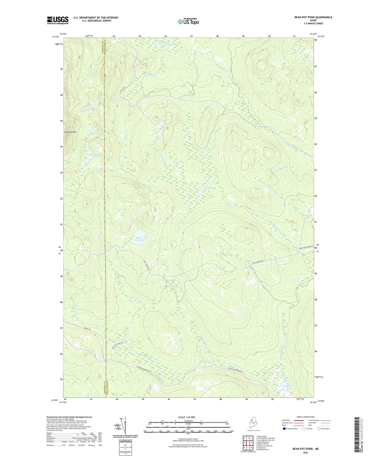
2021 topographic map quadrangle Bean Pot Pond in the state of Maine. Scale: 1:24000. Based on the newly updated USGS 7.5' US Topo map series, this map is in the following counties: Piscataquis, Somerset. The map contains contour data, water features, and other items you are used to seeing on USGS maps, but also has updated roads and other features. This is the next generation of topographic maps. Printed on high-quality waterproof paper with UV fade-resistant inks.
Quads adjacent to this one:
West: Russell Mountain
Northwest: Spruce Brook
North: Caucomgomoc Lake West
Northeast: Caucomgomoc Lake East
East: Ragmuff Stream
Southeast: Penobscot Farm
South: Seboomook
Southwest: Seboomook Lake East
Contains the following named places: Bean Pot Pond, Big Mucalsea Pond, Caribou Dam, Caribou Deadwater, Gibert Brook, Little Mucalsea Pond, Smith Brook, South Brook, T5 R15 WELS, Withey Bog, Withey Brook