MyTopo
Bog Lake Maine US Topo Map
Couldn't load pickup availability
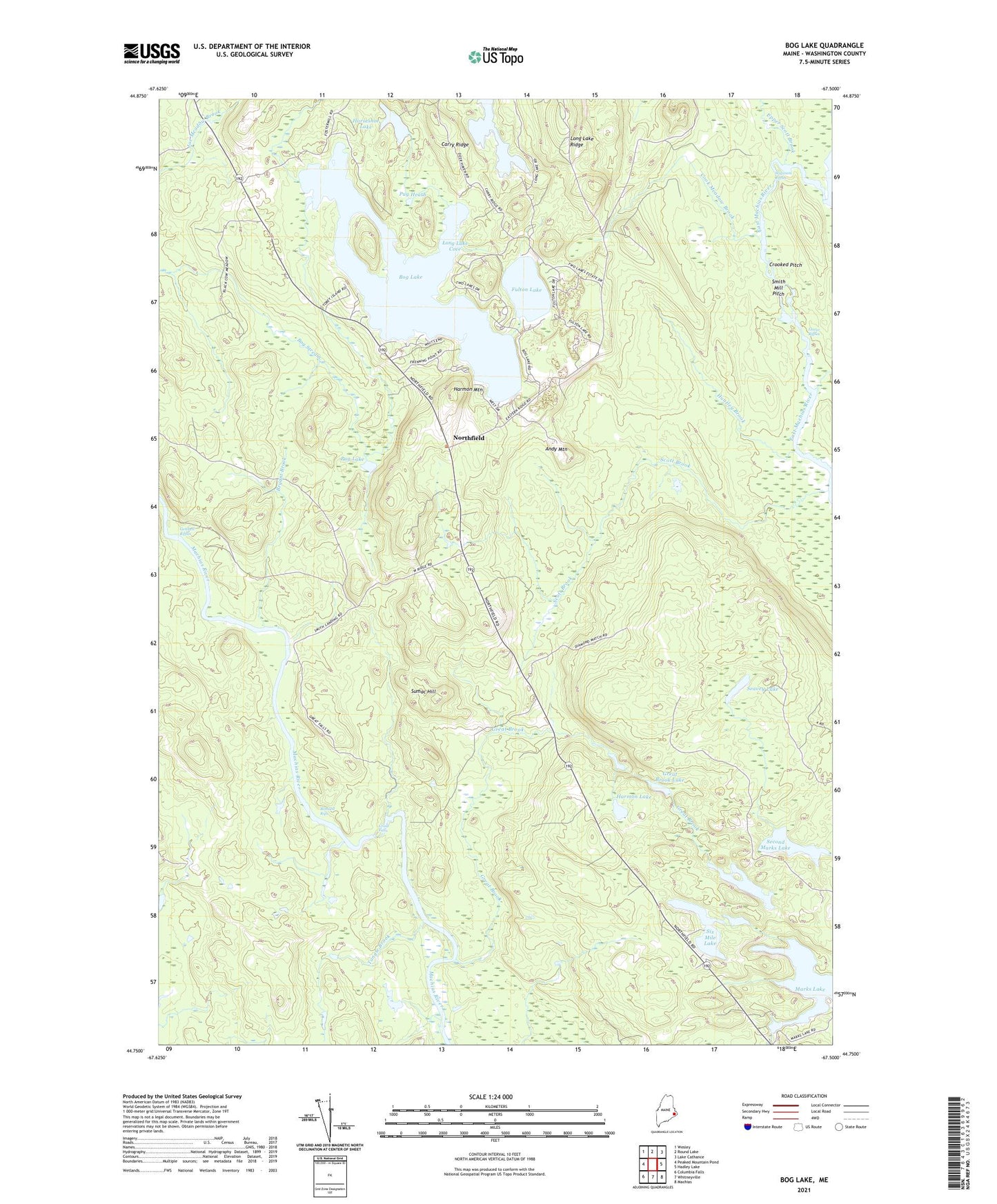
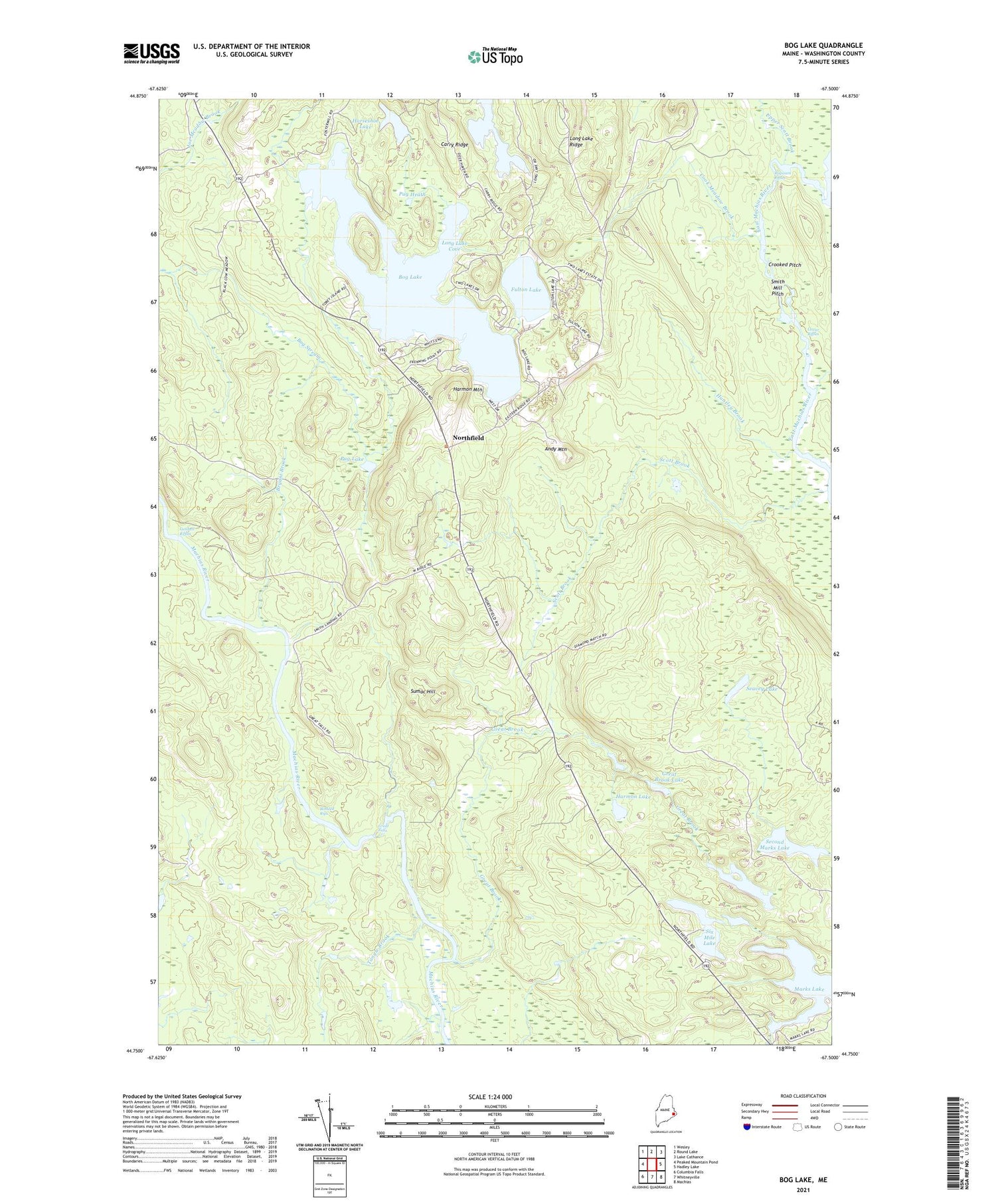
2021 topographic map quadrangle Bog Lake in the state of Maine. Scale: 1:24000. Based on the newly updated USGS 7.5' US Topo map series, this map is in the following counties: Washington. The map contains contour data, water features, and other items you are used to seeing on USGS maps, but also has updated roads and other features. This is the next generation of topographic maps. Printed on high-quality waterproof paper with UV fade-resistant inks.
Quads adjacent to this one:
West: Peaked Mountain Pond
Northwest: Wesley
North: Round Lake
Northeast: Lake Cathance
East: Hadley Lake
Southeast: Machias
South: Whitneyville
Southwest: Columbia Falls
Contains the following named places: Andy Mountain, Bobsled Rips, Bog Lake, Bryant Brook, Carry Ridge, Cook Meadow Brook, Crooked Pitch, Fulton Lake, Getchell Riffles, Great Brook, Great Brook Lake, Great Falls, Harmon Lake, Harmon Mountain, Horseshoe Lake, Huntley Brook, Keeley Lake, Long Lake, Long Lake Cove, Long Lake Ridge, Lower Riffles, Marks Lake, Marks Lake Dam, Northfield, Northfield School, Pug Heath, Pug Lake, Scott Brook, Seavey Lake, Second Marks Lake, Six Mile Lake, Smith Landing, Smith Mill Pitch, Sumac Hill, Tangle Brook, Town of Centerville, Town of Northfield, Wigwam Riffles, ZIP Code: 04654